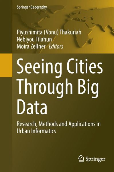
This book introduces the latest thinking on the use of Big Data in the context of urban systems, including research and insights on human behavior, urban dynamics, resource use, sustainability and spatial disparities, where it promises improved planning, management and governance in the urban sectors (e.g., transportation, energy, smart cities, crime, housing, urban and regional economies, public health, public engagement, urban governance and political systems), as well as Big Data's utility in decision-making, and development of indicators to monitor economic and social activity, and for…mehr
This book introduces the latest thinking on the use of Big Data in the context of urban systems, including research and insights on human behavior, urban dynamics, resource use, sustainability and spatial disparities, where it promises improved planning, management and governance in the urban sectors (e.g., transportation, energy, smart cities, crime, housing, urban and regional economies, public health, public engagement, urban governance and political systems), as well as Big Data's utility in decision-making, and development of indicators to monitor economic and social activity, and for urban sustainability, transparency, livability, social inclusion, place-making, accessibility and resilience.
Piyushimita (Vonu) Thakuriah is Ch2M Chair of Transportation and Professor of Urban Studies in the University of Glasgow, UK. She is the founding Director of the Urban Big Data Centre, a consortium of seven universities funded by the Economic and Social Research Council. Prior to current position, she was Professor of Urban Planning and Policy, University of Illinois at Chicago. She started her career as a postdoctoral researcher in the National Institute of Statistical Sciences, Research Triangle Park, North Carolina, with a fellowship funded by the National Science Foundation's (NSF) Division of Mathematical Sciences (DMS). Her research interests are in smart, socially-just and sustainable transportation, and on theories and methods explaining transportation policies and traveler behaviour. Her work has examined "smart" public transportation, bicycle and pedestrian active transportation, as well as in connected/collaborative/shared transportation systems. Vonu's research has considered the needs of a wide spectrum of travelers including low-wage workers, seniors, persons with disabilities and young adults and her work links social equity and human capital considerations to the labour market, safety, well-being and other outcomes experienced by travelers. She is more broadly interested in Urban Informatics or the analytics of emerging sources of data to understand complex urban problems, and the political economy surrounding many novel forms of data. Such analytics have significant potential to improve livability, learning and engagement in cities and to bring about urban planning, policy and business innovations. Aside from numerous journal articles in these areas, her recent book "Transportation and Information: Trends in Technology and Policy" discusses emerging ICT trends in smart mobility systems. She is currently a European Commission Marie Curie fellow. Nebiyou Tilahun is an Assistant Professor in the Urban Planning and Policy department at University of Illinois at Chicago. He earned his PhD in Civil Engineering from the University of Minnesota in 2010. He was previously a postdoctoral researcher at the Humphrey School for Public Affairs and at the Urban Transportation Center at University of Illinois at Chicago. His work focuses on travel behavior analyses, transportation planning models, and social issues surrounding transportation. His recent works includes the evaluation of last-mile barriers to intermodal transportation and on strategies to enhance transit accessibility in regions implementing transit system changes. He is also interested in the use of agent-based models for transportation planning applications and is the developer of ABODE (an agent based trip distribution model for work purposes). His research leverages large datasets collected by public and private institutions to inform questions about traveller's long and short-term decisions for location and mode as well as to understand urban transit and land use related issues to inform transportation policy. He received the 2008 Matthew J. Huber Award for Excellence in Transportation Research and Education from the University of Minnesota's Center for Transportation Studies. Moira Zellner joined the Urban Planning & Policy Program as an Assistant Professor in January of 2006. Born in Buenos Aires, Argentina, Moira earned her undergraduate degree in ecology at the Centro de Altos Estudios en Ciencias Exactas, and pursued graduate studies in urban and regional planning and in complex systems at the University of Michigan. Before coming to the US, she worked in Argentina as a consultant on environmental issues for local and international environmental engineering firms and for the undersecretary of Environment in the City of Buenos Aires, in projects related to domestic and hazardous waste management, river remediation, industrial pollution control, and environmental impact assessments. She also participated in interdisciplinary andinternational research projects of urban air pollution and of the spread of tuberculosis through public transportation. In the US, her professional work includes greenway development and river restoration projects in Miami Beach and in California, and transportation surveys. Her current research involves assessing the environmental impacts of urbanization, and exploring how to enhance the sustainability and resilience of urban areas. The focus is on how specific policy and behavioral changes can effectively address complex environmental problems, in which decentralized decisions result in regional land-use and consumption patterns that negatively affect resource availability and quality. Her research also examines the applicability of complexity theory and complexity-based models to policy exploration and social learning.
Inhaltsangabe
Introduction to Seeing Cities Through Big Data - Research, Methods, and Applications in Urban Informatics.- Big Data and Urban Informatics: Innovations and Challenges to Urban Planning and Knowledge Discovery.- Analytics of user-generated content.- Using User-Generated Content to Understand Cities.- Developing an Interactive Mobile Volunteered Geographic Information Platform to Integrate Environmental Big Data and Citizen Science in Urban Management.- CyberGIS-enabled Urban Sensing from Volunteered Citizen Participation Using Mobile Devices.- Challenges and opportunities of urban Big Data.- The Potential for Big Data to Improve Neighborhood-Level Census Data.- Big Data and Survey Research: Supplement or Substitute?.- Big Spatio-temporal Network Data Analytics for Smart Cities: Research Needs.- A review of heteroscedasticity treatment with Gaussian Processes and Quantile Regression meta-models.- Changing organizational and educational perspectives with urban Big Data.- Urban Informatics: Critical Data and Technology Considerations.- Emerging Urban Digital Infomediaries and Civic Hacking in an Era of Big Data and Open Data Initiatives.- How Should Urban Planners Be Trained to Handle Big Data?.- Energy Planning in Big data Era: A Theme Study of the Residential Sector.- Urban data management.- Using an online spatial analytics workbench for understanding housing affordability in Sydney.- A Big Data Mashing Tool for Measuring Transit System Performance.- Developing a Comprehensive U.S. Transit Accessibility Database.- Seeing Chinese Cities through Big Data and Statistics.- Urban knowledge discovery applied to different urban contexts.- Planning for the Change: Mapping Sea Level Rise and Storm Inundation in Sherman Island Using 3Di Hydrodynamic Model and LiDAR.- The Impact of Land-Use Variables on Free-floating Carsharing Vehicle Rental Choice and Parking Duration.- Dynamic Agent Based Simulation of an Urban Disaster Using Synthetic Big Data.- Estimation of Urban Transport Accessibility at the Spatial Resolution of an Individual Traveler.- Modeling Taxi Demand and Supply in New York City Using Large-Scale Taxi GPS Data.- Detecting stop episodes from GPS trajectories with gaps.- Emergencies and Crisis.- Using Social Media and Satellite Data for Damage Assessment in Urban Areas During Emergencies.- Health and well-being.- 'Big Data': Pedestrian Volume Using Google Street View Images.- Learning from Outdoor Webcams: Surveillance of Physical Activity Across Environments.- Mapping Urban Soundscapes via Citygram.- Social equity and data democracy.- Big Data and Smart (Equitable) Cities.- Big Data, Small Apps: Premises and Products of the Civic Hackathon.
Introduction to Seeing Cities Through Big Data – Research, Methods, and Applications in Urban Informatics.- Big Data and Urban Informatics: Innovations and Challenges to Urban Planning and Knowledge Discovery.- Analytics of user-generated content.- Using User-Generated Content to Understand Cities.- Developing an Interactive Mobile Volunteered Geographic Information Platform to Integrate Environmental Big Data and Citizen Science in Urban Management.- CyberGIS-enabled Urban Sensing from Volunteered Citizen Participation Using Mobile Devices.- Challenges and opportunities of urban Big Data.- The Potential for Big Data to Improve Neighborhood-Level Census Data.- Big Data and Survey Research: Supplement or Substitute?.- Big Spatio-temporal Network Data Analytics for Smart Cities: Research Needs.- A review of heteroscedasticity treatment with Gaussian Processes and Quantile Regression meta-models.- Changing organizational and educational perspectives with urban Big Data.- Urban Informatics: Critical Data and Technology Considerations.- Emerging Urban Digital Infomediaries and Civic Hacking in an Era of Big Data and Open Data Initiatives.- How Should Urban Planners Be Trained to Handle Big Data?.- Energy Planning in Big data Era: A Theme Study of the Residential Sector.- Urban data management.- Using an online spatial analytics workbench for understanding housing affordability in Sydney.- A Big Data Mashing Tool for Measuring Transit System Performance.- Developing a Comprehensive U.S. Transit Accessibility Database.- Seeing Chinese Cities through Big Data and Statistics.- Urban knowledge discovery applied to different urban contexts.- Planning for the Change: Mapping Sea Level Rise and Storm Inundation in Sherman Island Using 3Di Hydrodynamic Model and LiDAR.- The Impact of Land-Use Variables on Free-floating Carsharing Vehicle Rental Choice and Parking Duration.- Dynamic Agent Based Simulation of an Urban Disaster Using Synthetic Big Data.- Estimation of Urban Transport Accessibility at the Spatial Resolution of an Individual Traveler.- Modeling Taxi Demand and Supply in New York City Using Large-Scale Taxi GPS Data.- Detecting stop episodes from GPS trajectories with gaps.- Emergencies and Crisis.- Using Social Media and Satellite Data for Damage Assessment in Urban Areas During Emergencies.- Health and well-being.- ‘Big Data’: Pedestrian Volume Using Google Street View Images.- Learning from Outdoor Webcams: Surveillance of Physical Activity Across Environments.- Mapping Urban Soundscapes via Citygram.- Social equity and data democracy.- Big Data and Smart (Equitable) Cities.- Big Data, Small Apps: Premises and Products of the Civic Hackathon.
Rezensionen
"This book is a reviewed collection of papers presented in 2014 at a workshop at the University of Illinois at Chicago. ... each chapter contains an abstract, appropriate figures, illustrations, graphs, and a list of references ... . readers will find an excellent introduction to contemporary research and practice in urban informatics." (Brad Reid, Computing Reviews, June, 2017)
Es gelten unsere Allgemeinen Geschäftsbedingungen: www.buecher.de/agb
Impressum
www.buecher.de ist ein Internetauftritt der buecher.de internetstores GmbH
Geschäftsführung: Monica Sawhney | Roland Kölbl | Günter Hilger
Sitz der Gesellschaft: Batheyer Straße 115 - 117, 58099 Hagen
Postanschrift: Bürgermeister-Wegele-Str. 12, 86167 Augsburg
Amtsgericht Hagen HRB 13257
Steuernummer: 321/neu