C H Chen
Signal and Image Processing for Remote Sensing
C H Chen
Signal and Image Processing for Remote Sensing
- Broschiertes Buch
- Merkliste
- Auf die Merkliste
- Bewerten Bewerten
- Teilen
- Produkt teilen
- Produkterinnerung
- Produkterinnerung
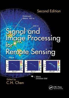
Written by more than 50 world leaders in the field, this book covers major topics in signal and image processing for remote sensing. The second edition features new chapters on compressive sensing, the super-resolution method in the mixed pixel problem with hyperspectral images, sparse representation for target detection and classification in hy
Andere Kunden interessierten sich auch für
![Remote Sensing of Land Use and Land Cover Remote Sensing of Land Use and Land Cover]() Remote Sensing of Land Use and Land Cover84,99 €
Remote Sensing of Land Use and Land Cover84,99 €![Remote Sensing of Soil Salinization Remote Sensing of Soil Salinization]() Remote Sensing of Soil Salinization85,99 €
Remote Sensing of Soil Salinization85,99 €![Satellite Remote Sensing and the Management of Natural Resources Satellite Remote Sensing and the Management of Natural Resources]() Nathalie PettorelliSatellite Remote Sensing and the Management of Natural Resources66,99 €
Nathalie PettorelliSatellite Remote Sensing and the Management of Natural Resources66,99 €![Field Methods in Remote Sensing Field Methods in Remote Sensing]() Roger M McCoyField Methods in Remote Sensing35,99 €
Roger M McCoyField Methods in Remote Sensing35,99 €![Radio Propagation and Remote Sensing of the Environment Radio Propagation and Remote Sensing of the Environment]() N. A. ArmandRadio Propagation and Remote Sensing of the Environment67,99 €
N. A. ArmandRadio Propagation and Remote Sensing of the Environment67,99 €![The Remote Sensing Data Book The Remote Sensing Data Book]() Gareth ReesThe Remote Sensing Data Book86,99 €
Gareth ReesThe Remote Sensing Data Book86,99 €![Digital and Statistical Signal Processing Digital and Statistical Signal Processing]() Anastasia VeloniDigital and Statistical Signal Processing64,99 €
Anastasia VeloniDigital and Statistical Signal Processing64,99 €-
-
-
Written by more than 50 world leaders in the field, this book covers major topics in signal and image processing for remote sensing. The second edition features new chapters on compressive sensing, the super-resolution method in the mixed pixel problem with hyperspectral images, sparse representation for target detection and classification in hy
Produktdetails
- Produktdetails
- Verlag: Taylor & Francis Ltd (Sales)
- 2nd edition
- Seitenzahl: 620
- Erscheinungstermin: 30. September 2020
- Englisch
- Abmessung: 254mm x 178mm x 32mm
- Gewicht: 1057g
- ISBN-13: 9780367866143
- ISBN-10: 0367866145
- Artikelnr.: 60017262
- Herstellerkennzeichnung
- Libri GmbH
- Europaallee 1
- 36244 Bad Hersfeld
- gpsr@libri.de
Chi Hau Chen is currently the Chancellor Professor Emeritus of electrical and computer engineering at the University of Massachusetts Dartmouth, where he has taught since 1968. Dr. Chen has published 29 books in his areas of research. He served as associate editor of the IEEE Transactions on Acoustics, Speech and Signal Processing for four years, associate editor of the IEEE Transactions on Geoscience and Remote Sensing for 15 years, and since 2008 has been a board member of Pattern Recognition. Dr. Chen is a Life Fellow of the IEEE, a Fellow of the International Association of Pattern Recognition (IAPR), and a member of Academia NDT International. For more information about Dr. Chen, visit his web page at the University of Massachusetts Dartmouth.
Signal Processing for Remote Sensing: On the Normalized Hilbert Transform
and Its Applications to Remote Sensing. Nyquist Pulse-Based Empirical Mode
Decomposition and Its Application to Remote Sensing Problems. Hydroacoustic
Signal Classification Using Support Vector Machines. Huygens Construction
and the Doppler Effect in Remote Detection. Compressed Remote Sensing.
Context-Dependent Classification: An Approach for Achieving Robust Remote
Sensing Performance in Changing Conditions. NMF and NTF for Sea Ice SAR
Feature Extraction and Classification. Relating Time-Series of
Meteorological and Remote Sensing Indices to Monitor Vegetation Moisture
Dynamics. Use of a Prediction-Error Filter in Merging High- and
Low-Resolution Images. Hyperspectral Microwave Atmospheric Sounding Using
Neural Networks. Satellite Passive Millimeter-Wave Retrieval of Global
Precipitation. Image Processing for Remote Sensing: On SAR Image
Processing: From Focusing to Target Recognition. Polarimetric SAR
Techniques for Remote Sensing of the Ocean Surface. An ISAR Technique for
Refocussing Moving Targets in SAR Images. Active Learning Methods in
Classification of Remote Sensing Images. Crater Detection Based on Marked
Point Processes. Probability Density Function Estimation for Classification
of High-Resolution SAR Images. Random Forest Classification of Remote
Sensing Data. Sparse Representation for Target Detection and Classification
in Hyperspectral Imagery. Integration of Full and Mixed Pixel Techniques to
Obtain Thematic Maps with a Refined Resolution. Signal Subspace
Identification in Hyperspecral Imagery. Image Classification and Object
Detection Using Spatial Contextual Constraints. Data Fusion for
Remote-Sensing Applications. Image Fusion in Remote Sensing with the
Steered Hermite Transform. Wavelet-Based Multi/Hyperspectral Image
Restoration and Fusion. The Land Cover Estimation with Satellite Image
Using Neural Network. Twenty-Five Years of Pansha

