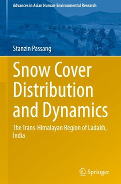
This comprehensive book examines a high mountain snow-covered expanse, spanning an investigation period of almost two decades. Leveraging advanced remote sensing and innovative algorithms, it meticulously maps the temporal and spatial dimensions of the snow cover extent of Ladakh, India. Rigorous statistical analyses, terrain examinations, and a groundbreaking snowfall prediction model contribute to a nuanced understanding. Grounded in empirical data, the volume not only enriches the research framework but also serves as a guiding compass for sustainable development amid the challenges of global warming. Seamlessly blending scientific rigour with a passion for discovery, the book invites readers to immerse themselves in a captivating snow-clad terrain, unlocking the secrets of its unique environment.
Snow Cover Distribution and Dynamics: The Trans-Himalayan Region of Ladakh, India is divided into five chapters. The book begins with an introduction and a comprehensive overview of the materials and methods used in the study. The focus is on the application of the MODIS NDSI snow mapping algorithm, validated using Landsat images. The research also involves the development of innovative algorithms for the removal of clouds from MODIS data and for forecasting snowfall. The study is further enriched by on-ground measurements and the deployment of terrestrial cameras across diverse topographies for data validation. Chapter 3 presents the results, including observed patterns and trends of the snow cover distribution, and the application of an ARIMA model for future snowfall predictions. The final two chapters discuss the findings in detail, draw conclusions, and provide a future outlook, thereby offering a comprehensive understanding of the subject matter.
Snow Cover Distribution and Dynamics: The Trans-Himalayan Region of Ladakh, India is divided into five chapters. The book begins with an introduction and a comprehensive overview of the materials and methods used in the study. The focus is on the application of the MODIS NDSI snow mapping algorithm, validated using Landsat images. The research also involves the development of innovative algorithms for the removal of clouds from MODIS data and for forecasting snowfall. The study is further enriched by on-ground measurements and the deployment of terrestrial cameras across diverse topographies for data validation. Chapter 3 presents the results, including observed patterns and trends of the snow cover distribution, and the application of an ARIMA model for future snowfall predictions. The final two chapters discuss the findings in detail, draw conclusions, and provide a future outlook, thereby offering a comprehensive understanding of the subject matter.


