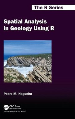
The integration of geology with data science disciplines, such as spatial statistics, remote sensing, and geographic information systems (GIS), has given rise to a shift in many natural sciences schools, pushing the boundaries of knowledge and enabling new discoveries in geological processes and earth systems. Spatial analysis of geological data can be used to identify patterns and trends in data, to map spatial relationships, and to model spatial processes. R is a consolidated and yet growing statistical programming language with increasing value in spatial analysis often replacing, with advantage, GIS tools. By providing a comprehensive guide for geologists to harness the power of spatial analysis in R, Spatial Analysis in Geology Using R serves as a tool in addressing real-world problems, such as natural resource management, environmental conservation, and hazard prediction and mitigation.
Features:
Provides a practical and accessible overview of spatial analysisin geology using ROrganised in three independent and complementary parts: Introduction to R, Spatial Analysis with R, and Spatial Statistics and ModellingApplied approach with many detailed examples and case studies using real geological dataPresents a collection of R packages that are useful in many geological situationsDoes not assume any prior knowledge of R; all code are explained in detailSupplemented by a website with all data, code, and examples
Spatial Analysis in Geology Using R will be useful to any geological researcher who has acquired basic spatial analysis skills, often using GIS, and is interested in deepening those skills through the use of R. It could be used as a reference by applied researchers and analysts in public, private, or third-sector industries. It could also be used to teach a course on the topic to graduate students or for self-study.

