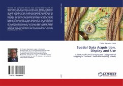
Spatial Data Acquisition, Display and Use
A Century of Land Surveying and Topographical Mapping in Tanzania - Dedicated to Policy Makers
Versandkostenfrei!
Versandfertig in 6-10 Tagen
55,99 €
inkl. MwSt.

PAYBACK Punkte
28 °P sammeln!
Humanity has used spatial data for many centuries begining with sea explorations in the 13-th century. The data, often displayed as navigation charts, were acquired with rudimental equipment. Technological advances were key in changing the use of map and surveyed data. In modern times, the great significance of land surveying and mapping processes lies in the ability to satisfy a diversity of user demands. In this fact also lies the justification for national and international policies to regulate outcomes and ensure that the skills and products will continue to exist as a public good througho...
Humanity has used spatial data for many centuries begining with sea explorations in the 13-th century. The data, often displayed as navigation charts, were acquired with rudimental equipment. Technological advances were key in changing the use of map and surveyed data. In modern times, the great significance of land surveying and mapping processes lies in the ability to satisfy a diversity of user demands. In this fact also lies the justification for national and international policies to regulate outcomes and ensure that the skills and products will continue to exist as a public good throughout the generations. Land surveying and topographical mapping are undertakings of great significance to the socio-economic fabric of nations. The Interventions are also known for the many cross-sector linkages manifested in: (i) the extent of reliance of landed projects on various services and products; (ii) its central place in national strategic plans including economic growth, poverty reduction and law and order; and (iii) its role in the development of urban centres. Based on Tanzania's century-old experience, this book is vital to policy makers and all pursuing landed projects in Africa.


