Spatial Distribution of Small Water Bodies in Bangladesh
A Mouza Based Geographical Analysis
Versandkostenfrei!
Versandfertig in 6-10 Tagen
32,99 €
inkl. MwSt.

PAYBACK Punkte
16 °P sammeln!
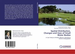
The present book is concerned with the spatial distribution of small water bodies including ponds, lakes, haors, baors, khals, beels and other marshy lands where discussed their size, shape, depth and several uses of small water bodies with temporal changes over time. This research was conducted at a micro scale in Gangaprasad and Bara Banya mouza of Daulatpur upazila in Manikganj district which are active low-lying flood prone areas of Bangladesh. This study is based on both primary data (questionnaire survey, group discussion, and field observation) and secondary data (Satellite images, publ...
The present book is concerned with the spatial distribution of small water bodies including ponds, lakes, haors, baors, khals, beels and other marshy lands where discussed their size, shape, depth and several uses of small water bodies with temporal changes over time. This research was conducted at a micro scale in Gangaprasad and Bara Banya mouza of Daulatpur upazila in Manikganj district which are active low-lying flood prone areas of Bangladesh. This study is based on both primary data (questionnaire survey, group discussion, and field observation) and secondary data (Satellite images, published and unpublished documents, and census data of different years). The study has been carried out under the framework of GIS where used ArcView3.3 and Arc GIS 9.2 and ERDAS IMAGINE 8.4 for image processing. The main objective of this study was to find out the change of small water bodies over a certain period of time and to identify their causes and impact on environment. Based on these findings, a number of recommendations have been put forward for sustainable management of small water bodies for our balance environment.


