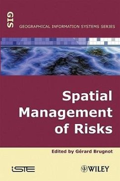
Spatial Management of Risks
Herausgeber: Brugnot, Gerard
Spatial Management of Risks
Herausgeber: Brugnot, Gerard
- Gebundenes Buch
- Merkliste
- Auf die Merkliste
- Bewerten Bewerten
- Teilen
- Produkt teilen
- Produkterinnerung
- Produkterinnerung
Spatial analysis is an increasingly important tool for detecting and preventing numerous risk and crisis phenomena such as floods in a geographical area. This book concentrates on examples of prevention but also gives crisis control advice and practical case studies. Some chapters address urban applications in which vulnerabilities are concentrated in area; others address more rural areas with more scattered phenomena.
Andere Kunden interessierten sich auch für
![Fund Spatial Data Quality Fund Spatial Data Quality]() Fund Spatial Data Quality169,99 €
Fund Spatial Data Quality169,99 €![Models in Spatial Analysis Models in Spatial Analysis]() Models in Spatial Analysis201,99 €
Models in Spatial Analysis201,99 €![Spatial Analysis Spatial Analysis]() Spatial Analysis164,99 €
Spatial Analysis164,99 €![Spatial Reasoning for Effective GIS Spatial Reasoning for Effective GIS]() Joseph K BerrySpatial Reasoning for Effective GIS124,99 €
Joseph K BerrySpatial Reasoning for Effective GIS124,99 €![Earthquake Risks in Baluchistan: Earthquake Risks in Baluchistan:]() Syed AinuddinEarthquake Risks in Baluchistan:32,99 €
Syed AinuddinEarthquake Risks in Baluchistan:32,99 €![Work Related Environmental Health Risks Work Related Environmental Health Risks]() Enock. C. MakwaraWork Related Environmental Health Risks32,99 €
Enock. C. MakwaraWork Related Environmental Health Risks32,99 €![Greening Water Risks Greening Water Risks]() Greening Water Risks39,99 €
Greening Water Risks39,99 €-
-
-
Spatial analysis is an increasingly important tool for detecting and preventing numerous risk and crisis phenomena such as floods in a geographical area. This book concentrates on examples of prevention but also gives crisis control advice and practical case studies. Some chapters address urban applications in which vulnerabilities are concentrated in area; others address more rural areas with more scattered phenomena.
Produktdetails
- Produktdetails
- Verlag: Wiley
- Seitenzahl: 256
- Erscheinungstermin: 1. November 2008
- Englisch
- Abmessung: 234mm x 157mm x 20mm
- Gewicht: 517g
- ISBN-13: 9781848210462
- ISBN-10: 1848210469
- Artikelnr.: 25916102
- Herstellerkennzeichnung
- Libri GmbH
- Europaallee 1
- 36244 Bad Hersfeld
- gpsr@libri.de
- Verlag: Wiley
- Seitenzahl: 256
- Erscheinungstermin: 1. November 2008
- Englisch
- Abmessung: 234mm x 157mm x 20mm
- Gewicht: 517g
- ISBN-13: 9781848210462
- ISBN-10: 1848210469
- Artikelnr.: 25916102
- Herstellerkennzeichnung
- Libri GmbH
- Europaallee 1
- 36244 Bad Hersfeld
- gpsr@libri.de
Gerard Brugnot is the editor of Spatial Management of Risks, published by Wiley.
Introduction xiii
Chapter 1. From Prevention to Risk Management: Use of GIS 1
Sophie SAUVAGNARGUES-LESAGE
1.1. Introduction 1
1.2. GIS and public security 3
1.3. Examples of applications for public security 8
1.3.1. SIGASC application 8
1.3.2. Application 12
1.3.3. SIG CODIS application 15
1.4. Prospects for development 18
1.5. Conclusion 19
1.6. Bibliography 19
Chapter 2. Coupled Use of Spatial Analysis and Fuzzy Arithmetic: Assessing
the Vulnerability of a Watershed to Phytosanitary Products 23
Bertrand DE BRUYN, Catherine FREISSINET and Michel VAUCLIN
2.1. Introduction 23
2.2. Construction of the index 24
2.3. Implementation of fuzzy calculations 26
2.4. Application to the watershed of Vannetin: vulnerability to atrazine 28
2.4.1. The research site 28
2.4.2. Parameters of the watershed 28
2.4.3. Cell parameters 29
2.4.4. Fuzzy parameters 30
2.4.5. Representation of the indicator and of its related inaccuracy 31
2.5. Conclusion 33
2.6. Bibliography 36
Chapter 3. Agricultural Non-Point Source Pollution 39
Philippe BOLO and Christophe BRACHET
3.1. Introduction 39
3.2. Mapping non-point source pollution phenomenon 40
3.2.1. Mapping principles 40
3.2.2. Description of the research phenomenon 41
3.2.3. Mapping steps 41
3.3. Territorial database building rules 42
3.3.1. Choosing software programs 43
3.3.2. Design of the implemented GIS 44
3.3.3. Organizing and creating geographic information layers 46
3.3.4. Organizing and creating attribute tables 47
3.4. The data sources used 48
3.4.1. Identifying the available information 48
3.4.2. Soil-related data 49
3.4.3. Topography-related data 52
3.4.4. Land use-related data 54
3.4.5. Land planning-related data 56
3.5. Pollution risk zoning 58
3.5.1. Treatments to be performed 58
3.5.2. An example of risk zoning 60
3.6. Risk zoning applications 66
3.6.1. Risk knowledge applications 67
3.6.2. Spatial planning applications 67
3.6.3. Applications related to monitoring water quality 68
3.7. Conclusion 69
3.8. Bibliography 70
Chapter 4. Cartographic Index and History of Road Sites that Face Natural
Hazards in the Province of Turin 71
Paola ALLEGRA, Laura TURCONI and Domenico TROPEANO
4.1. Introduction 71
4.2. Principal risks 73
4.3. Research area 74
4.3.1. Geological insight 74
4.3.2. Morphology of the research areas 75
4.4. Working method 76
4.5. Computer-based synthetic analysis and transcription of historical data
and information collected on the research area 78
4.6. First results 80
4.7. Structure of computer thematic mapping 82
4.8. Application and use of the method 84
4.9. Bibliography 85
Chapter 5. Forest and Mountain Natural Risks: From Hazard Representation to
Risk Zoning - The Example of Avalanches 87
Frédéric BERGER and Jérôme LIÉVOIS
5.1. Introduction 87
5.1.1. General information on forests 87
5.1.2. The protective role of mountain forests 88
5.2. Identification of protective forest zones 90
5.2.1. General principle 90
5.2.2. Methodology 90
5.2.3. Building up a synthesis map of natural hazards 91
5.2.4. Building up the forest map 102
5.2.5. Building up the natural forest-hazard synthesis map 102
5.2.6. Building up the map of socio-economic issues and vulnerability 103
5.2.7. Building up the priority areas for forestry action map 104
5.3. Perspectives 105
5.4. The creation of green zones in risk prevention plans 106
5.4.1. Natural hazard prevention plans 106
5.4.2. Transfer from researchers to users 107
5.4.3. The method used 108
5.4.4. Consequences of these works 111
5.4.5. Reflections and perspectives 111
5.5. Conclusion: general recommendations 112
5.6. Bibliography 112
Chapter 6. GIS and Modeling in Forest Fire Prevention 115
Marielle JAPPIOT, Raphaële BLANCHI and Franck GUARNIERI
6.1. Understanding forest fire risks 115
6.1.1. Risk 116
6.1.2. Description of the phenomenon 116
6.1.3. Particularities of fire risk 117
6.1.4. A spatio-temporal variation of forest fire risk 122
6.2. Forest fire management: risk mapping and the use of spatial analysis
123
6.2.1. Requirements with respect to forest fire risk assessment 123
6.2.2. Forest fire risk assessment and mapping: the use of geographic
information systems 126
6.3. Using GIS to map forest fire risks 137
6.3.1. Forest fire risk assessment and mapping in the Massif des Maures
(Department of Var): raster GIS 138
6.3.2. WILFRIED - fire fighting support (coupling GIS and model) 143
6.4. Conclusion 147
6.5. Bibliography 148
Chapter 7. Spatial Decision Support and Multi-Agent Systems: Application to
Forest Fire Prevention and Control 151
Franck GUARNIERI, Alain JABER and Jean-Luc WYBO
7.1. Introduction 151
7.2. Natural risk prevention support and the need for cooperation between
the software programs 152
7.2.1. The cooperation issue between the information systems 152
7.2.2. The various approaches aiming at facilitating this type of
cooperation 153
7.3. Towards an intelligent software agent model to satisfy the cooperation
between the decision-support systems dedicated to natural risk prevention
154
7.3.1. The multi-agent paradigm 154
7.3.2. Intelligent software agents 155
7.3.3. A proposed intelligent software agent model 157
7.4. Experiment in the field of forest fire prevention and control 158
7.4.1. Context of the experiment 158
7.4.2. The experiment scenario 160
7.4.3. First part of the scenario 160
7.4.4. Second part of the scenario 161
7.4.5. An example of problem solving 165
7.4.6. Conclusion of the scenario 166
7.5. Conclusions and perspectives 166
7.6. Bibliography 167
Chapter 8. Flood Monitoring Systems 169
Jean-Jacques VIDAL and Noël WATRIN
8.1. Introduction 169
8.2. Flood monitoring and warning 170
8.3. Situation diversity 171
8.3.1. Spatial information for a better understanding of the phenomenon 173
8.3.2. Spatial information for flood impact assessment 174
8.4. Technical answers 175
8.4.1. Hydrological observing networks 175
8.4.2. Data processing 176
8.4.3. The integration of acquired knowledge in the natural hazard
prevention policy 178
8.5. Conclusion 178
8.6. Bibliography 179
Chapter 9. Geography Applied to Mapping Flood-Sensitive Areas: A
Methodological Approach 181
Christophe PRUNET and Jean-Jacques VIDAL
9.1. Introduction 181
9.2. A geographic analysis of flooding 182
9.2.1. Intensity 182
9.2.2. Frequency 182
9.2.3. Extension 185
9.3. A concrete example 188
9.4. Bibliography 190
Chapter 10. Information Systems and Diked Areas: Examples at the National,
Regional and Local Levels 193
Pierre MAUREL, Rémy TOURMENT and William HALBECQ
10.1. Context 193
10.2. Analysis of the current situation for the management of diked areas
195
10.3. Spatial dimension and integrated management of diked areas 197
10.4. Examples of information systems dedicated to diked areas 198
10.4.1. An information system at the national level for dike inventory 199
10.4.2. An information system at the regional level to analyze dike failure
risks in the Mid-Loire region 200
10.4.3. An information system at local level for the integrated management
of diked areas 203
10.5. Recent progress and perspectives 212
10.6. Bibliography 213
Chapter 11. Geomatics and Urban Risk Management: Expected Advances 215
Jean-Pierre ASTÉ
11.1. Towns, risks and geomatics 215
11.1.1. An overview 215
11.1.2. City: a much sought after security area 216
11.1.3. Risk: a poorly understood notion 217
11.1.4. Geomatics as a data structuring and management tool 217
11.2. Prevention stakeholders: their responsibilities, their current
resources and expectations 218
11.2.1. Ordinary state or emergency state 218
11.2.2. Government and institutional stakeholders 218
11.2.3. Municipal stakeholders and the populations they represent 219
11.2.4. Operational and technical stakeholders 220
11.2.5. Insurance agents 220
11.2.6. Scientific stakeholders 221
11.2.7. Compelled to live with an identified risk 222
11.3. Today's methods and tools: strengths and weaknesses 223
11.3.1. Urban reference systems and the expected connection with the
digitizing of cadastral maps 223
11.3.2. Managing experience 224
11.3.3. Knowledge and modeling of phenomena 226
11.3.4. Monitoring phenomena 227
11.3.5. Reducing vulnerability 227
11.3.6. Risk assessment 228
11.3.7. Macro and microeconomic approach 229
11.3.8. The means of exchange of experiences, skills and knowledge 230
11.3.9. Consultation, public information, training and culture 230
11.4. New potentialities using geomatic methods and tools 232
11.4.1. Geomatics 232
11.4.2. Acquiring and structuring spatial and temporal data 233
11.4.3. Modeling phenomena and behaviors 235
11.4.4. Task analysis and support to complete and control them 237
11.4.5. Managing experience and knowledge 238
11.4.6. Quantified and hierarchical appreciation of the risks involved 239
11.5. Some ongoing initiatives since the beginning of 2001 240
11.5.1. Examples from Lyon: the information system of the service of Balmes
and the GERICO project 240
11.5.2. An Alpine concern: avalanche risk management 242
11.5.3. Risk management and natural or man-made subterranean caverns, mines
and quarries 243
11.5.4. The RADIUS project of the international decade for natural disaster
reduction (Décennie internationale pour la prevention des catastrophes
naturelles (DIPCN)) 243
11.5.5. Bogotá and its risk and crisis information system (SIRE) 244
11.5.6. The COEUR project in preparation between the Rhône-Alpine and
Mediterranean cities 244
11.5.7. The Base-In project of recording Grenoble's historical floods 245
11.6. Assessment and outlook: fundamental elements of future systems 245
11.6.1. Territory 246
11.6.2. Phenomena 246
11.6.3. Stakeholders 247
11.7. Bibliography 247
List of Authors 249
Index 251

