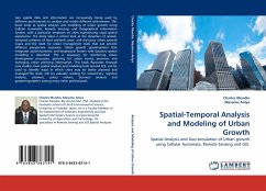
Spatial-Temporal Analysis and Modeling of Urban Growth
Spatial Analysis and Geo-simulation of Urban growth using Cellular Automata, Remote Sensing and GIS.
Versandkostenfrei!
Versandfertig in 6-10 Tagen
39,99 €
inkl. MwSt.

PAYBACK Punkte
20 °P sammeln!
Geo spatial data and information are increasingly being used by different professionals to analyze and model different phenomena. This book looks at spatial analysis and modeling of urban growth using Cellular Automata, Remote Sensing, and Geographical Information System, with a particular emphasis on cities experiencing rapid spatial expansions. The book takes a critical look at the dynamics of spatial-temporal patterns of land use/land cover, and discusses urban growth issues and the need for urban management tools that can provide different perspective scenarios. Urban growth geosimulation ...
Geo spatial data and information are increasingly being used by different professionals to analyze and model different phenomena. This book looks at spatial analysis and modeling of urban growth using Cellular Automata, Remote Sensing, and Geographical Information System, with a particular emphasis on cities experiencing rapid spatial expansions. The book takes a critical look at the dynamics of spatial-temporal patterns of land use/land cover, and discusses urban growth issues and the need for urban management tools that can provide different perspective scenarios. Urban growth geosimulation that integrates social-economic and biophysical factors with dynamic spatial modeling is described. This is necessary for monitoring urban development processes, planning for urban service provision and managing urban planning information. This book illustrates through case studies, how spatial analysis and modeling built around GIS, can be used to identify ways in which cities may be betterplanned and managed.The book will be valuable reading for researchers, regional analysts, planners, policy makers, business analysts and geodemographers among many other professionals.


