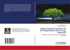
Spatio-temporal analysis of air temperature data in Iraq using GIS
Temperature distribution in the last four decades over Iraq
Herausgegeben: Al-Timimi, Yassen
Versandkostenfrei!
Versandfertig in 6-10 Tagen
41,99 €
inkl. MwSt.

PAYBACK Punkte
21 °P sammeln!
This book deals with the spatial and temporal analysis of temperature data in Iraq From1980-2015.The trends of temperature including monthly means for (maximum temperature ,minimum temperature and the mean temperature) were analyzed using linear regression and non parametric method, temporally by Mann-Kendall tests which are used to determine the significance of the trends, and spatially by Kriging interpolation and Thiessen method in the geographic information system (ArcGIS). This software program used techniques provide us a wide scope and collective picture for temperature risk detection a...
This book deals with the spatial and temporal analysis of temperature data in Iraq From1980-2015.The trends of temperature including monthly means for (maximum temperature ,minimum temperature and the mean temperature) were analyzed using linear regression and non parametric method, temporally by Mann-Kendall tests which are used to determine the significance of the trends, and spatially by Kriging interpolation and Thiessen method in the geographic information system (ArcGIS). This software program used techniques provide us a wide scope and collective picture for temperature risk detection and mapping over Iraq in the last four decades.


