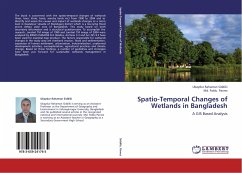
Spatio-Temporal Changes of Wetlands in Bangladesh
A GIS Based Analysis
Versandkostenfrei!
Versandfertig in 6-10 Tagen
45,99 €
inkl. MwSt.

PAYBACK Punkte
23 °P sammeln!
The book is concerned with the spatio-temporal changes of wetlands (haor, baor, khals, beels, marshy lands etc) from 1990 to 2004 and to identify and assess the causes and impact of wetlands changes at a micro level in Daulatpur Upazila of Manikganj district which is a low-lying flood prone deltaic plain area of Bangladesh. This study based on both secondary information and a structural questionnaire. To accomplish the research, Landsat TM image of 1990 and Landsat TM image of 2004 were analyzed by ERDAS IMAGINE 8.4. Besides, ArcView 3.3 and Arc GIS 9.2 have been used for essential map produce...
The book is concerned with the spatio-temporal changes of wetlands (haor, baor, khals, beels, marshy lands etc) from 1990 to 2004 and to identify and assess the causes and impact of wetlands changes at a micro level in Daulatpur Upazila of Manikganj district which is a low-lying flood prone deltaic plain area of Bangladesh. This study based on both secondary information and a structural questionnaire. To accomplish the research, Landsat TM image of 1990 and Landsat TM image of 2004 were analyzed by ERDAS IMAGINE 8.4. Besides, ArcView 3.3 and Arc GIS 9.2 have been used for essential map produce. The factors responsible for wetlands changes in the study area are riverbank erosion, flood and sedimentation, expansion of human settlement, urbanization, industrialization, unplanned development activities, overexploitation, agricultural practices and climate change. Based on these findings, a number of guidelines and strategies have been put forward for sustainable wetlands management in Bangladesh.


