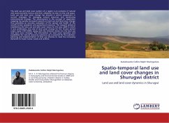
Spatio-temporal land use and land cover changes in Shurugwi district
Land use and land cover dynamics in Shurugwi
Versandkostenfrei!
Versandfertig in 6-10 Tagen
32,99 €
inkl. MwSt.

PAYBACK Punkte
16 °P sammeln!
The land use and land cover pattern of a region is an outcome of natural and socio-economic factors and their utilization by man in time and space. Land use and land cover change has become a central component in current strategies for managing natural resources and monitoring environmental changes. The advancement in the concept of vegetation mapping has greatly increased research on land use and land cover change thus providing an accurate evaluation of the spread and health of the world s forest, grassland, and agricultural resources. The research aimed at establishing the land use and land...
The land use and land cover pattern of a region is an outcome of natural and socio-economic factors and their utilization by man in time and space. Land use and land cover change has become a central component in current strategies for managing natural resources and monitoring environmental changes. The advancement in the concept of vegetation mapping has greatly increased research on land use and land cover change thus providing an accurate evaluation of the spread and health of the world s forest, grassland, and agricultural resources. The research aimed at establishing the land use and land cover status for the year 2009 in which it was undertaken; the rate of land cover change for the 18 year period under study (1991-2009), along with the inherent drivers for the land use and land cover changes. This information on land cover dynamics and possibilities for natural resources optimum use is essential for the selection; planning and implementation of land use schemes to meet theincreasing demands for basic human needs and welfare.


