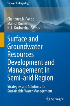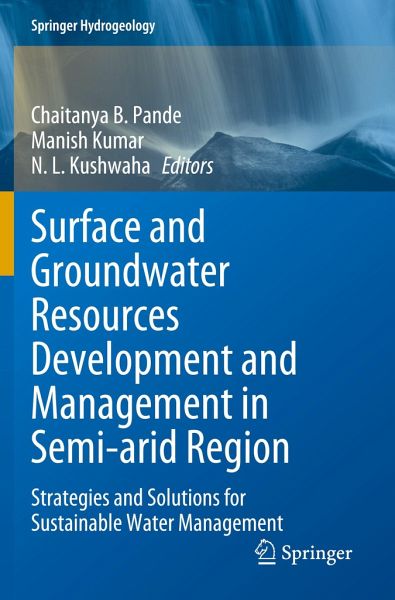
This book explains the challenges for efficient sustainable surface and groundwater development and management with the focus on India and other countries, providing a stable output presentation by using machine learning data mining methods, and modeling. It is a combination of machine learning, modeling, google earth engine, climate data modeling, remote sensing and GIS techniques, surface water modeling, AHP modeling, groundwater quality analysis, aquifer mapping, land use and land cover analysis, forecasting of water and rainfall and so on, its use to sustainable development, planning, and…mehr
This book explains the challenges for efficient sustainable surface and groundwater development and management with the focus on India and other countries, providing a stable output presentation by using machine learning data mining methods, and modeling. It is a combination of machine learning, modeling, google earth engine, climate data modeling, remote sensing and GIS techniques, surface water modeling, AHP modeling, groundwater quality analysis, aquifer mapping, land use and land cover analysis, forecasting of water and rainfall and so on, its use to sustainable development, planning, and management of groundwater purposes in India and other countries. The main purpose of this book will develop better outlines for the development of surface and groundwater and management in the semi-arid region climate, which supports the Sustainable Development Goals (SDGs) in India, especially on sustainable surface water and groundwater resources management.
This book provides amultidisciplinary overview for the faculty members, administrators scientists, policymakers, social science, and professionals involved in the various aspects of sustainable groundwater development, planning, and management.
Die Herstellerinformationen sind derzeit nicht verfügbar.
Autorenporträt
Dr Chaitanya B. Pande: He completed Ph.D. in Environment Science from Sant Gadge Baba Amravati University, Amravati and M.Sc. in Geoinformatics from Amravati University in 2011. His research interests include Remote Sensing, GIS, Google Earth Engine, Machine Learning, Watershed management, Hydrogeology, Hydrological Modeling, Drought Monitoring, Land Use and Land Cover analysis, Groundwater Quality, urban planning, Hydro-geochemistry, Groundwater Modelling, Geology, Hyperspectral Remote Sensing, Remote Sensing and GIS application in natural resources management, watershed management and Environmental Monitoring and assessment subjects. Dr Pande has more than 11 years of teaching, research and industrial experience. So far, he has published above 70 international and national research papers, 1 textbook, 3 edited book, 19 conferences papers and 18 book chapters with more than 1462 citations. He also acts as a reviewer for several scientific journals of the Internationalreputes with editorial board member in Journal of American Journal of Agricultural and Biological Sciences. Dr Manish Kumar, Assistant Professor (Con.), College of Agricultural Engineering and Technology, Dr Rajendra Prasad Central Agricultural University, Pusa, Bihar. He completed his B.Tech in Agricultural Engineering from Dr. Rajendra Prasad Central Agricultural University, Pusa, Bihar, M.Tech (SWCE) from MPUAT, Udaipur, Rajasthan, and obtained his Ph.D. in Soil and Water Conservation Engineering from G.B. Pant University of Agriculture and Technology, Pantnagar, Uttarakhand. Before joining RPCAU, he worked as Research Associate-III at WRDM Department, IIT Roorkee. He has published more than 30 research paper in National and International Journals with more than 260 citations. Dr Kumar received several awards for his contributions in the field of research and academics. He acts as reviewers for several scientific reputed journals. His research interests include hydrological modelling, watershed management, Remote Sensing and GIS, Land Use/Land Cover Analysis, application of AI in meteorological data estimation, climate change, groundwater modelling. Er. N. L. Kushwaha: Scientist, ICAR-Indian Agricultural Research Institute (IARI), Pusa Campus, New Delhi, India. For the past three years he has been involved in teaching and research. He completed his M. Tech. in Soil and Water Engineering from Punjab Agricultural University (PAU), Ludhiana, Punjab, India. Before joining IARI, he served as an Assistant Agricultural Engineering (AAE) at National Seeds Corporation Ltd., Hisar, Haryana for over 3 years, while he explored the sensor-based irrigation system and center pivot irrigation system for precise water application. By far, he has published 30 research papers in national and international journals with more than 250 citations. His research interests include AI in water resource management and planning, Remote Sensing, GIS, Climate change, Watershed modelling and management, Hydrogeology, Hydrological Modelling, Land use and land cover analysis, and Hyperspectral remote sensing in natural resources management.
Inhaltsangabe
Chapter 1. Evapotranspiration importance in water resources management through cutting-edge approaches of Remote sensing and machine learning algorithms (Ali Raza).- Chapter 2. Application of Remote Sensing and GIS for Morphometric Analysis: A Case Study of Burhanpur Watershed (Abhishek Patel).- Chapter 3. A GIS-based DRASTIC approach for Aquifer vulnerability assessment: Study conducted in the Municipal Corporation region of Ranchi, Jharkhand (Shivam Saw).- Chapter 4. Evaluation of Infiltration Models in an Agricultural Catchment Using Guelph Permeameter in Mysuru District (Harshith Y).- Chapter 5. Investigation of trends and variability associated with the SPI and SPEI as a drought prediction tools in Gujarat regions, India (Paras Hirapara).- Chapter 6. Fluoride mobilization and provenance identification in semi-arid conditions: A Hydrochemical and Isotopic approach (Abhinav Patel).- Chapter 7. A comparative study of different inverse groundwater models for aquifer parameter estimation (Sharad Patel).- Chapter 8. Water resources and irrigation management using GIS and Remote Sensing techniques: Case of Multan district (Pakistan) (Ali Raza).
Es gelten unsere Allgemeinen Geschäftsbedingungen: www.buecher.de/agb
Impressum
www.buecher.de ist ein Internetauftritt der buecher.de internetstores GmbH
Geschäftsführung: Monica Sawhney | Roland Kölbl | Günter Hilger
Sitz der Gesellschaft: Batheyer Straße 115 - 117, 58099 Hagen
Postanschrift: Bürgermeister-Wegele-Str. 12, 86167 Augsburg
Amtsgericht Hagen HRB 13257
Steuernummer: 321/5800/1497
USt-IdNr: DE450055826