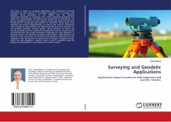
Surveying and Geodetic Applications
Applications based on extensive field experience and scientific theories
Versandkostenfrei!
Versandfertig in 6-10 Tagen
38,99 €
inkl. MwSt.

PAYBACK Punkte
19 °P sammeln!
This book is based on practical applications and theoretical formulae published by the authors. It introduces definitions of surveying and geodetic terms according to ISO 19000s and the national traditional standards of surveying work, while proposing standards that adopt new technologies, instruments and procedures to this domain. As part of published work for a new method, it discusses work that we have introduced for measuring deformations of structures whose parts have suffered non-uniform displacements, as well as, 3D traverse calculations using traditional total stations and differential...
This book is based on practical applications and theoretical formulae published by the authors. It introduces definitions of surveying and geodetic terms according to ISO 19000s and the national traditional standards of surveying work, while proposing standards that adopt new technologies, instruments and procedures to this domain. As part of published work for a new method, it discusses work that we have introduced for measuring deformations of structures whose parts have suffered non-uniform displacements, as well as, 3D traverse calculations using traditional total stations and differential GPS and new formulae for the geodetic geodesic, normal section, chord distances as direct and reverse problems used for a plethora of applications such as measuring the continental drift and crustal movements especially for large distances. It portrays theories of adjusting surveying and geodetic measurements and based on work carried out on 18 airports, the geodetic applications for air navigation with descriptions of components of airports, navigational aids, charts for safe navigation, obstacle charts A and B, geodetic work for taking off and landing of aircrafts based on ICAO annexes.


