Sustainability of Natural Resources
Planning, Development, and Management
Herausgeber: Kumar, Rohitashw; Varade, Abhay M; Pande, Chaitanya B; Singh, Vijay P; Moharir, Kanak N
Sustainability of Natural Resources
Planning, Development, and Management
Herausgeber: Kumar, Rohitashw; Varade, Abhay M; Pande, Chaitanya B; Singh, Vijay P; Moharir, Kanak N
- Gebundenes Buch
- Merkliste
- Auf die Merkliste
- Bewerten Bewerten
- Teilen
- Produkt teilen
- Produkterinnerung
- Produkterinnerung
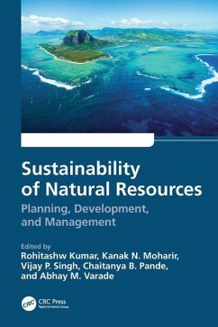
Sustainability of Natural Resources: Planning, Development, and Management addresses water resources exploration, planning, recent geographic information system-based studies, and groundwater modeling and applications. It highlights the optimal strategies for sustainable water resources management and development.
Andere Kunden interessierten sich auch für
![Experiment Design for Environmental Engineering Experiment Design for Environmental Engineering]() Francis J HopcroftExperiment Design for Environmental Engineering155,99 €
Francis J HopcroftExperiment Design for Environmental Engineering155,99 €![Sustainable Development Indicators Sustainable Development Indicators]() Søren Nors NielsenSustainable Development Indicators119,99 €
Søren Nors NielsenSustainable Development Indicators119,99 €![Hydraulic Designs of Pipelines, Intakes and Outlets Hydraulic Designs of Pipelines, Intakes and Outlets]() Sheng T HsuHydraulic Designs of Pipelines, Intakes and Outlets180,99 €
Sheng T HsuHydraulic Designs of Pipelines, Intakes and Outlets180,99 €![Green Productivity and Cleaner Production Green Productivity and Cleaner Production]() Guttila Yugantha JayasingheGreen Productivity and Cleaner Production119,99 €
Guttila Yugantha JayasingheGreen Productivity and Cleaner Production119,99 €![Improving Global Worker Health and Safety Through Collaborative Capacity Building Initiatives Improving Global Worker Health and Safety Through Collaborative Capacity Building Initiatives]() Improving Global Worker Health and Safety Through Collaborative Capacity Building Initiatives119,99 €
Improving Global Worker Health and Safety Through Collaborative Capacity Building Initiatives119,99 €![Environmental Risk Communication Environmental Risk Communication]() Susan Zummo ForneyEnvironmental Risk Communication166,99 €
Susan Zummo ForneyEnvironmental Risk Communication166,99 €![Respiratory Protection Against Hazardous Biological Agents Respiratory Protection Against Hazardous Biological Agents]() Katarzyna MajchrzyckaRespiratory Protection Against Hazardous Biological Agents145,99 €
Katarzyna MajchrzyckaRespiratory Protection Against Hazardous Biological Agents145,99 €-
-
-
Sustainability of Natural Resources: Planning, Development, and Management addresses water resources exploration, planning, recent geographic information system-based studies, and groundwater modeling and applications. It highlights the optimal strategies for sustainable water resources management and development.
Hinweis: Dieser Artikel kann nur an eine deutsche Lieferadresse ausgeliefert werden.
Hinweis: Dieser Artikel kann nur an eine deutsche Lieferadresse ausgeliefert werden.
Produktdetails
- Produktdetails
- Verlag: CRC Press
- Seitenzahl: 376
- Erscheinungstermin: 28. Juni 2024
- Englisch
- Abmessung: 254mm x 178mm x 24mm
- Gewicht: 916g
- ISBN-13: 9781032295312
- ISBN-10: 1032295317
- Artikelnr.: 70146274
- Herstellerkennzeichnung
- Libri GmbH
- Europaallee 1
- 36244 Bad Hersfeld
- gpsr@libri.de
- Verlag: CRC Press
- Seitenzahl: 376
- Erscheinungstermin: 28. Juni 2024
- Englisch
- Abmessung: 254mm x 178mm x 24mm
- Gewicht: 916g
- ISBN-13: 9781032295312
- ISBN-10: 1032295317
- Artikelnr.: 70146274
- Herstellerkennzeichnung
- Libri GmbH
- Europaallee 1
- 36244 Bad Hersfeld
- gpsr@libri.de
Rohitashw Kumar (B.E., M.E., Ph. D.) is Associate Dean and Professor in the College of Agricultural Engineering and Technology, Sher-e-Kashmir University of Agricultural Sciences and Technology of Kashmir, Srinagar, India. He worked as Professor Water Chair (Sheikkul Alam ShiekhNuruddin Water Chair), Ministry of Jal Shakti, Government of India, at the National Institute of Technology, Srinagar (J&K) for 3 years. He is also Professor and Head, Division of Irrigation and Drainage Engineering. He obtained his Ph.D. degree in Water Resources Engineering from the National Institute of Technology, Hamirpur, and Master of Engineering Degree in Irrigation Water Management Engineering from Maharana Pratap University of Agriculture and Technology, Udaipur. He received a gold medal in 2022, a leadership award in 2020, a Special Research award in 2017, and a Student Incentive Award in 2015 (Ph.D. Research) from the Soil Conservation Society of India, New Delhi. He also got the first prize for the best M. Tech thesis in Agricultural Engineering in 2001 in India. He has published over 130 papers in peer-reviewed journals, more than 25 popular articles, 8 books, 4 practical manuals, and 30 book chapters. He has guided two Ph.D students and 16 M.Tech students in soil and water engineering. He has handled more than 12 research projects as a principal or co-principal investigator. Since 2011, he has been the Principal Investigator of ICAR, All India Coordinated Research Project on Plastic Engineering in Agriculture Structural and Environment Management. Kanak N. Moharir is working as Assistant Professor at Banasthali University, Jaipur, India. She has more than 5 years of teaching and research experience and has published more than 40 research papers in national and international journals and has presented 15 papers in national and international conferences with more than 870 citations. She is working in remote sensing, watershed management, hydrology, land use and land cover, aquifer mapping, groundwater modeling, hydrogeology, geomorphology, and geology. Vijay P. Singh is a Distinguished Professor, a Regents Professor, and the inaugural holder of the Caroline and William N. Lehrer Distinguished Chair in Water Engineering at Texas A&M University. His research interests include surface water hydrology, groundwater hydrology, hydraulics, irrigation engineering, environmental quality, water resources, water-food-energy nexus, climate change impacts, entropy theory, copula theory, and mathematical modeling. He graduated with a B.Sc. in Engineering and Technology with emphasis on Soil and Water Conservation Engineering in 1967 from U.P. Agricultural University, India. He earned an MS in Engineering with specialization in Hydrology in 1970 from the University of Guelph, Canada; a Ph.D. in Civil Engineering with specialization in Hydrology and Water Resources in 1974 from Colorado State University, Fort Collins, USA; and a D.Sc. in Environmental and Water Resources Engineering in 1998 from the University of the Witwatersrand, Johannesburg, South Africa. He has published extensively on a wide range of topics. His publications include more than 1,365 journal articles, 32 books, 80 edited books, 305 book chapters, and 315 conference proceedings papers. For his seminar contributions, he has received more than 100 national and international awards, including three honorary doctorates. Currently, he serves as Past President of the American Academy of Water Resources Engineers, the American Society of Civil Engineers (ASCE), and previously, he served as President of the American Institute of Hydrology and Cahir, Watershed Council, ASCE. He is Editor-in-Chief of two book series and three journals and serves on the editorial boards of more than 25 journals. He has served as Editor-in-Chief of three other journals. He is a Distinguished Member of the American Society of Civil Engineers, an Honorary Member of the American Water Resources Association, an Honorary Member of International Water Resource Association, and a Distinguished Fellow of the Association of Global Groundwater Scientists. He is a fellow of five professional societies. He is also a fellow or member of 11 national or international engineering or science academies. Chaitanya B. Pande has completed his Ph.D. in Environment Science from Sant Gadge Baba Amravati University. He has completed M.Sc. in Geoinformatics from Amravati University in 2011. He has more than 11 years of teaching, research, and industrial experience. He is a reviewer for several scientific journals of the international repute and an editorial board member in the American Journal of Agricultural and Biological Sciences. He has published 57 research papers, 1 textbook, 3 edited books entitled "Groundwater Resources Development and Planning in the Semi¿rid Region," 19 conference papers, and 18 book chapters with more than 1,349 citations. His research interests include remote sensing, GIS, Google Earth Engine, machine learning, watershed management, hydrogeology, hydrological modeling, drought monitoring, land use and land cover analysis, groundwater quality, urban planning, hydro-eochemistry, groundwater modeling, geology, hyperspectral remote sensing, remote sensing and GIS application in natural resources management, watershed management, and environmental monitoring and assessment subjects. Abhay M. Varade is working as an Associate Professor at the Post Graduate Department of Geology, Rashtrasant Tukadoji Maharaj Nagpur University, Nagpur. He has completed his M.Sc. in Geology from Amravati University, Amravati, and M.Tech. in Petroleum Exploration from the renowned Indian School of Mines, Dhanbad. Before joining the post of Lecturer in the Department of Geology, RTM Nagpur University Nagpur, he obtained experience at the Central Mining Research Institute (CSIR Lab., Dhanbad) and SGS India Pvt. Limited, Mumbai. Presently, he is associated with different Earth science-related societies. Till date, he has published 77 research papers in the journals/books of international (25 international) and national (52 national) repute and also edited (Editor) three Special Volumes of Gondwana Geological Society (Journal of Geosciences Research). His publications mainly cover the topics like sedimentology, coal bed methane technology, coal petrology, Quaternary geology and vertebrate palaentology, hydrochemistry, applications of RS/GIS and geophysical/geostatistical techniques in groundwater and agricultural based studies, pumping test analysis for aquifer characterization, watershed characterization, and prioritization and management. He is a reviewer for high-impact factor journals along with several other Indian referred journals and has worked as a Co-chairman/Rapporteur in many scientific/technical sessions. As an Organizing Secretary, he has organized five national/state-level seminars/conferences. Presently, he is working on an International Book Proposal related to Climate Change Impact - Uzbekistan. His noteworthy contribution includes Advisory Committee Membership of UGC¿SAP Programme for the Department of Geology, RTM NU (2016-2021); Core Member of RTM NU Nagpur for NAAC (2020 NAAC); Member of the Task Force Committee-board of Studies in Geology (2016-2018); Ex¿Executive Member of the Alumni Association of the Department of Geology, RTM NU (2016-2018); Ex¿Executive Member (Joint Secretary) of the Gondwana Geological Society, Nagpur; Deputy Chief Officer for the Examination of RTM NU (2012-2013); and Training and Placement In¿harge (2004-2009; 2016-2017; 2017-2021).
Chapter 1 Characterization and Mapping of Soils for Sustainable Management
Using Geospatial Techniques. 1.1 Introduction. 1.2 Materials and Methods.
1.3 Results and Discussion. 1.4 Available Potassium. 1.5 Land Capability
Classification. 1.6 Soil Suitability for Crops. 1.7 Recommendation. 1.8
Conclusion. Chapter 2 Sustainable Biodiversity Conservation in Tribal Area.
2.1 Introduction. 2.2 Tribes Role in Indigenous Botanical knowledge (IBK).
2.3 Tribes Ethno Botany and Traditional Practices. 2.4 Tribes Relationship
with Flora Protection. 2.5 Ethnic and Aboriginal Peoples' Role in
Conservation. 2.6 Tribal Relationship with Fauna. 2.7 Tribes Role in
Conservation of Insects. 2.8 Tribes of Southern Indian. 2.9 North Eastern
Tribes. 2.10 Tribes Association in Protecting Nature. 2.11 Conclusion.
Chapter 3 Soil Bioengineering Practices for Sustainable Ecosystem
Restoration in Landslide-Affected Areas. 3.1 Introduction. 3.2 Ecosystem
Deterioration and Need to Replenish. 3.3 Landslides and Ecology
Deterioration. 3.4 Landslide Restoration. 3.5 Landslide Restoration: Losses
Incurred Directly vs. Indirectly. 3.6 Landslide-Associated Problems and
Their Mitigation & Management Measures. 3.7 Bioengineering Strategy in
Landslide Risk Mitigation. 3.8 Application. 3.9 Participation of the Social
Environment in the Application and Succession of Soil Bioengineering. 3.10
Slope Stability and Ecosystem Restoration. 3.11 Native Species in Ecosystem
Regeneration. 3.12 Barrier to Ecological Restoration of Landslides. 3.13
Indigenous People and their Support. 3.14 Indigenous Knowledge in Ecosystem
Restoration. 3.15 Selection of Potential Indigenous Plants Based on Their
Soil Reinforcement and Anchoring Capabilities. 3.16 Recommendations. 3.17
Conclusion. Chapter 4 Sustainable Ecosystem Development and Landscaping for
Urban and Peri-Urban Areas. 4.1 Introduction. 4.2 Landscapes. 4.3
Challenges. 4.4 Conclusion. Chapter 5 Climate Change Impact of Fluoride
Contamination on Human Health in Dry Zone of Sri Lanka. 5.1 Introduction.
5.2 Study Area. 5.3 Climate Change and Fluoride Contamination in
Groundwater. 5.4 Groundwater Resources and Climate Change in Sri Lanka. 5.5
Fluoride Contamination & Health Issues in Dry Zone Sri Lanka. 5.6
Conclusion. Chapter 6 Application of Geospatial Technology in Catchment
Modeling Using SCS-CN Method for Estimating the Direct Runoff on Barakar
River Basin, Jharkhand. 6.1 Introduction. 6.2 Study Area. 6.3 Materials and
Methods. 6.4 SCS-CN method. 6.5 Methodology. 6.6 Results and Discussions.
6.7 Antecedent Moisture Conditions, CN I and CN III Values. 6.8 Potential
Maximum Retention (S) and Runoff Depth (Q). 6.9 Conclusion. Chapter 7
Hydro-Geospatial Investigation to Propose Water Conservation Sites for
Water Management in Limestone Terrain. 7.1 Introduction. 7.2 Study Area.
7.3 Materials and Methods. 7.4 Results and Discussion. 7.5 Lithology. 7.6
Lineament Density. 7.7 Geomorphology. 7.8 Drainage Density. 7.9 Rainfall.
7.10 Land Use/Land Cover (LULC). 7.11 Slope. 7.12 Soil. 7.13 Terrain
Wetness Index (TWI). 7.14 Validation. 7.15 Conclusion. Chapter 8 Rainfall
Spatiotemporal Variability and Trends in Semi-Arid Ecological Zone of
Nigeria. 8.1 Introduction. 8.2 Study Area. 8.3 Materials and Methods. 8.4
Results and Discussion. 8.5 Rainfall Characteristics. 8.6 Annual,
Interannual, and Monthly Trends. 8.7 Trends Detection Based on the WMO
Standardized Period. 8.8 Implications for Agriculture and Water Ecosystem
Services. 8.9 Conclusion. Chapter 9 Climate Change Awareness, Perception,
and Adaptation Strategies for Small and Marginal Farmers in Yobe State,
Nigeria. 9.1 Introduction. 9.2 Materials and Methods. 9.3 Study Area. 9.4
Data Compilation Techniques. 9.5 Sampling Procedures. 9.6 Analysis of Data.
9.7 Results and Discussion. 9.8 Climate Change and Farmers' Perceptions.
9.9 Factors that Influence Farmers' Perceptions of Climate Change. 9.10
Constraints Facing Farmers as a Result of Climate Change. 9.11 Conclusion
and Recommendation.
Chapter 10 Delineation of Groundwater Prospect Zones Based on Earth
Observation Data and AHP Modelling - A Study from Basaltic Rock Formation.
10.1 Introduction. 10.2. Study Area Description. 10.3. Materials and
Methods. 10.4 Results and Discussion. 10.5 Groundwater Prospective Zone
Mapping. 10.6. Validation. 10.7. Conclusion. Chapter 11 Hydro-geochemical
Evaluation of Phreatic Groundwater for Assessing Drinking and Irrigation
Appropriateness - A Case Study of Chandrapur Watershed. 11.1 Introduction.
11.2 Fluorite (CaF2) Mineralization in Geological Environment. 11.3 Study
Area Details. 11.4 Materials and Methods. 11.5 Physicochemical
Characteristics of Groundwater. 11.6 Discussion on Groundwater
Appropriateness. 11.7 F-Contents from Study Area. 11.8 Conclusions. Chapter
12 Variability of Gound Water Quality in Quaternary Aquifers of the Cauvery
and Vennar Sub-basins within the Cauvery Delta, Southern India. 12.1
Introduction. 12.2 Materials and Methods. 12.3 Results and Discussion. 12.4
Drinking Water Quality. 12.5 Water Quality Index. 12.6 Irrigation
Suitability. 12.7 Hydrogeochemical Processes. 12.8 Gibbs Plot. 12.9 Chadha
Diagram. 12.10 Conclusions. Chapter 13 Groundwater Potential Zones Mapping
based on the ANN and ML Models Using AHP and MIF Techniques. 13.1
Introduction. 13.2. Methods for Identification of Groundwater Potential
Zones 13.3 Multi Influence Factor (MIF). 13.4 Machine Learning Models (ML).
13.5 Hybrid Intelligence Approach. 13.6 Conclusion and Recommendations.
Chapter 14 Irrigation Water Requirement and Estimation of ETo Based on the
Remote Sensing, GIS, and Other Technologies. 14.1 Introduction. 14.2
Potential and References Evapotranspiration. 14.3 Potential
Evapotranspiration. 14.4 Reference Crop Evapotranspiration. 14.5 Effective
Precipitation (EP) Definition. 14.6 Measurements of Effective Rainfall.
14.7 Net Irrigation Water Requirement (NIWR). 14.8 Datasets Sources to
Estimate Reference Evapotranspiration (ETo). 14.9 Calculation of Reference
Evaporation. 14.10 Approaches Used for Estimating the Reference
Evapotranspiration (ETo) and Crop Water Requirements (CWR). 14.11.
Traditional Methods for Estimating (ETo). 14.12 Temperature-Based Methods.
14.13. Lysimeter Experiments. 14.14 Eddy Covariance. 14.15. Remote Sensing
Energy Balance. 14.16. Crop Evapotranspiration (ETC) and Crop Water
Requirements (CWR). 14.17. Artificial Intelligence Methods for Estimating
ET0. 14.18 Conclusions. Chapter 15 Smart Irrigation Water Using Sensors and
Internet of Things (IOT). 15.1 Introduction. 15.2 Benefits of Smart
Irrigation System and Datasets. 15.3 Smart Irrigation System Components.
15.4 ARDUINO Uno. 15.5 DHTll Temperature and Humidity Sensor. 15.6
Connecter Wire. 15.7 Different Sensors Used in Smart Irrigation System.
15.8 Algorithms Used for Smart Irrigation. 15.9 Applications of Smart
Irrigation in Agricultural Water Saving. 15.10 Conclusions and
Recommendations. Chapter 16 Analysis of Climate Variability and Change
Impact on Rainfall Trend Pattern in Nigeria: A Case Study of Calabar River
Basin, South-eastern Nigeria. 16.1 Introduction. 16.2 Aim and Objectives.
16.3 Study Area. 16.4 Literature Review. 16.5 Methodology. 16.6 Results.
16.7 Discussions and Recommendations. 16.8 Conclusion. Chapter 17
Assessment of Hydrochemistry and Water Quality Index for Groundwater
Quality - A Case Study of Maharashtra. 17.1 Introduction.
17.2 Study Area Setup. 17.3 Results and Discussion. 17.4 Physicochemical
Parameters of Groundwater. 17.5 Water Types. 17.6 Correlation Analysis.
17.7 Correlation investigation of groundwater. 17.8 Water Quality Index.
17.9 Conclusions. Chapter 18 Assessment of Heavy Metal Contamination in
Water and Sediments of Major Industrial Streams. 18.1. Introduction. 18.2.
Materials and Methods. 18.3. Results and Discussion. 18.4. Conclusion.
Chapter 19 Water Waste Treatment and Reuse for Sustainability. 19.1
Introduction. 19.2 Types of Water Waste. 19.3 Goals of Wastewater
Management. 19.4 Management of Water Quality. 19.5 Grouping of Pollutants
in Wastewater. 19.6 Categorization of Methods Used in Treating Wastewater.
19.7 Characterization of Wastewater. 19.8 Wastewater Objectives. 19.9 Water
Waste Treatment Process. 19.10 Water Reuse. 19.11 Wastewater Reuse. 19.12
Factors Affecting Reusability of Wastewater. 19.13 Additional Water Quality
Parameters to Consider for Wastewater Reuse. 19.14 Applications of Water
Reuse. 19.15 Regulations for Water Reuse. 19.16 Challenges on Wastewater
Treatment and Reuse. 19.17 Conclusion. Chapter 20 Watershed Development - A
Holistic Approach for Sustainable Agriculture. 20.1 Introduction. 20.2
Characteristics of Watersheds 20.3 Classification of Watershed. 20.4
Watershed Characteristics: Physical and Geomorphologic Characteristics
associated with Watersheds. 20.5 Watershed Management and its Objectives.
20.6 Effect of Physical Properties on Watershed Management. 20.7 Effect of
Geomorphologic Factors and Associated Processes on Watershed Management.
20.8 Scope of Watershed Management. 20.9 Watershed Management: Indian
Perspective. 20.10 Problems and Constraints in Watershed Management. 20.11
New Prospects and Opportunities Associated with Watershed Management. 20.12
Land Capability and its Classification. 20.13 Impact on Watershed due to
Land Use. 20.14 Planning the Land Use. 20.15 Applications of Remote Sensing
and GIS in Watershed Planning. 20.16 Watershed Policy Analysis and Decision
Support. 20.17 Conclusion.

