48,99 €
inkl. MwSt.
Versandkostenfrei*
Versandfertig in über 4 Wochen
  • Broschiertes Buch

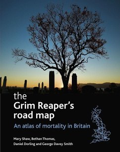
This impressive full-color atlas with over 100 color-coded and accessible maps uniquely presents the geography of mortality in Britain. The book presents data from more than 14 million deaths over a 24-year period in Britain. The maps detail over 100

Produktbeschreibung
This impressive full-color atlas with over 100 color-coded and accessible maps uniquely presents the geography of mortality in Britain. The book presents data from more than 14 million deaths over a 24-year period in Britain. The maps detail over 100
Hinweis: Dieser Artikel kann nur an eine deutsche Lieferadresse ausgeliefert werden.
Autorenporträt
Mary Shaw is Reader in Medical Sociology in the Department of Social Medicine at the University of Bristol. She has published extensively in the field of health inequalities and is an active proponent of the use of photography in social science. Bethan Thomas is a researcher in the Department of Geography at the University of Sheffield. Her research interests include the social geography of Great Britain, social and health inequalities and visualisation methods. George Davey Smith is Professor of Clinical Epidemiology in the Department of Social Medicine at the University of Bristol. His research interests span socioeconomic differentials in health, lifecourse influences on chronic disease in adulthood, AIDS/HIV prevention in India and meta-analysis. Danny Dorling is Professor of Human Geography at the University of Sheffield. His research aims to understand and map the changing social, political and medical geographies of Britain and further afield, concentrating on social and spatial inequalities to life chances and how these may be narrowed.