277,99 €
inkl. MwSt.
Versandkostenfrei*
Versandfertig in über 4 Wochen
  • Gebundenes Buch

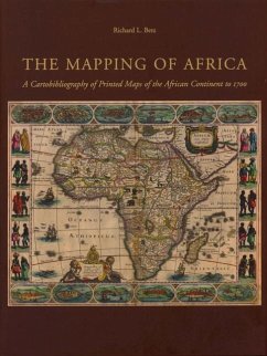
The Mapping of Africa systematically categorizes and provides an overview of all printed maps showing the entire African continent published from 1508 to 1700. Volume 7 in the Utrechtse Historisch-Cartografische Studies.

Produktbeschreibung
The Mapping of Africa systematically categorizes and provides an overview of all printed maps showing the entire African continent published from 1508 to 1700. Volume 7 in the Utrechtse Historisch-Cartografische Studies.
Hinweis: Dieser Artikel kann nur an eine deutsche Lieferadresse ausgeliefert werden.
Autorenporträt
Richard and Penelope have had a lifelong attraction to Africa. At present, they are co-owners of Hemispheres Antique Maps & Prints. Prior to founding Hemispheres, Richard completed a career in economic development work with over twenty years of consulting and living in many areas of the world. Twelve of these years were spent living in Africa, with numerous visits to many parts of the continent since then. His doctoral dissertation focused on factors that influenced the successful development of rural enterprise in Africa. A native Californian, Penelope met and married Richard, who is from New Hampshire, when they served as U.S. Peace Corps Volunteers on St. Lucia and Barbados. With her BA in Art History and Masters of Education in Teaching English as a Second Language, Penelope taught Art, Elementary School, High School English and ESL in various International and American schools for 25 years. She also worked for two years as a writer and editor of Teacher Training Materials and ESL textbooks. They have three grown children, and several grandchildren.