22,99 €
inkl. MwSt.

Versandfertig in über 4 Wochen
  • Broschiertes Buch

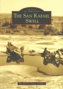
The San Rafael Swell is an anticline, or a geological uplift, that originally looked like an oval bowl turned upside down. Over time it has been carved into castle-like formations and deep canyons by erosive conditions. This landscape seemed so formidable to early cartographers that it was the last area in the continental United States to be mapped. The San Rafael Swell itself has no permanent human inhabitants, but small towns are scattered along its northern and eastern borders where first American Indians and later cowboys, ranchers, and miners made their homes. The hardy settlers of these…mehr

Produktbeschreibung
The San Rafael Swell is an anticline, or a geological uplift, that originally looked like an oval bowl turned upside down. Over time it has been carved into castle-like formations and deep canyons by erosive conditions. This landscape seemed so formidable to early cartographers that it was the last area in the continental United States to be mapped. The San Rafael Swell itself has no permanent human inhabitants, but small towns are scattered along its northern and eastern borders where first American Indians and later cowboys, ranchers, and miners made their homes. The hardy settlers of these towns familiarized themselves with what they called "the Desert" and gradually discovered its treasures and its secrets.
Autorenporträt
Author Dottie Grimes began working with the Emery County Archives in 2001, and she helped to write two books about Emery County: Cowboy Poetry from the San Rafael and Castle Valley: Our Towns, Our Desert, Our Mountains. She is currently administrator of the Emery County Archives, vice president of the Emery County Historical Society, and a member of the Emery County Historic Preservation Commission. The photographs in this volume were drawn from the Emery County Archives, special collections at Brigham Young University, Utah State History, and from private collections.