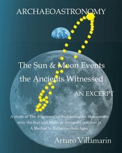
A method was developed to find the age of ancient monuments using the sun's declination in antiquity. This method showed the monument ages in the study are significantly older than those calculated via other methods. In this excerpt we present the results from the study of Teotihuacan in Mexico and El Infiernito in Colombia Thousands of years in the past, the earth's axis due to the variation in its obliquity (nutation) and its precession, pointed to the celestial sphere in a different direction than it does today. These two factors made the sun rays impinge upon a site on earth at an angle different than it does today at any time during the year. Since the early days in human history it has been claimed, some archaeological monuments were designed in antiquity to align with the sun at certain times during the year. Those claims were and are mostly based on observations under contemporary astronomical conditions, not under the then prevailing conditions in the year they were designed in. Today those monuments have become misaligned since those earth axis' parameters have continued changing thru the ages; which makes those contemporary observations just approximations. Going back in time to find the original direction the earth's axis pointed to when the monuments were designed to align with the sun, allows us to calculate their ages. Plotting the calculated sun's geographic positions during the solstice thru millennia with respect to a monument on a GIS map, generates a curve analog to an analemma, which we named a Super-Analemma. Extending a line on the GIS map at the azimuth of a monument's axis of symmetry to its intersection point with the Super-Analemma yields the year of the monument's original alignment with the sun; hence its age. Applying the method in various archaeological sites unexpected alignments of the sun were found in combination with those from the moon, in the years the method indicated the monuments were designed. These alignments validated some of those traditionally claimed singly for the sun or the moon, but with greater precision. The Teotihuacan results show that the position of the pyramids in the layout, not only matches various astronomical phenomena but also show the arrangement reflects the planetary system. The connection between the events and the physical layout is punctuated by the Avenue of the Dead: Its length, its orientation and its displacement from the pyramids of the sun and Quetzalcoatl alignment. The following sites are included in the complete study: Teotihuacán in México, El Infiernito in Colómbia, Mohenjo Daro in Pakistan, Machu Picchu in Peru, Giza in Egypt, Kalasasaya in Bolivia, Stonehenge in the UK and Tifariti in W. Sahara.
Hinweis: Dieser Artikel kann nur an eine deutsche Lieferadresse ausgeliefert werden.
Hinweis: Dieser Artikel kann nur an eine deutsche Lieferadresse ausgeliefert werden.



![Sun Yat Sen and the Awakening of China [microform] Sun Yat Sen and the Awakening of China [microform]](https://bilder.buecher.de/produkte/65/65634/65634553m.jpg)