21,99 €
inkl. MwSt.

Versandfertig in 2-4 Wochen
  • Broschiertes Buch

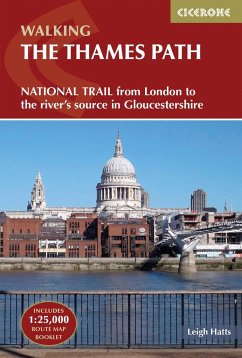
The route is described from east to west in 20 stages between 6 and 26km (4-16 miles) in length. An optional route extension from Erith in Kent to the traditional start at Woolwich Foot Tunnel is also provided. * GPX files available to download * Contains step-by-step description of the route alongside 1:50,000 OS maps * Includes a separate map booklet containing OS 1:25,000 mapping and route line * Handy route summary table helps you plan your itinerary * Refreshment and accommodation information given for each route stage * Public transport by stage is listed for those wanting to break the trail into shorter sections…mehr

Produktbeschreibung
The route is described from east to west in 20 stages between 6 and 26km (4-16 miles) in length. An optional route extension from Erith in Kent to the traditional start at Woolwich Foot Tunnel is also provided. * GPX files available to download * Contains step-by-step description of the route alongside 1:50,000 OS maps * Includes a separate map booklet containing OS 1:25,000 mapping and route line * Handy route summary table helps you plan your itinerary * Refreshment and accommodation information given for each route stage * Public transport by stage is listed for those wanting to break the trail into shorter sections
Hinweis: Dieser Artikel kann nur an eine deutsche Lieferadresse ausgeliefert werden.
Autorenporträt
Leigh Hatts has been walking the Thames towpath and exploring the river and Docklands since 1981, when he worked on the feasibility study that resulted in the decision to establish the route as a National Trail. He worked as a reporter with the walkers' magazine TGO and as arts correspondent of the Catholic Herald. He is co-founder of Bankside Press.