- Gebundenes Buch
- Merkliste
- Auf die Merkliste
- Bewerten Bewerten
- Teilen
- Produkt teilen
- Produkterinnerung
- Produkterinnerung
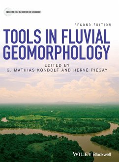
Fluvial Geomorphology studies the biophysical processes acting in rivers, and the sediment patterns and landforms resulting from them. It is a discipline of synthesis, with roots in geology, geography, and river engineering, and with strong interactions with allied fields such as ecology and landscape architecture. This book comprehensively reviews tools used in fluvial geomorphology, at a level suitable to guide the selection of research methods for a given question. Presenting an integrated approach to the interdisciplinary nature of the subject, it provides guidance for researchers and…mehr
Andere Kunden interessierten sich auch für
![Fundamentals of Fluvial Geomorphology Fundamentals of Fluvial Geomorphology]() Ro Charlton (National University of Ireland, Maynooth, Ireland)Fundamentals of Fluvial Geomorphology105,99 €
Ro Charlton (National University of Ireland, Maynooth, Ireland)Fundamentals of Fluvial Geomorphology105,99 €![The Application of Hydraulic and Sediment Transport Models in Fluvial Geomorphology The Application of Hydraulic and Sediment Transport Models in Fluvial Geomorphology]() The Application of Hydraulic and Sediment Transport Models in Fluvial Geomorphology110,99 €
The Application of Hydraulic and Sediment Transport Models in Fluvial Geomorphology110,99 €![Global Geomorphology Global Geomorphology]() Michael A. SummerfieldGlobal Geomorphology85,99 €
Michael A. SummerfieldGlobal Geomorphology85,99 €![Geomorphology in the Anthropocene Geomorphology in the Anthropocene]() Andrew S. Goudie (University of Oxford)Geomorphology in the Anthropocene92,99 €
Andrew S. Goudie (University of Oxford)Geomorphology in the Anthropocene92,99 €![Geomorphology of Central America Geomorphology of Central America]() Jean Pierre BergoeingGeomorphology of Central America109,99 €
Jean Pierre BergoeingGeomorphology of Central America109,99 €![The Geology of Devon The Geology of Devon]() The Geology of Devon45,99 €
The Geology of Devon45,99 €![Fluvial Processes Fluvial Processes]() Ana Maria Ferreira da SilvaFluvial Processes214,99 €
Ana Maria Ferreira da SilvaFluvial Processes214,99 €-
-
-
Fluvial Geomorphology studies the biophysical processes acting in rivers, and the sediment patterns and landforms resulting from them. It is a discipline of synthesis, with roots in geology, geography, and river engineering, and with strong interactions with allied fields such as ecology and landscape architecture. This book comprehensively reviews tools used in fluvial geomorphology, at a level suitable to guide the selection of research methods for a given question. Presenting an integrated approach to the interdisciplinary nature of the subject, it provides guidance for researchers and professionals on the tools available to answer questions on river restoration and management. Thoroughly updated since the first edition in 2003 by experts in their subfields, the book presents state-of-the-art tools that have revolutionized fluvial geomorphology in recent decades, such as e.g., physical and numerical modelling, remote sensing and GIS, new field techniques and advances in dating, tracking and sourcing, statistical approaches as well as more traditional methods such as system concept, stratigraphic analysis, form and flow characterisation or historical analysis. This book: Covers five main types of geomorphological questions and their associated tools: historical framework; spatial framework; chemical, physical and biological methods; analysis of processes and forms; and future understanding framework. Provides guidance on advantages and limitations of different tools for different applications, data sources, equipment and supplies needed, and case studies illustrating their application in an integrated perspective. It is an essential resource for researchers and professional geomorphologists, hydrologists, geologists, engineers, planners, and ecologists concerned with river management, conservation and restoration. It is a useful supplementary textbook for upper level undergraduate and graduate courses in Geography, Geology, Environmental Science, Civil and Environmental Engineering, and interdisciplinary courses in river management and restoration.
Hinweis: Dieser Artikel kann nur an eine deutsche Lieferadresse ausgeliefert werden.
Hinweis: Dieser Artikel kann nur an eine deutsche Lieferadresse ausgeliefert werden.
Produktdetails
- Produktdetails
- Advancing River Restoration and Management
- Verlag: John Wiley and Sons Ltd
- 2nd Edition
- Seitenzahl: 560
- Erscheinungstermin: 13. Juni 2016
- Englisch
- Abmessung: 286mm x 221mm x 35mm
- Gewicht: 1784g
- ISBN-13: 9780470684054
- ISBN-10: 0470684054
- Artikelnr.: 43038632
- Herstellerkennzeichnung
- Libri GmbH
- Europaallee 1
- 36244 Bad Hersfeld
- gpsr@libri.de
Mathias (Matt) Kondolf, Professor of Environmental Planning, University of California Berkeley, USA Professor Kondolf is a fluvial geomorphologist specializing in environmental river management and restoration. At Berkeley he teaches courses in hydrology, river restoration, and environmental science. His research focuses on human-river interactions, with emphasis on managing of flood-prone lands, managing sediment in rivers and reservoirs, and river restoration, and he has published extensively on these topics. He has served as advisor to US and state agencies on river management and restoration, and provided expert testimony before the US Congress, the California Legislature, and the International Court of Justice and International Court of Arbitration in the Hague. Hervé Piégay, Research Director at CNRS - National Centre of Scientific Research, ENS of Lyon, France Professor Piégay is involved in integrated sciences for rivers, and works closely with practitioners, providing knowledge for river management, planning and restoration and methodological frameworks and tools, especially using GIS and remote sensing. As scientific director of the Rhône Observatory of Human and Environment Interactions, he leads an interdisciplinary scientific team conducting research on the Rhône valley, to inform management of the river, its floodplain, and tributaries. He has contributed to more than 200 papers in peer-reviewed journals and book chapters, and has coordinated several edited books.
List of contributors xi
Series Foreword xv
Preface to the Second Edition xvii
Section I: Background
1 Tools in fluvial geomorphology: problem statement and recent practice 3
G. Mathias Kondolf and Hervé Piégay
1.1 Introduction 3
1.2 Tools and fluvial geomorphology: the terms 4
1.3 What is a tool in fluvial geomorphology? 4
1.4 Overview and trends of tools used in the field 9
1.5 Scope and organization of this book 9
Acknowledgements 11
References 11
Section II: The Temporal Framework: Dating and Assessing Geomorphological
Trends
2 Surficial geological tools in fluvial geomorphology 15
Robert B. Jacobson, Jim E. O'Connor and Takashi Oguchi
2.1 Introduction 15
2.2 Overview of surficial geological approaches 15
2.3 Applications of surficial geological approaches to geomorphic
interpretation 27
2.4 Summary and conclusions 33
References 34
3 Archaeology and human artefacts 40
Anthony G. Brown François Petit and L. Allen James
3.1 Introduction 40
3.2 General considerations in using archaeological evidence in
geomorphology 40
3.3 Archaeological tools 41
3.4 Legacy sediment 44
3.5 Using archaeological data: case studies 45
3.6 Conclusions 51
References 52
4 Using historical data in fluvial geomorphology 56
Robert C. Grabowski and Angela M. Gurnell
4.1 Introduction 56
4.2 The documentary record 57
4.3 The cartographic record 63
4.4 The topographic record 66
4.5 The modern historical record: remote-sensing 69
4.6 Conclusion 71
Acknowledgements 71
References 71
Section III: The Spatial Framework: Emphasizing Spatial Structure and
Nested Character of Fluvial Forms
5 System approaches in fluvial geomorphology 79
Hervé Piégay
5.1 System, fluvial system, hydrosystem 79
5.2 Components of the fluvial system 83
5.3 Fluvial system, a conceptual tool for geomorphologists 84
5.4 Examples of applications 95
5.5 Conclusions 98
Acknowledgements 98
References 100
6 Analysis of remotely sensed data for fluvial geomorphology and river
science 103
David Gilvear and Robert Bryant
6.1 Introduction 103
6.2 The physical basis 103
6.3 River geomorphology and in-channel processes 115
6.4 Floodplain geomorphology and fluvial processes 119
6.5 Conclusions 122
Acknowledgements 122
References 128
7 Geomorphic classification of rivers and streams 133
G. Mathias Kondolf, Hervé Piégay, Laurent Schmitt and David R. Montgomery
7.1 Introduction 133
7.2 Classifications for fluvial understanding 138
7.3 Interactions between geomorphic classifications and ecology 143
7.4 Geomorphic classification and quality of river environments 144
7.5 Applying geomorphic classification schemes to fluvial systems 148
Acknowledgements 153
References 153
8 Modelling catchment processes 159
Peter W. Downs and Rafael Real de Asua
8.1 Introduction 159
8.2 Approaches to catchment processes modelling 160
8.3 Conceptual models 160
8.4 Problem-centred interpretative models 161
8.5 Data-driven empirical models 163
8.6 Numerical models 164
8.7 Tools for developing a catchment process model: representation and
accuracy considerations 168
8.8 Prospect 173
Acknowledgements 174
References 175
Section IV: Chemical Physical and Biological Evidence: Dating, Emphasizing
Spatial Structure and Fluvial Processes
9 Using environmental radionuclides, mineral magnetism and sediment
geochemistry for tracing and dating fine fluvial sediments 183
Des Walling and Ian Foster
9.1 Introduction 183
9.2 The tools 183
9.3 Applications 187
9.4 Case study 200
9.5 The prospect 201
References 202
10 Vegetation as a tool in the interpretation of fluvial geomorphic
processes and landforms 210
Cliff R. Hupp, Simon Dufour and Gudrun Bornette
10.1 Introduction 210
10.2 Scientific background: plant ecological-fluvial geomorphic relations
210
10.3 Vegetation as a tool: an overview 211
10.4 Dendrogeomorphology in fluvial systems 216
10.5 Description of fluvial landforms through vegetation 220
10.6 Communities as an indicator of disturbance regime 223
10.7 Conclusions 225
References 226
Section V: Analysis of Processes and Forms: Water and Sediment Interactions
11 Channel form and adjustment: characterization, measurement,
interpretation and analysis 237
Andrew Simon, Janine Castro and Massimo Rinaldi
11.1 Introduction 237
11.2 Characterization and measurement 237
11.3 Interpretation and analysis 249
11.4 Conclusions 254
References 254
12 Flow measurement and characterization 260
Peter J. Whiting
12.1 Introduction 260
12.2 Velocity measurement 260
12.3 Discharge measurements 265
12.4 Indirect methods of discharge estimation 270
12.5 Flow hydrographs and analysis of flow records 271
12.6 Issues in selecting methods 273
12.7 Conclusion 275
References 275
13 Measuring bed sediment 278
G. Mathias Kondolf and Thomas E. Lisle
13.1 Introduction 278
13.2 Attributes and reporting of sediment size distributions 278
13.3 Particle shape and roundness 282
13.4 Surface versus subsurface layers in gravel bed rivers 283
13.5 Sampling sand and finer grained sediment 283
13.6 Sampling and describing the surface of gravel beds 284
13.7 Subsurface sampling methods 289
13.8 Sample size requirements 290
13.9 Comparability of pebble counts and bulk samples 293
13.10 Sampling strategy 293
13.11 Applications of bed sediment sampling related to aquatic habitat 295
13.12 Case study: determining changes in fine sediment content during
flushing flows, Trinity River, California 297
13.13 Case study: application of V* to French and Bear Creeks, California
298
13.14 Conclusion: selecting an appropriate sampling method 299
Acknowledgement 302
References 302
14 Coarse particle tracing in fluvial geomorphology 306
Marwan A. Hassan and André G. Roy
14.1 Introduction 306
14.2 Tracing methods 312
14.3 Conclusion 319
Acknowledgements 319
References 319
15 Sediment transport 324
D. Murray Hicks and Basil Gomez
15.1 Introduction 324
15.2 Basic concepts 324
15.3 Suspended load sampling and monitoring 326
15.4 Bedload sampling, measurement and prediction 335
15.5 Total load 342
15.6 Estimating sediment yields from reservoir sedimentation 342
15.7 Key points for designing a sediment measurement programme - a summary
343
15.8 Case example: sediment budget for Upper Clutha River, New Zealand 345
Acknowledgements 347
References 347
16 Sediment budgets as an organizing framework in fluvial geomorphology 357
Leslie M. Reid and Thomas Dunne
16.1 Introduction 357
16.2 Understanding and assessing components of the sediment system 360
16.3 Designing a sediment budget 366
16.4 Examples 373
16.5 Conclusions 375
References 375
Section VI: Discriminating Simulating and Modelling Processes and Trends
17 Models in fluvial geomorphology 383
Marco J. Van de Wiel, Yannick Y. Rousseau and Stephen E. Darby
17.1 Introduction 383
17.2 Conceptual models 385
17.3 Statistical models 385
17.4 Analytical models 387
17.5 Numerical models 389
17.6 Use of remote sensing and GIS in fluvial geomorphological modelling
393
17.7 Physical models 394
17.8 Overview of the modelling process 394
17.9 Modelling applications in fluvial geomorphology 395
17.10 Generic framework for fluvial geomorphological modelling applications
397
17.11 Case study: meander dynamics 399
17.12 Conclusion 402
Acknowledgements 403
References 403
18 Modelling flow, sediment transport and morphodynamics in rivers, 412
Jonathan M. Nelson, Richard R. McDonald, Yasuyuki Shimizu, Ichiro Kimura,
Mohamed Nabi and Kazutake Asahi
18.1 Introduction 412
18.2 Flow conservation laws 413
18.3 Sediment-transport relations 419
18.4 Numerical methods 421
18.5 One-dimensional models 422
18.6 Two-dimensional models 423
18.7 Three-dimensional models 426
18.8 Bank evolution models 432
18.9 Bedform models 432
18.10 Practical considerations 435
18.11 Conclusions and future directions 439
References 439
19 Modelling fluvial morphodynamics 442
James E. Pizzuto
19.1 Introduction 442
19.2 Modelling longitudinal profiles 443
19.3 Modelling hydraulic geometry of rivers 445
19.4 Modelling channel planforms 447
19.5 Modelling floodplain sedimentation and erosion 450
19.6 Conclusion 451
References 452
20 Experimental studies and practical challenges in fluvial geomorphology
456
François Métivier, Chris Paola, Jessica L. Kozarek and Michal Tal
20.1 Introduction 456
20.2 Experimental methods and facilities 457
20.3 Example experimental studies 463
20.4 Scaling issues and application of experimental results 469
20.5 Additional areas for experimentation 470
20.6 Conclusion 472
Acknowledgements 472
References 472
21 Statistics and fluvial geomorphology 476
Hervé Piégay and Lise Vaudor
21.1 Introduction 476
21.2 Bivariate statistics to explore patterns of forms and their drivers
478
21.3 Exploration of datasets using multivariate statistics 482
21.4 Describing, explaining and predicting through probabilities and
distributions 487
21.5 Describing explaining and predicting variables in space and time 491
21.6 Relevance and limitations of statistical tools 496
21.7 Conclusion 502
Acknowledgements 503
References 503
Section VII: Conclusion: Applying the Tools
22 Integrating geomorphological tools to address practical problems in
river management and restoration 509
Hervé Piégay, G. Mathias Kondolf and David A. Sear
22.1 Introduction 509
22.2 Motivations for applying fluvial geomorphology 509
22.3 Meeting the demand: geomorphological training and application 510
22.4 The role of geomorphology in planning and management 511
22.5 Current geomorphological practices 512
22.6 Case study: preventing erosion risks, from top-down to bottom-up
approaches 520
22.7 Case study: pre-appraisal approach for sediment reintroduction in the
Rhine: evaluating risks of restoring processes 522
22.8 Case study: the River Wylye: a post-project monitoring framework to
establish the performance of a range of rehabilitation schemes 524
22.9 Conclusion 527
Acknowledgements 529
References 529
Index 533

