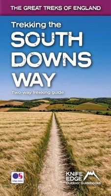
The definitive two-way guide to the South Downs Way: both westbound and eastbound routes are described in full. Real Maps: Full Ordnance Survey Explorer mapping inside (1:25,000) 18 different itineraries: schedules of 4, 5, 6, 7, 8, 9, 10, 11 and 12 days for walkers and runners. Includes both westbound and eastbound itineraries. Difficult calculations of time, distance and altitude gain are done for you. Also includes: Detailed information on equipment and travelling light Everything the trekker needs to know: route, costs, difficulty, weather, travel, and more Full accommodation listings: the best inns, B&Bs and hotels Detailed section on camping Essential info for both self-guided and guided trekkers Information on geology, history, plants and wildlife Numbered waypoints linking the Real Maps to our clear descriptions The South Downs Way leads you on an unforgettable journey of discovery through the magnificent chalk hills of Sussex and Hampshire. It travels the length of the South Downs National Park across wonderful hills and meadows bedecked with wild-flowers, through endless fields of shimmering golden corn and along the edge of the epic white cliffs of the Seven Sisters and Beachy Head. It is one of England's official 'National Trails' and is an unforgettable experience
Hinweis: Dieser Artikel kann nur an eine deutsche Lieferadresse ausgeliefert werden.
Hinweis: Dieser Artikel kann nur an eine deutsche Lieferadresse ausgeliefert werden.

