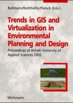
Die Hochschule Anhalt (FH) in Bernburg veranstaltet im Rahmen des Studienganges "Master of Landscape Architecture" vom 2. bis 3. Mai 2002 die Tagung "GIS Technical Trends". Die Veranstaltung ist englischsprachig; die Vorträge werden von international renommierten GIS-Experten gehalten (u. a. Prof. Strobl/Uni Salzburg, Prof. Nicholson, Uni Utah/USA).Die englischsprachigen Beiträge im Tagungsband behandeln u. a. folgende Themenschwerpunkte:
- Internet GIS/Web-Mapping
- mobile GIS
- virtuelle GIS (z. B. 3-D-Simulationen von Landschaften)
Kurzinformation: Die Hochschule Anhalt (FH) in Bernburg veranstaltete im Rahmen des Studienganges "Master of Landscape Architecture" vom 2. bis 3. Mai 2002 die internationale Tagung "GIS Trends in Environmental Planning: Internet GIS and Web-Mapping, Mobile- and Virtual GIS". Dieses Buch enthält die englischsprachigen Beiträge der Veranstaltung; behandelt werden hochaktuelle Entwicklungen wie Internet-GIS, Web-Mapping, mobile und virtuelle Geoinformationssysteme. Ausführliche Information: Since the establishment of the program in 1999, the Master of Landscape Architecture (MLA) program of Anhalt University of Applied Sciences has organized several international seminars on the use of new technologies in the area of environmental planning and design. These proceedings contain the main contributions of the seminar "GIS Trends in Environmental Planning: Internet GIS and Web-Mapping, Mobile- and Virtual GIS" being held on May 2 and 3, 2002 in Bernburg. Also included are some additional articles of speakers of the international seminar "Virtuality in Landscape Architecture", held earlier by the MLA program. Following the focus of the two seminars, the proceedings cover the trends in following areas: - Geoinformation Society - Internet GIS and Web-Mapping - Mobile GIS - Virtual GIS - Virtualization in Landscape Design - Technical Trends in GIScienceDie Hochschule Anhalt (FH) in Bernburg veranstaltete im Rahmen des Studienganges "Master of Landscape Architecture" vom 2. bis 3. Mai 2002 die internationale Tagung "GIS Trends in Environmental Planning: Internet GIS and Web-Mapping, Mobile- and Virtual GIS". Dieses Buch enthält die englischsprachigen Beiträge der Veranstaltung; behandelt werden hochaktuelle Entwicklungen wie Internet-GIS, Web-Mapping, mobile und virtuelle Geoinformationssysteme.

