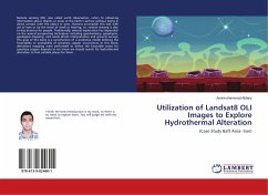
Utilization of Landsat8 OLI Images to Explore Hydrothermal Alteration
(Case Study Baft Area- Iran)
Versandkostenfrei!
Versandfertig in 6-10 Tagen
33,99 €
inkl. MwSt.

PAYBACK Punkte
17 °P sammeln!
Remote sensing (RS), also called earth observation, refers to obtaining information about objects or areas at the Earth's surface without being in direct contact with the object or area. Humans accomplish this task with aid of eyes or by the sense of smell or hearing; so, remote sensing is day-to-day business for people. Traditionally, mineral exploration has depended on the several prospecting techniques including geochemistry, geophysics, geological mapping, and aerial photo interpretation and ground surveys. The goal of this book is a construction of a predictive model defining the favorabi...
Remote sensing (RS), also called earth observation, refers to obtaining information about objects or areas at the Earth's surface without being in direct contact with the object or area. Humans accomplish this task with aid of eyes or by the sense of smell or hearing; so, remote sensing is day-to-day business for people. Traditionally, mineral exploration has depended on the several prospecting techniques including geochemistry, geophysics, geological mapping, and aerial photo interpretation and ground surveys. The goal of this book is a construction of a predictive model defining the favorability or probability of porphyry copper occurrences. In this book, alterations mapping were performed to define the favorable zones for porphyry copper deposits as we know we should search for hydrothermal alteration to find suitable places for them.


