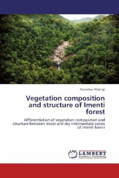
Vegetation composition and structure of Imenti forest
Differentiation of vegetation composition and structure between moist and dry intermediate zones of Imenti forest
Versandkostenfrei!
Versandfertig in 6-10 Tagen
32,99 €
inkl. MwSt.

PAYBACK Punkte
16 °P sammeln!
Anthropogenic and climate change impacts on forest ecosystems can be monitored by use of vegetation maps. Accuracy of a revised vegetation map for moist and dry forest types in Imenti was tested to understand their vegetation dynamics. The mapped vegetation boundary of the two forests was marked using Map source software and then loaded into GPS. Five sampling sites were randomly selected in each forest type. Trees with DBH 5cm and height 5 m and saplings were recorded from quadrats of 0.16 ha and 0.01ha respectively. A 4 x 100 m belt transects were used for profiling the vegetation. The two f...
Anthropogenic and climate change impacts on forest ecosystems can be monitored by use of vegetation maps. Accuracy of a revised vegetation map for moist and dry forest types in Imenti was tested to understand their vegetation dynamics. The mapped vegetation boundary of the two forests was marked using Map source software and then loaded into GPS. Five sampling sites were randomly selected in each forest type. Trees with DBH 5cm and height 5 m and saplings were recorded from quadrats of 0.16 ha and 0.01ha respectively. A 4 x 100 m belt transects were used for profiling the vegetation. The two forest types were separated df 1, p 0.05 by ordination analysis. Eleven characteristic species occurred in moist forest compared to ten in dry forest. Height and DBH frequency graphs showed that more trees occurred in lower classes while DBH histograms assumed an inverse J-shaped distribution. Cordia africana and Olea europaea had highest value index in moist and dry forest respectively. The accuracy of the vegetation map was confirmed to be correct. There is need to enhance security patrols and involve the local communities in managing the forest.


