VOLCANIC HAZARD MAPPING STUDY
CASE OF THE CITY OF GOMA AND ITS SURROUNDINGS
Versandkostenfrei!
Versandfertig in 6-10 Tagen
27,99 €
inkl. MwSt.

PAYBACK Punkte
14 °P sammeln!
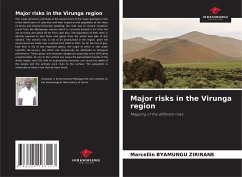
Our work is part of a cartographic study in the Virunga region which is characterized by volcanic rock outcrops. These have allowed us to approach the cartographic approach of the region of Goma and its surroundings. This being the case, we ended up making a risk map of the city of Goma by taking into account all the data acquired in the field. Thus, several types of deformations were noted: (fractures, faults, tunnels, etc.), were analyzed and finally mapped. The cartographic study allowed to see after analysis, two main fractures of the Nyiragongo volcano and its ramifications, one of which ...
Our work is part of a cartographic study in the Virunga region which is characterized by volcanic rock outcrops. These have allowed us to approach the cartographic approach of the region of Goma and its surroundings. This being the case, we ended up making a risk map of the city of Goma by taking into account all the data acquired in the field. Thus, several types of deformations were noted: (fractures, faults, tunnels, etc.), were analyzed and finally mapped. The cartographic study allowed to see after analysis, two main fractures of the Nyiragongo volcano and its ramifications, one of which goes from the North-East of the city towards the Kivu lake.We were moved by the way the city of Goma is built, because the foundations of the city are based on fractures, cracks and faults; the ramifications of the main fracture runs along the city to Lake Kivu without anyone realizing it.


