Vulnerability and development of a tsunami-affected coast
A case study of Banda Aceh, Indonesia
Versandkostenfrei!
Versandfertig in 6-10 Tagen
39,99 €
inkl. MwSt.

PAYBACK Punkte
20 °P sammeln!
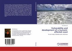
This book provides a thorough geomorphological investigation to analyse the extent of damage and subsequent development of a coast before and after the tsunami of 26 December 2004. The main objective is to increase the understanding of future coastal development that is vulnerable to the tectonic activities resulting tsunami and land subsidence. Little was known about the geomorphic settings of the Banda Aceh, a coast worst affected by this tsunami event. This study fills in the gap of knowledge on the forcing factors involved in shaping the geomorphic settings of this study area in history. T...
This book provides a thorough geomorphological investigation to analyse the extent of damage and subsequent development of a coast before and after the tsunami of 26 December 2004. The main objective is to increase the understanding of future coastal development that is vulnerable to the tectonic activities resulting tsunami and land subsidence. Little was known about the geomorphic settings of the Banda Aceh, a coast worst affected by this tsunami event. This study fills in the gap of knowledge on the forcing factors involved in shaping the geomorphic settings of this study area in history. This information was subsequently used to set some scenarios of future morphological development of the coast. Frequent earthquakes cause high probability of land subsidence and tsunami recurrence (once every 20 to 30 years) in a century. The rate of shoreline retreat caused by tectonic subsidence and tsunami can be an order of magnitude greater than that caused by the gradual sea-level rise in this region.


