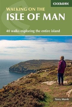
A guidebook to 40 walks exploring the Isle of Man. Covering the whole island, including the mountains, coast and National Glens, there are walks to suit all abilities, from shorter low-level routes to longer and more demanding excursions. With many walks accessible by public transport, the routes range from 2 to 23km (1-14 miles) and take in waterfalls, historical sites of interest and the island's highest mountains, Snaefell and North and South Barrule. * 1:50,000 OS maps , reproduced at 1:40,000, included for each walk * Sized to easily fit in a jacket pocket * Notes on refreshments and parking * Information on local geology, history, culture, plants and wildlife * Brief summaries of five longer routes , including the 153km (95 mile) Raad ny Foillan (Isle of Man Coast Path, covered in a separate Cicerone guide)
Hinweis: Dieser Artikel kann nur an eine deutsche Lieferadresse ausgeliefert werden.
Hinweis: Dieser Artikel kann nur an eine deutsche Lieferadresse ausgeliefert werden.


