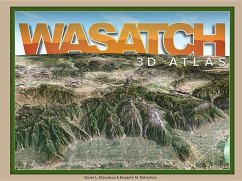
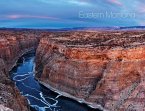
Experience the Wasatch mountains like you've never seen them before! Explore the awesome topography of every ridge, cliff, hiking trail and ski area from Salt Lake City to Park City to Provo. Peaks rise above the page in eye-popping 3D, while canyons descend below. Using their deep understanding of phogrammetry, cartography, and computer graphics, Steve and Ben Richardson transform US goverment maps into a one-of-a-kind map experience to delight geologists, outdoor enthusiasts, and armchair explorers alike. View the Wasatch landscape from the comfort of home or use this book to navigate your next Wasatch adventure.
Hinweis: Dieser Artikel kann nur an eine deutsche Lieferadresse ausgeliefert werden.
Hinweis: Dieser Artikel kann nur an eine deutsche Lieferadresse ausgeliefert werden.

