26,99 €
inkl. MwSt.
Versandkostenfrei*
Versandfertig in 6-10 Tagen
payback
13 °P sammeln
  • Broschiertes Buch

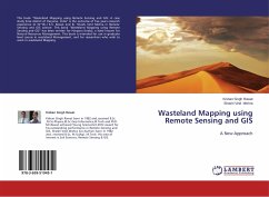
This book "Wasteland Mapping using Remote Sensing and GIS: A case study Sirsa district of Haryana, India" is the outcome of five years research experience of Dr (Er.) K.S. Rawat and Er. Shashi Vind Mishra in Remote Sensing and GIS science. This book "Wasteland Mapping using Remote Sensing and GIS" has been written for Haryana (India), a state known for Natural Resources Management. This book is intended for use in graduate level course in wasteland Management, and for researchers who wish to work in wasteland Mapping.

Produktbeschreibung
This book "Wasteland Mapping using Remote Sensing and GIS: A case study Sirsa district of Haryana, India" is the outcome of five years research experience of Dr (Er.) K.S. Rawat and Er. Shashi Vind Mishra in Remote Sensing and GIS science. This book "Wasteland Mapping using Remote Sensing and GIS" has been written for Haryana (India), a state known for Natural Resources Management. This book is intended for use in graduate level course in wasteland Management, and for researchers who wish to work in wasteland Mapping.
Autorenporträt
Kishan Singh Rawat born in 1982 and,received B.Sc ,M.Sc-Physics,M.Sc Geo-Informatics,M.Tech and PhD. Mr.Rawat achieved Young Scientist-2012 award for his outstanding performance in Remote Sensing and GIS. Shashi Vind Mishra (Co-Author) born in 1982 and, received B.Sc, M.Sc(Ag), M.Tech. His area of interest is Soil Sciences, Remote Sensing GIS