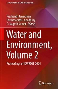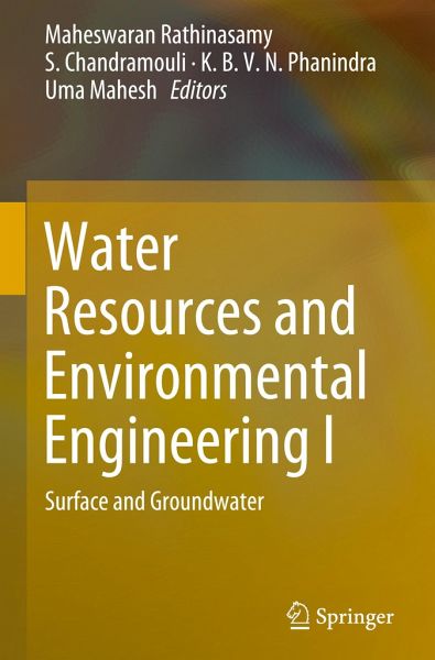
The book is a compilation of the papers presented in the International Conference on Emerging Trends in Water Resources and Environmental Engineering (ETWREE 2017). The high quality papers are written by research scholars and academicians of prestigious institutes across India. The book discusses the challenges of water management due to misuse or abuse of water resources and the ever mounting challenges on use, reuse and conservation of water. It also discusses issues of water resources such as water quantity, quality, management and planning for the benefits of water resource scientists,…mehr
The book is a compilation of the papers presented in the International Conference on Emerging Trends in Water Resources and Environmental Engineering (ETWREE 2017). The high quality papers are written by research scholars and academicians of prestigious institutes across India. The book discusses the challenges of water management due to misuse or abuse of water resources and the ever mounting challenges on use, reuse and conservation of water. It also discusses issues of water resources such as water quantity, quality, management and planning for the benefits of water resource scientists, faculties, policy makers, stake holders working in the water resources planning and management. The research content discussed in the book will be helpful for engineers to solve practical day to day problems related to water and environmental engineering.
R. Maheswaran is currently associated with the Department of Civil Engineering at MVGR College of Engineering, Vizianagaram. He completed his Ph.D. at the Indian Institute of Technology Delhi in 2012. He is the recipient of Alexander Von Humboldt Fellowship, Germany and Inspire Faculty Award, GoI. His areas of interest include stochastic hydrology, hydrological modeling, scaling concepts, application of wavelet analysis in understanding the hydrologic system and hydrologic forecasting. He has guided 4 M.Tech. and 30 B.Tech. students, and has published over 25 journal papers, 18 conference papers. S. Chandramouli has been engaged in the academic field since August 2002, and is an expert on water resources engineering with a special interest in optimization techniques. His areas of interest include water resources systems planning and management, analysis and design of pipe networks, design of pumps and turbines, design of storm water drainage system, applications of ANN, fuzzy logic and genetic algorithms in water resources engineering. He completed his Ph.D. at Andhra University in 2013. He has over 15 years of teaching experience and also guided one Ph.D student and 2 M.Tech students and currently guiding four M.Tech students. He is currently working as a Professor in the Department of Civil Engineering, MVGRCE, Vizianagaram. He has published 16 journal papers, and over 15 conference papers (national and international). K.B.V.N. Phanindra is Assistant Professor in Department of Civil Engineering, Indian Institute of Technology, Hyderabad. He completed his PhD. from New Mexico State University, USA (2010) in Water Resource Engineering and M.Tech. from IIT Kanpur (2002) in Hydraulics and Water Resources Engineering. Previously, he has also worked in Birla Institute of Technology, Pilani. His area of research interests is in Groundwater flow and transport modeling, RS & GIS applications in water resources, Hydro-geologic characterization, Soil-Water-Crop interactions and Eco-hydrological processes. He has published many papers in international journals and conferences in these areas. Umamahesh N.V. is a Professor at the Department of Civil Engineering at National Institute of Technology, Warangal, India. His areas of interest include water resources systems, hydrologic modeling, irrigation management, water quality modeling and management, applications of soft computing techniques, and modeling impacts of climate change. He has published 20 journal papers and 50 conference papers. He has supervised 6 Ph.D. students and is currently guiding 7 Ph.D. students.
Inhaltsangabe
Prediction of Nitrite and Fluoride Contamination in Ground Water Suing Artificial Neural Networks (ANN).- Morphometric Analysis of Upper Tapi River Basin: A GIS Approach.- Role of Data Models and Standards in a Hydro Geo-Database.- What Constitutes a Fair and Equitable Water Apportionment?.- Study of Ground Water Quality -Contour Maps of Kamavarapukota Mandal Westgodavari District, Andhra Pradesh, India.- Study of Ground Water Quality - Contour Maps of Kamavarapukota Mandal Westgodavari District, Andhra Pradesh, India.- Estimation of the Sediment Yield for Vamsadhara River Basin Using ILWIS.- Geo Spatial Data Requirements, Software and Analysis for the Study of Floods in Urban Catchments.- Groundwater Recharge through Infiltration Process: A Case Study of Coastal Belt of Mentada to Kovvada, Srikakulam, A.P, India.- Assessment of Geographical Characteristics of Krishna Central Delta Using GIS & RS Techniques.- Poor Storm Water Drainage and Stripping on a Stretch of Nh-1.- Optimization Techniques on Multipurpose Reservoirs and Surface Water Resources: A Review.- Construction of Artificial Recharge Pit through Injection Well in Tpist Campus.- Impact of Urbanization on Surface Run off Characteristics at Catchment Scale.- Monitoring Surface Water Bodies Using Multi-temporal Landsat Imagery.- Mapping of Groundwater Potential Zones Using Remote Sensing Data.- Estimation of Reservoir Storage Using Artificial Neural Network (Ann).- Water Distribution Modelling and Analysis for a Developing City.- Urban Watershed Modelling of GHMC Zone-XII.- Impact of Anthropogenic Interventions on the Vembanad Lake System.- Application of Foam and Sand as Dual Media Filter for Rooftop Rainwater Harvesting System.- Land Use Land Cover Changes Using Remote Sensing and GIS Techniques: A Case Study of Shamshabad Region, Hyderabad, Telangana, India.- Hydrological Modeling of Nagavali River Basin Using SWAT.- Application of GIS and Multivariate Statistical Analysis for the Identification ofHeavy Metal Concentrations in Groundwater.- Comparison of Event Based and Continuous Rainfall-Run off Models: A Review.- Morphometric Analysis of Selected Drainage Network of Brahmaputra River, NE India Using Remote Sensing and Geographical Information System.- Estimation of Run off and Planning for Location of Recharge Structure for Sustainable Water Resources Using RS & GIS: A Case Study on Milli-Watershed at Zaheerabad.- Deciphering Groundwater Prospect Zones in Sub-Watershed of Sarada Gadda: A Geospatial Approach.- Design of Storm Water Drainage System - A Case Study.- Assessment of Groundwater Quality at Industrial Zone in Visakhapatnam.- Comparison of Saturated Hydraulic Conductivity Methods for Sandy Loam Soil with Different Land Uses.- Effect of Fragmented Vegetation Meadows on Wave Attenuation.- A Review On- Caisson Breakwater.- Effect of Gap Width on Wave Attenuation in Artificial Vegetation with Trunk and Root System.- Physical Model Study on Caission Type Breakwater.- Stress Analysis of Ocean Offshore Structure.- Hydrodynamic Study of Deeply Submerged Breakwaters on Reduction of Wave Run-Up, Wave Reflection and Energy Dissipation.- Evaluation of Sediment Yield by Using Remote Sensing and GIS.- Sediment Distribution Pattern Studies for Thandava and Konam Reservoirs in Visakhapatnam District.- The Effects of Earthquakes on Groundwater in Ongole Domain of Eastern Ghat Mobile Belt, South India.- A MATLAB Code For Linking Genetic Algorithm and EPANET for Reliability Based Optimal Design of a Water Distribution Network.
Prediction of Nitrite and Fluoride Contamination in Ground Water Suing Artificial Neural Networks (ANN).- Morphometric Analysis of Upper Tapi River Basin: A GIS Approach.- Role of Data Models and Standards in a Hydro Geo-Database.- What Constitutes a Fair and Equitable Water Apportionment?.- Study of Ground Water Quality –Contour Maps of Kamavarapukota Mandal Westgodavari District, Andhra Pradesh, India.- Study of Ground Water Quality – Contour Maps of Kamavarapukota Mandal Westgodavari District, Andhra Pradesh, India.- Estimation of the Sediment Yield for Vamsadhara River Basin Using ILWIS.- Geo Spatial Data Requirements, Software and Analysis for the Study of Floods in Urban Catchments.- Groundwater Recharge through Infiltration Process: A Case Study of Coastal Belt of Mentada to Kovvada, Srikakulam, A.P, India.- Assessment of Geographical Characteristics of Krishna Central Delta Using GIS & RS Techniques.- Poor Storm Water Drainage and Stripping on a Stretch of Nh-1.- Optimization Techniques on Multipurpose Reservoirs and Surface Water Resources: A Review.- Construction of Artificial Recharge Pit through Injection Well in Tpist Campus.- Impact of Urbanization on Surface Run off Characteristics at Catchment Scale.- Monitoring Surface Water Bodies Using Multi-temporal Landsat Imagery.- Mapping of Groundwater Potential Zones Using Remote Sensing Data.- Estimation of Reservoir Storage Using Artificial Neural Network (Ann).- Water Distribution Modelling and Analysis for a Developing City.- Urban Watershed Modelling of GHMC Zone-XII.- Impact of Anthropogenic Interventions on the Vembanad Lake System.- Application of Foam and Sand as Dual Media Filter for Rooftop Rainwater Harvesting System.- Land Use Land Cover Changes Using Remote Sensing and GIS Techniques: A Case Study of Shamshabad Region, Hyderabad, Telangana, India.- Hydrological Modeling of Nagavali River Basin Using SWAT.- Application of GIS and Multivariate Statistical Analysis for the Identification ofHeavy Metal Concentrations in Groundwater.- Comparison of Event Based and Continuous Rainfall-Run off Models: A Review.- Morphometric Analysis of Selected Drainage Network of Brahmaputra River, NE India Using Remote Sensing and Geographical Information System.- Estimation of Run off and Planning for Location of Recharge Structure for Sustainable Water Resources Using RS & GIS: A Case Study on Milli-Watershed at Zaheerabad.- Deciphering Groundwater Prospect Zones in Sub-Watershed of Sarada Gadda: A Geospatial Approach.- Design of Storm Water Drainage System – A Case Study.- Assessment of Groundwater Quality at Industrial Zone in Visakhapatnam.- Comparison of Saturated Hydraulic Conductivity Methods for Sandy Loam Soil with Different Land Uses.- Effect of Fragmented Vegetation Meadows on Wave Attenuation.- A Review On– Caisson Breakwater.- Effect of Gap Width on Wave Attenuation in Artificial Vegetation with Trunk and Root System.- Physical Model Study on Caission Type Breakwater.- Stress Analysis of Ocean Offshore Structure.- Hydrodynamic Study of Deeply Submerged Breakwaters on Reduction of Wave Run-Up, Wave Reflection and Energy Dissipation.- Evaluation of Sediment Yield by Using Remote Sensing and GIS.- Sediment Distribution Pattern Studies for Thandava and Konam Reservoirs in Visakhapatnam District.- The Effects of Earthquakes on Groundwater in Ongole Domain of Eastern Ghat Mobile Belt, South India.- A MATLAB Code For Linking Genetic Algorithm and EPANET for Reliability Based Optimal Design of a Water Distribution Network.
Es gelten unsere Allgemeinen Geschäftsbedingungen: www.buecher.de/agb
Impressum
www.buecher.de ist ein Internetauftritt der buecher.de internetstores GmbH
Geschäftsführung: Monica Sawhney | Roland Kölbl | Günter Hilger
Sitz der Gesellschaft: Batheyer Straße 115 - 117, 58099 Hagen
Postanschrift: Bürgermeister-Wegele-Str. 12, 86167 Augsburg
Amtsgericht Hagen HRB 13257
Steuernummer: 321/5800/1497