Matthew J Nelson, The Arizona Trail Association
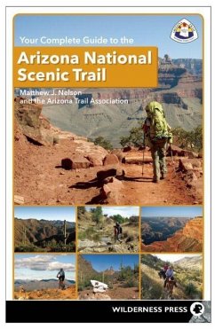
Your Complete Guide to the Arizona National Scenic Trail
23,99 €
inkl. MwSt.
Versandfertig in über 4 Wochen

12 °P sammeln
Matthew J Nelson, The Arizona Trail Association
Your Complete Guide to the Arizona National Scenic Trail
- Broschiertes Buch
- Merkliste
- Auf die Merkliste
- Bewerten Bewerten
- Teilen
- Produkt teilen
- Produkterinnerung
- Produkterinnerung
This guide tells you everything you need to know about the Arizona National Scenic Trial, which beckons hikers, cyclists, and equestrians to experience a diverse combination of desert, forest, and canyon terrain across the state.
Andere Kunden interessierten sich auch für
![Best Day Hikes on the Arizona National Scenic Trail Best Day Hikes on the Arizona National Scenic Trail]() Sirena RanaBest Day Hikes on the Arizona National Scenic Trail18,99 €
Sirena RanaBest Day Hikes on the Arizona National Scenic Trail18,99 €![Roadtrip America Arizona & New Mexico: 25 Scenic Side Trips Roadtrip America Arizona & New Mexico: 25 Scenic Side Trips]() Rick QuinnRoadtrip America Arizona & New Mexico: 25 Scenic Side Trips23,99 €
Rick QuinnRoadtrip America Arizona & New Mexico: 25 Scenic Side Trips23,99 €![Walking the Steps of Cincinnati: A Guide to the Queen City's Scenic and Historic Secrets Walking the Steps of Cincinnati: A Guide to the Queen City's Scenic and Historic Secrets]() Mary Anna DusablonWalking the Steps of Cincinnati: A Guide to the Queen City's Scenic and Historic Secrets22,99 €
Mary Anna DusablonWalking the Steps of Cincinnati: A Guide to the Queen City's Scenic and Historic Secrets22,99 €![Guide to the Jemez Mountain Trail: A National Scenic Byway Guide to the Jemez Mountain Trail: A National Scenic Byway]() Judith Ann IsaacsGuide to the Jemez Mountain Trail: A National Scenic Byway19,99 €
Judith Ann IsaacsGuide to the Jemez Mountain Trail: A National Scenic Byway19,99 €![The Lone Star Hiking Trail The Lone Star Hiking Trail]() Karen Borski SomersThe Lone Star Hiking Trail17,99 €
Karen Borski SomersThe Lone Star Hiking Trail17,99 €![The Best of Grand Teton National Park: Wildlife, Wildflowers, Hikes, History & Scenic Drives The Best of Grand Teton National Park: Wildlife, Wildflowers, Hikes, History & Scenic Drives]() Charles CraigheadThe Best of Grand Teton National Park: Wildlife, Wildflowers, Hikes, History & Scenic Drives7,49 €
Charles CraigheadThe Best of Grand Teton National Park: Wildlife, Wildflowers, Hikes, History & Scenic Drives7,49 €![Top Trails: Yellowstone and Grand Teton National Parks Top Trails: Yellowstone and Grand Teton National Parks]() Andrew Dean NystromTop Trails: Yellowstone and Grand Teton National Parks17,99 €
Andrew Dean NystromTop Trails: Yellowstone and Grand Teton National Parks17,99 €-
-
-
This guide tells you everything you need to know about the Arizona National Scenic Trial, which beckons hikers, cyclists, and equestrians to experience a diverse combination of desert, forest, and canyon terrain across the state.
Hinweis: Dieser Artikel kann nur an eine deutsche Lieferadresse ausgeliefert werden.
Hinweis: Dieser Artikel kann nur an eine deutsche Lieferadresse ausgeliefert werden.
Produktdetails
- Produktdetails
- Verlag: Wilderness Press
- Seitenzahl: 400
- Erscheinungstermin: 7. Januar 2014
- Englisch
- Abmessung: 216mm x 139mm x 22mm
- Gewicht: 713g
- ISBN-13: 9780899977478
- ISBN-10: 0899977472
- Artikelnr.: 38431869
- Herstellerkennzeichnung
- Libri GmbH
- Europaallee 1
- 36244 Bad Hersfeld
- gpsr@libri.de
Primary editor and executive director of the Arizona Trail Association Matthew J. Nelson has more than 500 published articles to his credit and has explored many parts of the Arizona National Scenic Trail. He divides his time between Flagstaff, AZ, and Big Pine, CA.
CONTENTS
Overview Map
Dedication
Acknowledgments
Introduction to the Arizona National Scenic Trail
History
Arizona Trail Association
Use at Your Own Risk
Planning Your Trip
When to Go
Permits
Fences and Gates
Backcountry Safety
Water
Contaminated Water
Dehydration
Heat Exhaustion
Hypothermia
Flash Floods
Lightning
Animals, Reptiles, and Insects
Mine Shafts
Snags
Leave No Trace
Plan Ahead and Prepare
Backcountry Etiquette
Travel and Camp on Durable Surfaces
Equestrians
Leave What You Find
Use Fire Responsibly
Conserve Water
Pack It In, Pack It Out
Waste Disposal
Wilderness Areas
The Botany of Diversity
South Region
Central Region
North Region
Ongoing Observations
Welcome to the Geology of Arizona
Geological Time Scale
Plate Tectonics
Rock Classifications
The Rock Cycle
Physiographic Provinces
Basin and Range Province (Passages 1-18)
Transition Zone Province (Passages 19-27)
Colorado Plateau Province (Passages 28-43)
The AZT: South, Central, and North
AZT South Section: Passages 1-15
1 Huachuca Mountains
2 Canelo Hills: East
3 Canelo Hills: West
4 Temporal Gulch
5 Santa Rita Mountains
6 Las Colinas
7 Las Cienegas
8 Rincon Valley
9 Rincon Mountains
10 Redington Pass
11 Santa Catalina Mountains
12 Oracle Ridge
13 Oracle
14 Black Hills
15 Tortilla Mountains
AZT Central Section: Passages 16-27
16 Gila River Canyons
17 Alamo Canyon
18 Reavis Canyon
19 Superstition Wilderness
20 Four Peaks
21 Pine Mountain
22 Saddle Mountain
23 Mazatzal Divide
24 Red Hills
25 Whiterock Mesa
26 Hardscrabble Mesa
27 Highline
AZT North Section: Passages 28-43
28 Blue Ridge
29 Happy Jack
30 Mormon Lake
31 Walnut Canyon
32 Elden Mountain
33 Flagstaff (Resupply Route)
34 San Francisco Peaks
35 Babbitt Ranch
36 Coconino Rim
37 Grand Canyon: South Rim
38 Grand Canyon: Inner Gorge
39 Grand Canyon: North Rim
40 Kaibab Plateau: South
41 Kaibab Plateau: Central
42 Kaibab Plateau: North
43 Buckskin Mountain
Gateway Communities (South to North)
Sierra Vista
Patagonia
Sonoita
Vail
Tucson
Summerhaven
Oracle
Mammoth
San Manuel
Central Copper Corridor: Dudleyville, Winkelman, Hayden, Kearny, and Kelvin
and Riverside
Globe
Florence
Superior
Roosevelt and Tonto Basin
Payson
Pine and Strawberry
Mormon Lake
Flagstaff
Tusayan and Grand Canyon Village
North Rim to Jacob Lake
Page
Fredonia, Arizona, and Kanab, Utah
Geology Features of the AZT
The Karst of Colossal Cave
The Mighty Santa Catalina and Rincon Mountains
Supervolcanoes of the Superstition Mountains
Amazing Mazatzals
Elden Mountain: A Volcano Unlike the Others
The San Francisco Peaks' Violent Past
Grand Canyon: A Geological Masterpiece
Appendix 1: Water Sources Along the AZT
Appendix 2: Land-Management Agencies
Appendix 3: Trail Resources
Index
Profile: Executive Director, Arizona Trail Association
