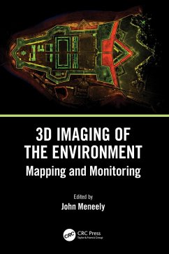
3D Imaging of the Environment (eBook, PDF)
Mapping and Monitoring
Redaktion: Meneely, John
105,95 €
105,95 €
inkl. MwSt.
Sofort per Download lieferbar

53 °P sammeln
105,95 €
Als Download kaufen

105,95 €
inkl. MwSt.
Sofort per Download lieferbar

53 °P sammeln
Jetzt verschenken
Alle Infos zum eBook verschenken
105,95 €
inkl. MwSt.
Sofort per Download lieferbar
Alle Infos zum eBook verschenken

53 °P sammeln
3D Imaging of the Environment (eBook, PDF)
Mapping and Monitoring
Redaktion: Meneely, John
- Format: PDF
- Merkliste
- Auf die Merkliste
- Bewerten Bewerten
- Teilen
- Produkt teilen
- Produkterinnerung
- Produkterinnerung

Bitte loggen Sie sich zunächst in Ihr Kundenkonto ein oder registrieren Sie sich bei
bücher.de, um das eBook-Abo tolino select nutzen zu können.
Hier können Sie sich einloggen
Hier können Sie sich einloggen
Sie sind bereits eingeloggt. Klicken Sie auf 2. tolino select Abo, um fortzufahren.

Bitte loggen Sie sich zunächst in Ihr Kundenkonto ein oder registrieren Sie sich bei bücher.de, um das eBook-Abo tolino select nutzen zu können.
This book gives readers detailed explanations of the techniques used to map and monitor the built and natural environment and how that data, collected from a wide range of scales and cost options, is translated into an image or visual experience. It is written with technical, professional, and academic readers in mind.
- Geräte: PC
- mit Kopierschutz
- eBook Hilfe
Andere Kunden interessierten sich auch für
![3D Imaging of the Environment (eBook, ePUB) 3D Imaging of the Environment (eBook, ePUB)]() 3D Imaging of the Environment (eBook, ePUB)105,95 €
3D Imaging of the Environment (eBook, ePUB)105,95 €![On-Board Processing for Satellite Remote Sensing Images (eBook, PDF) On-Board Processing for Satellite Remote Sensing Images (eBook, PDF)]() Guoqing ZhouOn-Board Processing for Satellite Remote Sensing Images (eBook, PDF)131,95 €
Guoqing ZhouOn-Board Processing for Satellite Remote Sensing Images (eBook, PDF)131,95 €![Advances in Geospatial Technologies for Natural Resource Management (eBook, PDF) Advances in Geospatial Technologies for Natural Resource Management (eBook, PDF)]() Advances in Geospatial Technologies for Natural Resource Management (eBook, PDF)188,95 €
Advances in Geospatial Technologies for Natural Resource Management (eBook, PDF)188,95 €![Polarimetric SAR Imaging (eBook, PDF) Polarimetric SAR Imaging (eBook, PDF)]() Yoshio YamaguchiPolarimetric SAR Imaging (eBook, PDF)56,95 €
Yoshio YamaguchiPolarimetric SAR Imaging (eBook, PDF)56,95 €![Remote Sensing Handbook, Volume VI (eBook, PDF) Remote Sensing Handbook, Volume VI (eBook, PDF)]() Remote Sensing Handbook, Volume VI (eBook, PDF)52,95 €
Remote Sensing Handbook, Volume VI (eBook, PDF)52,95 €![Remote Sensing Handbook, Volume V (eBook, PDF) Remote Sensing Handbook, Volume V (eBook, PDF)]() Remote Sensing Handbook, Volume V (eBook, PDF)52,95 €
Remote Sensing Handbook, Volume V (eBook, PDF)52,95 €![Remote Sensing and Image Processing in Mineralogy (eBook, PDF) Remote Sensing and Image Processing in Mineralogy (eBook, PDF)]() Maged MarghanyRemote Sensing and Image Processing in Mineralogy (eBook, PDF)72,95 €
Maged MarghanyRemote Sensing and Image Processing in Mineralogy (eBook, PDF)72,95 €-
-
-
This book gives readers detailed explanations of the techniques used to map and monitor the built and natural environment and how that data, collected from a wide range of scales and cost options, is translated into an image or visual experience. It is written with technical, professional, and academic readers in mind.
Dieser Download kann aus rechtlichen Gründen nur mit Rechnungsadresse in A, B, BG, CY, CZ, D, DK, EW, E, FIN, F, GR, HR, H, IRL, I, LT, L, LR, M, NL, PL, P, R, S, SLO, SK ausgeliefert werden.
Produktdetails
- Produktdetails
- Verlag: Taylor & Francis eBooks
- Seitenzahl: 246
- Erscheinungstermin: 1. November 2023
- Englisch
- ISBN-13: 9781000983517
- Artikelnr.: 68961495
- Verlag: Taylor & Francis eBooks
- Seitenzahl: 246
- Erscheinungstermin: 1. November 2023
- Englisch
- ISBN-13: 9781000983517
- Artikelnr.: 68961495
- Herstellerkennzeichnung Die Herstellerinformationen sind derzeit nicht verfügbar.
John Meneely is the founder of 3D Surveying Ltd, having previously worked as Senior Research Technician at the School of Natural and Built Environment, Queen's University, Belfast. With over 30 years of experience in practical research, he has worked all over the world with interdisciplinary teams across the earth sciences. His expertise lies in using a variety of 3D laser scanning and other digital technologies to map, monitor, and visualise the built and natural environment across a wide range of spatial and temporal scales. He has presented his work at many national and international conferences and been the keynote speaker at several 3D digital technologies conferences. He was on the advisory board for SPAR Europe for two years - Europe's largest 3D scanning conference - and invited to speak at the 2009 International Council on Monuments and Sites (ICOMOS) symposium in Malta on the use of terrestrial laser scanning. His early research and publications focused on studying the catastrophic decay of building stone under complex environmental regimes and the digital documentation of natural and built heritage sites for several geological, geographical, archaeological, managerial, and educational applications. His recent interest has extended his data collection skills into 3D visualisation via 3D printing, VR, and AR. He is currently advising several SMEs, primarily in the environmental monitoring, built heritage, construction, and facilities management sector on integrating 3D technologies into their workflow.
1. Digital Documentation and Digital Innovation in Practice. 2. Mapping the
Urban Environment with a Handheld Mobile LiDAR System-A Case Study from the
UrbanARK Project. 3. Using Drones to Map and Visualise Glacial Landscapes.
4. Laser Scanning of a Complex Cave System during Multiple Campaigns. 5.
Digitizing Giant Skeletons with Handheld Scanning Technology for Research,
Digital Reconstruction, and 3D Printing. 6. Mapping, Monitoring, and
Visualising Stone Decay in the Urban Environment. 7. Unpiloted Airborne
Laser Scanning of a Mixed Forest. 8. Digital Mapping and Recording of
Inishtrahull Island and Its Built Heritage in 24 Hours. 9. CHERISH:
Development of a Toolkit for the 3D Documentation and Analysis of the
Marine and Coastal Historic Environment. 10. 3D in the Construction of a
Full-Scale Replica of St. Patrick's Cross, Downpatrick. 11. Thermography
Using Unmanned Aerial Vehicles. 12. Reconstruction of the Ballintaggart
Court Tomb Using 3D Scanning, 3D Printing, and Augmented Reality (AR). 13.
Terrestrial Laser Scanning for Monitoring and Modelling Coastal Dune
Morphodynamics. 14. Creating a Virtual Reality Experience of Fingal's Cave,
Isle of Staffa, Scotland.
