Al M. Rocca
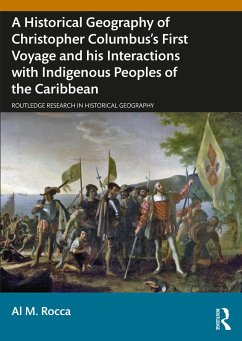
A Historical Geography of Christopher Columbus's First Voyage and his Interactions with Indigenous Peoples of the Caribbean (eBook, ePUB)
40,95 €
40,95 €
inkl. MwSt.
Sofort per Download lieferbar

20 °P sammeln
40,95 €
Als Download kaufen

40,95 €
inkl. MwSt.
Sofort per Download lieferbar

20 °P sammeln
Jetzt verschenken
Alle Infos zum eBook verschenken
40,95 €
inkl. MwSt.
Sofort per Download lieferbar
Alle Infos zum eBook verschenken

20 °P sammeln
Al M. Rocca
A Historical Geography of Christopher Columbus's First Voyage and his Interactions with Indigenous Peoples of the Caribbean (eBook, ePUB)
- Format: ePub
- Merkliste
- Auf die Merkliste
- Bewerten Bewerten
- Teilen
- Produkt teilen
- Produkterinnerung
- Produkterinnerung

Bitte loggen Sie sich zunächst in Ihr Kundenkonto ein oder registrieren Sie sich bei
bücher.de, um das eBook-Abo tolino select nutzen zu können.
Hier können Sie sich einloggen
Hier können Sie sich einloggen
Sie sind bereits eingeloggt. Klicken Sie auf 2. tolino select Abo, um fortzufahren.

Bitte loggen Sie sich zunächst in Ihr Kundenkonto ein oder registrieren Sie sich bei bücher.de, um das eBook-Abo tolino select nutzen zu können.
This book offers a unique account of Christopher Columbus's first voyage, the most consequential voyage in world history. It provides a detailed day-by-day account of the explorer's travels and activities, richly illustrated with thematic maps.
- Geräte: eReader
- mit Kopierschutz
- eBook Hilfe
Andere Kunden interessierten sich auch für
![A Historical Geography of Christopher Columbus's First Voyage and his Interactions with Indigenous Peoples of the Caribbean (eBook, PDF) A Historical Geography of Christopher Columbus's First Voyage and his Interactions with Indigenous Peoples of the Caribbean (eBook, PDF)]() Al M. RoccaA Historical Geography of Christopher Columbus's First Voyage and his Interactions with Indigenous Peoples of the Caribbean (eBook, PDF)40,95 €
Al M. RoccaA Historical Geography of Christopher Columbus's First Voyage and his Interactions with Indigenous Peoples of the Caribbean (eBook, PDF)40,95 €![Impure and Worldly Geography (eBook, ePUB) Impure and Worldly Geography (eBook, ePUB)]() Gavin BowdImpure and Worldly Geography (eBook, ePUB)41,95 €
Gavin BowdImpure and Worldly Geography (eBook, ePUB)41,95 €![Transport Policy: Learning Lessons from History (eBook, ePUB) Transport Policy: Learning Lessons from History (eBook, ePUB)]() Colin DivallTransport Policy: Learning Lessons from History (eBook, ePUB)41,95 €
Colin DivallTransport Policy: Learning Lessons from History (eBook, ePUB)41,95 €![The Explorer's Roadmap to National-Socialism (eBook, ePUB) The Explorer's Roadmap to National-Socialism (eBook, ePUB)]() Sarah K. DanielssonThe Explorer's Roadmap to National-Socialism (eBook, ePUB)45,95 €
Sarah K. DanielssonThe Explorer's Roadmap to National-Socialism (eBook, ePUB)45,95 €![Routledge Handbook of Indigenous Peoples in the Arctic (eBook, ePUB) Routledge Handbook of Indigenous Peoples in the Arctic (eBook, ePUB)]() Routledge Handbook of Indigenous Peoples in the Arctic (eBook, ePUB)45,95 €
Routledge Handbook of Indigenous Peoples in the Arctic (eBook, ePUB)45,95 €![Population Mobility and Indigenous Peoples in Australasia and North America (eBook, ePUB) Population Mobility and Indigenous Peoples in Australasia and North America (eBook, ePUB)]() Population Mobility and Indigenous Peoples in Australasia and North America (eBook, ePUB)41,95 €
Population Mobility and Indigenous Peoples in Australasia and North America (eBook, ePUB)41,95 €![Decolonising Political Concepts (eBook, ePUB) Decolonising Political Concepts (eBook, ePUB)]() Decolonising Political Concepts (eBook, ePUB)0,99 €
Decolonising Political Concepts (eBook, ePUB)0,99 €-
-
-
This book offers a unique account of Christopher Columbus's first voyage, the most consequential voyage in world history. It provides a detailed day-by-day account of the explorer's travels and activities, richly illustrated with thematic maps.
Dieser Download kann aus rechtlichen Gründen nur mit Rechnungsadresse in A, B, BG, CY, CZ, D, DK, EW, E, FIN, F, GR, HR, H, IRL, I, LT, L, LR, M, NL, PL, P, R, S, SLO, SK ausgeliefert werden.
Produktdetails
- Produktdetails
- Verlag: Taylor & Francis
- Seitenzahl: 400
- Erscheinungstermin: 2. Mai 2024
- Englisch
- ISBN-13: 9781040016978
- Artikelnr.: 70127552
- Verlag: Taylor & Francis
- Seitenzahl: 400
- Erscheinungstermin: 2. Mai 2024
- Englisch
- ISBN-13: 9781040016978
- Artikelnr.: 70127552
- Herstellerkennzeichnung Die Herstellerinformationen sind derzeit nicht verfügbar.
Al M. Rocca is a Professor Emeritus at Simpson University and is currently serving as Adjunct Research Professor at California State University, Monterey Bay.
Foreword
Part I: Planning the Transatlantic Voyage and Setting the Physical Geography of the Caribbean
Chapter 1: The Transatlantic Proposal and Preparation for the Voyage
Chapter 2: Preparing for the Voyage
Chapter 3: The Adventure Begins
Part II: The Mid-Transatlantic Crossing
Chapter 4: Into the Ocean Sea: Canary Islands and Beyond, September 6-19
Chapter 5: Searching for the Indies: September 20 to October 11
Part III: The Columbus Landfall and Search for the Mainland
Chapter 6: The First Encounter: October 12-14
Chapter 7: A Sea of Islands: October 15-27
Part IV: Cuba and Hispaniola
Chapter 8: Cibao (Cuba): October 28 to December 5
Chapter 9: Hispaniola: December 7-25
Chapter 10: A Time for Decisions: December 26 to January 15, 1493
Part V: Return Voyage, Accolades, and a Promise of Colonization
Chapter 11: The Voyage Home: January 16 to March 15
Chapter 12: Spanish Accolades and Future Plans
Afterword
Appendices
Bibliography
Part I: Planning the Transatlantic Voyage and Setting the Physical Geography of the Caribbean
Chapter 1: The Transatlantic Proposal and Preparation for the Voyage
- The Santa Fe Capitulations
- Palos de la Frontera and the Acquisition of Men and Ships
- The Plan
- Political Goals
- Notes
Chapter 2: Preparing for the Voyage
- The Columbus Map
- Columbus's Methodology for Calculating Global Distances
- Sequence of Conception: Enterprise to the Indies
- The First Voyage Maps of Columbus
- The Art of Navigation in the 15th Century
- Directional Methodology
- Nautical Mileage Methodology
- Notes
Chapter 3: The Adventure Begins
- The Journal of Christopher Columbus
- Sabotage as the Voyage Begins, August 3 to September 5
- The Lady Doña Beatriz Ines Peraza
- Notes
Part II: The Mid-Transatlantic Crossing
Chapter 4: Into the Ocean Sea: Canary Islands and Beyond, September 6-19
- The Voyage West Begins and the Deception of Recorded Mileage
- The Difficulty Measuring Latitude at Sea and Magnetic Variation
- Entering Unknown Waters (Sea of Darkness)
- Notes
Chapter 5: Searching for the Indies: September 20 to October 11
- Looking for an Island, any Island
- A Nervous Crew Puts Pressure on Columbus
- October Arrives but Still No Land
- Notes
Part III: The Columbus Landfall and Search for the Mainland
Chapter 6: The First Encounter: October 12-14
- The Day the World Changed
- The Lucayan Islanders Barter with the Europeans
- Exploring Guanahani
- Did Columbus Kidnap Several Lucayans?
- Notes
Chapter 7: A Sea of Islands: October 15-27
- Rum Cay, A Lucayan "Escapes"
- The Search for Gold Begins
- A Lucayan Village and Cemetery
- Isabella (Crooked Island) and the Search for Samoet
- Where is Cibao (Cuba)?
- Notes
Part IV: Cuba and Hispaniola
Chapter 8: Cibao (Cuba): October 28 to December 5
- Columbus Believes Cibao is Cipangu (Japan)
- Searching for a Taino King (Cacique)
- A Lucayan Initiates Friendly Relations with Cuban Taínos
- Is This Cipangu (Japan) or Cathay (China)?
- The Ambassadors Describe a Large Taíno Village and Tobacco
- The Geography of Linking Religious and Commercial Goals
- Martín Pinzón Abandons Columbus
- Notes
Chapter 9: Hispaniola: December 7-25
- Exploring Bohio
- The Taíno of Hispaniola
- I am No God
- Columbus and a Cacique Break Bread on the Santa Maria
- Shipwreck, the Santa Maria Is Destroyed
- Notes
Chapter 10: A Time for Decisions: December 26 to January 15, 1493
- Columbus and Guacanagarí
- Return to Spain or Continue Exploring?
- The Voyage Home Begins
- Along the Coast of Northeastern Hispaniola
- Notes
Part V: Return Voyage, Accolades, and a Promise of Colonization
Chapter 11: The Voyage Home: January 16 to March 15
- Columbus Knows the Route Home
- A Change of Course for the Azores
- The Ocean Fury Unleashed
- The Azores Sighted and His Men Imprisoned
- A Run for the Mainland
- Portugal Sighted and Contact with King João
- Palos and Home
- Notes
Chapter 12: Spanish Accolades and Future Plans
- Triumphant Return at the Palace of Ferdinand and Isabella
- Plans for Voyage Two
- Notes
Afterword
Appendices
- Appendix I: History and Methodology of Columbus's Landfall
- Appendix II: Anchorage and Beach Landing Site
- Appendix III: Las Casas and Columbus on the Future of the Indigenous Peoples: A Comparison to the Portuguese Experience in São da la Mina
- Appendix IV: Columbus Vision for Spanish-Indio Relations on La Española (Hispaniola) in Comparison to the Existing Slave Conditions on the Canary Islands, circa 1492
- Appendix V: Slavery in the Pre-Columbian Americas
- Appendix VI: Latitude and Longitude Estimates for Daily Sailing Locations
Bibliography
