96,95 €
96,95 €
inkl. MwSt.
Sofort per Download lieferbar
payback
48 °P sammeln
96,95 €
96,95 €
inkl. MwSt.
Sofort per Download lieferbar

Alle Infos zum eBook verschenken
payback
48 °P sammeln
Als Download kaufen
96,95 €
inkl. MwSt.
Sofort per Download lieferbar
payback
48 °P sammeln
Jetzt verschenken
96,95 €
inkl. MwSt.
Sofort per Download lieferbar

Alle Infos zum eBook verschenken
payback
48 °P sammeln
  • Format: ePub

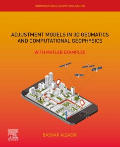
Adjustment Models in 3D Geomatics and Computational Geophysics: With MATLAB Examples, Volume Four introduces a complete package of theoretical and practical subjects in adjustment computations relating to Geomatics and geophysical applications, particularly photogrammetry, surveying, remote sensing, GIS, cartography, and geodesy. Supported by illustrating figures and solved examples with MATLAB codes, the book provides clear methods for processing 3D data for accurate and reliable results. Problems cover free net adjustment, adjustment with constraints, blunder detection, RANSAC, robust…mehr

Produktbeschreibung
Adjustment Models in 3D Geomatics and Computational Geophysics: With MATLAB Examples, Volume Four introduces a complete package of theoretical and practical subjects in adjustment computations relating to Geomatics and geophysical applications, particularly photogrammetry, surveying, remote sensing, GIS, cartography, and geodesy. Supported by illustrating figures and solved examples with MATLAB codes, the book provides clear methods for processing 3D data for accurate and reliable results. Problems cover free net adjustment, adjustment with constraints, blunder detection, RANSAC, robust estimation, error propagation, 3D co-registration, image pose determination, and more.

  • Covers both the theory and practice of using adjustment techniques in a wide variety of modern applications in Geomatics
  • Presents topics on the Kalman filter, Robust estimation, Levenberg Marquardt technique, and many other vital applications in the context of Geomatics and photogrammetry
  • Provides 75 solved problems in detail, especially related to 3-dimensional applications of Geomatics
  • Offers MATLAB codes to strengthen understanding and give readers up-to-date knowledge on information science

Dieser Download kann aus rechtlichen Gründen nur mit Rechnungsadresse in A, B, BG, CY, CZ, D, DK, EW, E, FIN, F, GR, HR, H, IRL, I, LT, L, LR, M, NL, PL, P, R, S, SLO, SK ausgeliefert werden.

Autorenporträt
Bashar Alsadik is an assistant professor in photogrammetry. He holds a PhD degree in the field of Geoinformation from the ITC faculty in the Netherlands.