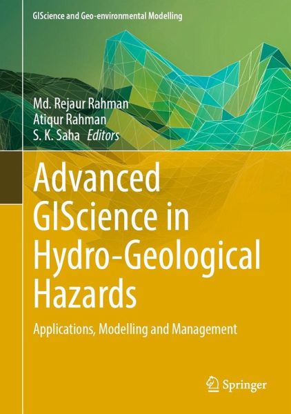
Dr. Md. Rejaur Rahman is a distinguished Professor of Geography and Environmental Studies at the esteemed University of Rajshahi, Bangladesh. His academic journey is marked by notable achievements, including his Ph.D. in Information Engineering of Resources and Environment from the prestigious College of Resources and Environment at Huazhong Agricultural University in Wuhan, China. Additionally, he holds a Master of Technology (M.Tech) in Remote Sensing (RS) and Geographic Information System (GIS) from the Centre for Space Science and Technology Education in Asia and the Pacific (CSSTEAP) in India, an institution affiliated to the United Nations. Dr. Rahman worked as a Post-Doctoral Research Fellow at the University of Science Malaysia (Universiti Sains Malaysia, USM). He received several scholarships to pursue his higher studies, including the CSSTEAP-UN scholarship, the China Government scholarship, and the TWAS (Italy-Malaysia) scholarship. He has also been awarded the Fulbright Visiting Research Fellowship for 2024-2025 at Ohio State University, USA. Besides, he served as the Associate Sub-Project Manager of the Higher Education Quality Enhancement Project (HEQEP), a collaboration between the Government of Bangladesh and the World Bank, from 2012 to 2013. Dr Rahman enriched his research experience as a Research Fellow in the project focusing on GIS application in Coastal Area Planning and Management at the Department of Environmental Science, University Putra Malaysia (UPM), Malaysia, from September 2000 to February 2001. He has served as the Chairman of the Department of Geography and Environmental Studies and later as the Dean of the Faculty of Geo-Sciences at the University of Rajshahi, Bangladesh. His research interests encompass a wide array of crucial areas including the application of Remote Sensing, GIS, and Artificial Intelligence (AI) in monitoring, modeling, and managing natural disasters such as floods, soil erosion, droughts, river bank erosion and landslides. He has also made significant contributions to understanding climate change issues, land use/land cover change analysis, modeling, and planning, as well as cropland monitoring and planning. Dr. Rahman's scholarly contributions are extensive, with over 45 reviewed research papers published in esteemed international and national refereed journals covering various aspects of remote sensing and GIS applications, image processing, natural disaster monitoring and modeling, climate variability and change, and land use/land cover mapping, monitoring, and planning. His work has been featured in prominent publications such as The Egyptian Journal of Remote Sensing and Space Science, Geo-Spatial Information Science, Journal of Spatial Science, International Journal of Geoinformatics, Climate Dynamics, Ecological Modelling, Theoretical and Applied Climatology, Environmental Monitoring and Assessment, Environmental Earth Sciences, Earth Science Informatics, Journal of the Indian Society of Remote Sensing, and Modeling Earth Systems and Environment. Additionally, he has authored numerous book chapters published by Springer-Nature. Dr. Rahman's expertise is recognized globally, as evidenced by his participation in numerous national and international seminars and workshops, where he has presented several research papers. Furthermore, he has undertaken advanced/specialized training courses on Remote Sensing and GIS across several countries including India, China, Jordan, Egypt, Sweden, Russia, Iran, South Korea, Turkey, and the Netherlands. Beyond his research endeavors, Dr. Rahman has also contributed to the academic community as a Reviewer/Editor for various journals published by Springer, Elsevier, Taylor and Francis, MDPI, and Frontiers, reflecting his commitment to advancing scientific knowledge in his academic and research field. Dr. Atiqur Rahman is a Professor of Geography at Dept. of Geography, Faculty of Sciences, Jamia Millia Islamia. He is alumnus of prestigious Aligarh Muslim University (AM) Aligarh. He completed B. Sc. (Hons.), M Sc., M Phil and Ph. D. from AMU. His research interest is urban environmental management, water resources, physical Geography, digital image processing and use of remote sensing satellite data, GIS and GPS. He was Post-Doctoral Fellow (PDF) at UFZ-Centre for Environmental Research, Leipzig, Germany (1999). He was Co-PI of Indo-Germany DST-DAAD major project. He is the recipient of prestigious Young Scientist Project Grant Award (2001-2004) from Department of Science and Technology (DST), Govt. of India. He worked as one a member of Scientific Research Team of NASA funded UEM project on Urban Ecology and Sustainability (2004-2007). He is the Co-PI Indo-Canadian major research projects on Economic Transformation and Childhood Obesity funded by ICMR (India) and CHI (Canada) 2010-2015. He was Co-PI of a major research project funded by Ministry of Environment and Forest, Govt. of India. He was the collaborating Scientist of NASA funded major project on Impacts of Desert Urbanization on Climate using Remote Sensing and Numerical Modeling (2012-2015). Prof. Rahman has also done professional development initiative training on Climate Change and Its Impacts: Resilience and Adaptation to Changes in Precipitation, at Brown University USA (2010). He served as a Steering Committee (SC) Member (2009-2012) of Population and Environment Research Network (PERN), CISIN, Columbia University USA. He was the Advisor-Technical cum Consultant on Remote Sensing & GIS for the project (2013-18) in the PHFI & AIIMS, and Emory University, USA project. He was also a Member of the National Steering Committee (NSC) on Technology Need Assessment (TNA) for Habitat Sector (TIFAC), Department of Science and Technology, Govt. of India. He also served as a Member, Governing Body (GB), of some colleges of University of Delhi as a University Nominee. He was the Faculty Coordinator, Inspired Teachers In-Residence Programme organized by the Office of the President of India at Rashtrapati Bhavan, New Delhi, 6-12 June, 2015. Prof. Rahman served Jamia Millia Isamia was Hony. Dy. Director (Academic) Jamia Millia Islamia, (2015-2018), Chief Prcotor & Security In-charge (2022-2024). Prof. Rahman was Coordinator/Dy. Coordinator, UGC-DRS SAP-I, Special Assistance Programme (SAP-I) during (2016-2021), Department of Geography, JMI. Thirteen students have been awarded Ph. D. degrees under his supervision. He has published 19 books and 180 peer reviewed research papers in Applied Geography, Journal of Cleaner Production, Ecological Indicators, Urban Climate, Sustainable Cities and Society, Environmental Science and Pollution Research, Science of the Total Environment, Natural Hazards, Environment, Development and Sustainability, Journal of Environmental Management and Nature-Scientific Reports journal to name a few. He has widely traveled to various countries in Europe, Africa and USA. He is the reviewer of about 80 SCI journals and on Editorial Board of some of the SCI journals. Prof. Rahman is amongst the top 2% Global Elite Scientists in the study by Prof. John P. A. Loannidis, University of Stanford, USA, published in the journal PLOS Biology since 2019. Dr. S.K. Saha is a former professor and Head of Agriculture and Soils Division, Indian Institute of Remote Sensing (IIRS), Dehradun India. He was former Dean & Group Director, Earth Resources and System Studies Group of the said Institute. He also held position of Distinguished Professor, Geoinformatics, Dept. of Petroleum Engineering & Earth Sciences, University of Petroleum and Energy Studies (UPES), Dehradun, India from 2017-2021, and Emeritus Professor, CSSTEAP (Centre for Space Science & Technology Education in Asia-Pacific) (Affiliated to the United Nations), IIRS Campus, Dehradun, India from 2015-2017. Dr Saha received prestigious award of "Fellow of Indian Society of Remote Sensing" for life time research contributions in RS and GIS applications in natural resources and environmental management, prestigious award of "Satish Dhawan Award 2015" by ISRS for outstanding contributions in developing applications of RS and GIS in natural resources inventory, monitoring and management as well as capacity building in Asia-Pacific region and a "Junior and Senior Research Fellowships" by ICAR (Indian Council of Agricultural Research) based on national level tests for postgraduate studies. Dr Saha earned his PhD in Agricultural Sciences (Soil Science and Agricultural Chemistry) from the Indian Agricultural Research Institute (IARI, New Delhi) with Distinction. His research interest is in Remote Sensing (RS) and Geographic Information System (GIS) applications in Natural Resource Inventory, Monitoring and Management (including Agricultural Resources and Watershed Management). He served as an expert of International Technical Advisory Mission Members (TAM) of UN-SPIDER (Space based Information for Disaster Management and Emergency Response), 2011 and a visiting guest faculty to GDTA (Groupe for Development of Tele-detection Aerospatiale), Remote Sensing Research Institute of CNES (National Space Research Organization of France), Toulouse, France, for teaching various topics on RS & GIS applications in Agriculture and Soils, 2000. Dr. Saha has published more than 100 reviewed research papers in the international and national peer reviewed Journals, 60 in Proceedings of Seminars/Symposia, 20 in Technical Reports, and 6 Special book publications as Editor. He has also successfully carried out several ISRO supported projects as Principal Investigator. Dr Saha contributed significantly towards popularization of RS & GIS by organizing number of ISRS (Indian Society of Remote Sensing) national symposia; online publication of international standard journal of ISRS jointly with reputed international publisher - Springer and also by organizing several outreach activities on RS and GIS technology and applications at local ISRS Local Chapter level, as secretary of ISRS National Body (2 terms), Associate Editor of JISRS (1999-2018) and Chairman and Secretary of ISRS Dehradun Chapter. He is an active member of professional associations viz. Indian Society of Remote Sensing; Indian Society of Geomatics; Indian Society of Soil Science; Indian Meteorological Society. Dr Saha has widely traveled to various countries in Europe, Africa, Asia and USA.
