Sie sind bereits eingeloggt. Klicken Sie auf 2. tolino select Abo, um fortzufahren.
Bitte loggen Sie sich zunächst in Ihr Kundenkonto ein oder registrieren Sie sich bei bücher.de, um das eBook-Abo tolino select nutzen zu können.
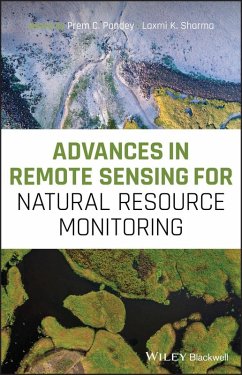
Sustainable management of natural resources is an urgent need, given the changing climatic conditions of Earth systems. The ability to monitor natural resources precisely and accurately is increasingly important. New and advanced remote sensing tools and techniques are continually being developed to monitor and manage natural resources in an effective way. Remote sensing technology uses electromagnetic sensors to record, measure and monitor even small variations in natural resources. The addition of new remote sensing datasets, processing techniques and software makes remote sensing an exact…mehr
Sustainable management of natural resources is an urgent need, given the changing climatic conditions of Earth systems. The ability to monitor natural resources precisely and accurately is increasingly important. New and advanced remote sensing tools and techniques are continually being developed to monitor and manage natural resources in an effective way. Remote sensing technology uses electromagnetic sensors to record, measure and monitor even small variations in natural resources. The addition of new remote sensing datasets, processing techniques and software makes remote sensing an exact and cost-effective tool and technology for natural resource monitoring and management. Advances in Remote Sensing for Natural Resources Monitoring provides a detailed overview of the potential applications of advanced satellite data in natural resource monitoring. The book determines how environmental and - ecological knowledge and satellite-based information can be effectively combined to address a wide array of current natural resource management needs. Each chapter covers different aspects of remote sensing approach to monitor the natural resources effectively, to provide a platform for decision and policy. This important work: * Provides comprehensive coverage of advances and applications of remote sensing in natural resources monitoring * Includes new and emerging approaches for resource monitoring with case studies * Covers different aspects of forest, water, soil- land resources, and agriculture * Provides exemplary illustration of themes such as glaciers, surface runoff, ground water potential and soil moisture content with temporal analysis * Covers blue carbon, seawater intrusion, playa wetlands, and wetland inundation with case studies * Showcases disaster studies such as floods, tsunami, showing where remote sensing technologies have been used This edited book is the first volume of the book series Advances in Remote Sensing for Earth Observation.
Dieser Download kann aus rechtlichen Gründen nur mit Rechnungsadresse in A, B, BG, CY, CZ, D, DK, EW, E, FIN, F, GR, HR, H, IRL, I, LT, L, LR, M, NL, PL, P, R, S, SLO, SK ausgeliefert werden.
Die Herstellerinformationen sind derzeit nicht verfügbar.
Autorenporträt
Dr Prem C. Pandey is Assistant Professor in the Center for Environmental Sciences & Engineering, Shiv Nadar University, UP, India. Dr Laxmi K. Sharma is Associate Professor, at the Department of Environmental Science, Central University of Rajasthan, Ajmer, India.
Inhaltsangabe
List of abbreviations
List of Contributors
List of Editors
Foreword [to come]
Preface [to come]
Section I General
Chapter 1 Introduction to Natural Resource Monitoring Using Remote Sensing Technology
Prem Chandra PANDEY and Laxmi Kant SHARMA
Chapter 2 Spectroradiometry: Types, Data Collection, and Processing
Chapter 3 Geometric-optical modeling of Bidirectional Reflectance Distribution Function for trees and forest stands
Nour El Islam BACHARI, Salim LAMINE & Khaled MEHARRAR
Section II Vegetation Resource Monitoring (Forest and Agriculture)
Chapter 4 Mapping Stand Age of Indonesian Rubber Plantation using Fully Polarimetric L-Band Synthetic Aperture Radar
Bambang H. TRISASONGKO
Chapter 5 Responses of Multi-Frequency Remote Sensing to Forest Biomass
Suman SINHA, A. SANTRA, L.K. SHARMA, A.K. DAS, C. JEGANATHAN, Shiv MOHAN, S.S. MITRA, M.S. NATHAWAT
Chapter 6 Crop water Requirements Analysis Using Geoinformatics Techniques in the Water Scarce Semi-Arid Watershed
Ibrahim-Bathis. K, SA AHMED, Nischitha.V and M.A Mohammed-ASLAM
Chapter 7 Biophysical Characterization and Monitoring Large-Scale Water and Vegetation Anomalies by Remote Sensing in the Agricultural Growing Areas of the Brazilian Semiarid Region
Chapter 8 SMOS L4 Downscaled Soil Moisture Product Evaluation over a 2 year- period in a Mediterranean Setting
Patrick N. L. LAMPTEY, George P. PETROPOULOS, Prashant K. SRIVASTAVA
Chapter 9 Estimating Urban Population Density Using Remotely Sensed Imagery Products
Dimitris TRIANTAKONSTANTIS, Demetris STATHAKIS and Zoi PAPADOPOULOU
Chapter 10 Impact of Land Cover Change on Surface Runoff
Apoorv SOOD, S.K.GHOSH, Priyadarshi UPADHYAY
Chapter 11 Delineation of Ground Water Potential Zone and Site Suitability of Rainwater Harvesting Structures using Remote Sensing and In-situ Geophysical Measurements
Prachi SINGH, Akash ANAND, Prashant K. SRIVASTAVA, Arjun SINGH and Prem Chandra PANDEY
Chapter 12 Structural control on the landscape Evolution of Son Alluvial Fan System in Ganga foreland basin
Manish PANDEY, Yogesh RAY, Aman ARORA, UK SHUKLA, Shyam RANJAN
Chapter 13 Managing the Blue Carbon Ecosystem: A Remote Sensing and GIS Approaches
Parul MAURYA, Anup Kumar DAS, Rina KUMARI
Chapter 14 Appraising the Changing Climate and Extent of Snow in the Kashmir Himalaya using MODIS data
Seema RANI
Chapter 15 Knowledge-based mapping of debris-covered glaciers in the Greater Himalayan Range
Swagata GHOSH and RAAJ RAMSANKARAN
Chapter 16 Seawater Intrusion and Salinity Mapping in coastal Aquifers: A Geospatial approach
TANUSHREE, Rina KUMARI
Chapter 17 Wetland Inundated Area Modelling and Monitoring using Supervised and machine learning classifiers