Advances in Scalable and Intelligent Geospatial Analytics (eBook, PDF)
Challenges and Applications
Redaktion: Durbha, Surya S; Kurte, Kuldeep; Bharambe, Ujwala; Bhangale, Ujwala; S Chaudhari, Sangita; Yang, Lexie; Sanyal, Jibonananda
142,95 €
142,95 €
inkl. MwSt.
Sofort per Download lieferbar

71 °P sammeln
142,95 €
Als Download kaufen

142,95 €
inkl. MwSt.
Sofort per Download lieferbar

71 °P sammeln
Jetzt verschenken
Alle Infos zum eBook verschenken
142,95 €
inkl. MwSt.
Sofort per Download lieferbar
Alle Infos zum eBook verschenken

71 °P sammeln
Advances in Scalable and Intelligent Geospatial Analytics (eBook, PDF)
Challenges and Applications
Redaktion: Durbha, Surya S; Kurte, Kuldeep; Bharambe, Ujwala; Bhangale, Ujwala; S Chaudhari, Sangita; Yang, Lexie; Sanyal, Jibonananda
- Format: PDF
- Merkliste
- Auf die Merkliste
- Bewerten Bewerten
- Teilen
- Produkt teilen
- Produkterinnerung
- Produkterinnerung

Bitte loggen Sie sich zunächst in Ihr Kundenkonto ein oder registrieren Sie sich bei
bücher.de, um das eBook-Abo tolino select nutzen zu können.
Hier können Sie sich einloggen
Hier können Sie sich einloggen
Sie sind bereits eingeloggt. Klicken Sie auf 2. tolino select Abo, um fortzufahren.

Bitte loggen Sie sich zunächst in Ihr Kundenkonto ein oder registrieren Sie sich bei bücher.de, um das eBook-Abo tolino select nutzen zu können.
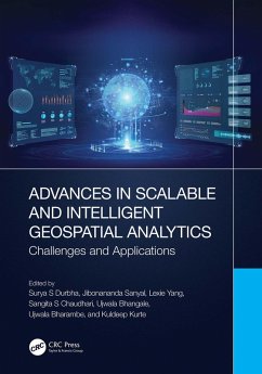
Advances in high-performance computing, computer vision, and big data analytics enable the efficient processing of big-geospatial data. Geospatial communities have adopted these techniques in a variety of applications. This book is a comprehensive overview of the state-of-the-art, and future developments in this domain.
- Geräte: PC
- mit Kopierschutz
- eBook Hilfe
Andere Kunden interessierten sich auch für
![Advances in Scalable and Intelligent Geospatial Analytics (eBook, ePUB) Advances in Scalable and Intelligent Geospatial Analytics (eBook, ePUB)]() Advances in Scalable and Intelligent Geospatial Analytics (eBook, ePUB)142,95 €
Advances in Scalable and Intelligent Geospatial Analytics (eBook, ePUB)142,95 €![Data Mining for Co-location Patterns (eBook, PDF) Data Mining for Co-location Patterns (eBook, PDF)]() Guoqing ZhouData Mining for Co-location Patterns (eBook, PDF)48,95 €
Guoqing ZhouData Mining for Co-location Patterns (eBook, PDF)48,95 €![Explainable Machine Learning for Geospatial Data Analysis (eBook, PDF) Explainable Machine Learning for Geospatial Data Analysis (eBook, PDF)]() Courage KamusokoExplainable Machine Learning for Geospatial Data Analysis (eBook, PDF)115,95 €
Courage KamusokoExplainable Machine Learning for Geospatial Data Analysis (eBook, PDF)115,95 €![Fuzzy Machine Learning Algorithms for Remote Sensing Image Classification (eBook, PDF) Fuzzy Machine Learning Algorithms for Remote Sensing Image Classification (eBook, PDF)]() Anil KumarFuzzy Machine Learning Algorithms for Remote Sensing Image Classification (eBook, PDF)55,95 €
Anil KumarFuzzy Machine Learning Algorithms for Remote Sensing Image Classification (eBook, PDF)55,95 €![Handbook of Geospatial Artificial Intelligence (eBook, PDF) Handbook of Geospatial Artificial Intelligence (eBook, PDF)]() Handbook of Geospatial Artificial Intelligence (eBook, PDF)178,95 €
Handbook of Geospatial Artificial Intelligence (eBook, PDF)178,95 €![On-Board Processing for Satellite Remote Sensing Images (eBook, PDF) On-Board Processing for Satellite Remote Sensing Images (eBook, PDF)]() Guoqing ZhouOn-Board Processing for Satellite Remote Sensing Images (eBook, PDF)131,95 €
Guoqing ZhouOn-Board Processing for Satellite Remote Sensing Images (eBook, PDF)131,95 €![Social Data Analytics in the Cloud with AI (eBook, PDF) Social Data Analytics in the Cloud with AI (eBook, PDF)]() Xuebin WeiSocial Data Analytics in the Cloud with AI (eBook, PDF)79,95 €
Xuebin WeiSocial Data Analytics in the Cloud with AI (eBook, PDF)79,95 €-
-
-
Advances in high-performance computing, computer vision, and big data analytics enable the efficient processing of big-geospatial data. Geospatial communities have adopted these techniques in a variety of applications. This book is a comprehensive overview of the state-of-the-art, and future developments in this domain.
Dieser Download kann aus rechtlichen Gründen nur mit Rechnungsadresse in A, B, BG, CY, CZ, D, DK, EW, E, FIN, F, GR, HR, H, IRL, I, LT, L, LR, M, NL, PL, P, R, S, SLO, SK ausgeliefert werden.
Produktdetails
- Produktdetails
- Verlag: Taylor & Francis eBooks
- Seitenzahl: 421
- Erscheinungstermin: 12. Mai 2023
- Englisch
- ISBN-13: 9781000877489
- Artikelnr.: 67663495
- Verlag: Taylor & Francis eBooks
- Seitenzahl: 421
- Erscheinungstermin: 12. Mai 2023
- Englisch
- ISBN-13: 9781000877489
- Artikelnr.: 67663495
- Herstellerkennzeichnung Die Herstellerinformationen sind derzeit nicht verfügbar.
Dr. Surya Durbha is a Professor at CSRE, Indian Institute of Technology Bombay (IITB). Before joining IITB, he held an adjunct faculty position in the Electrical and Computer Engineering Department at Mississippi State University. He has published over 80 peer reviewed articles and has written a book on the Internet of Things published by Oxford University Press in March 2021. Dr. Jibonananda Sanyal serves as the Group Leader for Oak Ridge National Laboratory's Computational Urban Sciences research group. He is an IEEE Senior Member, an ACM Distinguished Speaker, and a 2017 Knoxville's 40 under 40 honoree. Dr. Lexie Yang is a lead research scientist in the GeoAI Group at Oak Ridge National Laboratory. She leads several AI-enabled geoscience data analytics projects with large-scale multi-modality geospatial data. The recent work from her team has been widely used to support national-scale disaster assessment and management by federal and local agencies. Dr. Sangita S. Chaudhari is a Professor in the Department of Computer Engineering, Ramrao Adik Institute of Technology Nerul, Navi Mumbai, India. She is vice chair of IEEE GRSS Mumbai Chapter and has published several journal articles and book chapters. Dr. Ujwala Bhangale is an Associate Professor in the Department of Information Technology, at K.J. Somaiya College of Engineering, Somaiya Vidyavihar University, Mumbai, India. She has published several papers in IEEE/ACM publications. Dr. Ujwala Bharambe is an Assistant Professor in the Department of Computer Engineering, at Thadomal Shahani Engineering College, Mumbai, India. She has published several papers in IEEE/ACM publications. Dr. Kuldeep Kurte is a research scientist in the Computational Urban Sciences Group (CUSG) at Oak Ridge National Laboratory. He has experience working on various applications on different HPC platforms from NVIDIA Jetson Tk1 to the Summit supercomputer.
Section I: Introduction to Geospatial Analytics. 1. Geospatial Technology -
Developments, Present Scenario and Research Challenges. Section II: Geo-Ai.
2. Perspectives on Geospatial Artificial Intelligence Platforms for
Multimodal Spatiotemporal Datasets. 3. Temporal Dynamics of Place and
Mobility. 4. Geospatial Knowledge Graph Construction Workflow for
Semantics-Enabled Remote Sensing Scene Understanding. 5. Geosemantic
Standards-Driven Intelligent Information Retrieval Framework for 3D LiDAR
Point Clouds. 6. Geospatial Analytics Using Natural Language Processing.
Section III: Scalable Geospatial Analytics. 7. A Scalable Automated
Satellite Data Downloading and Processing Pipeline Developed on AWS Cloud
for Agricultural Applications. 8. Providing Geospatial Intelligence through
a Scalable Imagery Pipeline. 9. Distributed Deep Learning and Its
Application in Geo-spatial Analytics. 10. High-Performance Computing for
Processing Big Geospatial Disaster Data. Section IV: Geovisualization:
Innovative Approaches for Geovisualization and Geovisual Analytics for Big
Geospatial Data. 11. Dashboard for Earth Observation. 12. Visual
Exploration of LiDAR Point Clouds. Section V: Other Advances in Geospatial
Domain. 13. Toward a Smart Metaverse City: Immersive Realism and 3D
Visualization of Digital Twin Cities. 14. Current UAS Capabilities for
Geospatial Spectral Solutions. 15. Flood Mapping and Damage Assessment
Using Sentinel - 1 & 2 in Google Earth Engine of Port Berge & Mampikony
Districts, Sophia Region, Madagascar. Section VI: Case Studies from the
Geospatial Domain. 16. Fuzzy-Based Meta-Heuristic and Bi-Variate
Geo-Statistical Modelling for Spatial Prediction of Landslides. 17.
Understanding the Dynamics of the City through Crowdsourced Datasets: A
Case Study of Indore City. 18. A Hybrid Model for the Prediction of Land
Use/Land Cover Pattern in Kurunegala City, Sri Lanka. 19. Spatio-Temporal
Dynamics of Tropical Deciduous Forests under Climate Change Scenarios in
India. 20. A Survey of Machine Learning Techniques in Forestry Applications
Using SAR Data.
