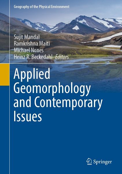
Applied Geomorphology and Contemporary Issues (eBook, PDF)
Statt 106,99 €**
96,29 €
**Preis der gedruckten Ausgabe (Gebundenes Buch)
inkl. MwSt. und vom Verlag festgesetzt.
Applied Geomorphology and Contemporary Issues (eBook, PDF)
- Format: PDF
- Merkliste
- Auf die Merkliste
- Bewerten Bewerten
- Teilen
- Produkt teilen
- Produkterinnerung
- Produkterinnerung
Bitte loggen Sie sich zunächst in Ihr Kundenkonto ein oder registrieren Sie sich bei
bücher.de, um das eBook-Abo tolino select nutzen zu können.
Hier können Sie sich einloggen
Sie sind bereits eingeloggt. Klicken Sie auf 2. tolino select Abo, um fortzufahren.
Bitte loggen Sie sich zunächst in Ihr Kundenkonto ein oder registrieren Sie sich bei bücher.de, um das eBook-Abo tolino select nutzen zu können.
The edited book deals with climate change and its response to river system which is one of the most burning issues of the Global environment. Due to urbanization and industrialization land degradation and resource depletion are happening and promoting livelihood challenges in the world which is reflected in the book too. The book addresses the construction of dams over large rivers and its possible consequences in the environment. Changes of the hydrology and sedimentology are to be addressed in the book. The climate change phenomena and associated geomorphic hazards and contemporary…mehr
- Geräte: PC
- ohne Kopierschutz
- eBook Hilfe
- Größe: 47.6MB
- Upload möglich
Andere Kunden interessierten sich auch für
- Raj Kumar BhattacharyaRiver Sand Mining Modelling and Sustainable Practice (eBook, PDF)96,29 €
- Urban Soils (eBook, PDF)117,69 €
- Natural Resource Management in the Thar Desert Region of Rajasthan (eBook, PDF)149,79 €
- Geomorphology of Proglacial Systems (eBook, PDF)181,89 €
- Mehran MaghsoudiDesert Landscapes and Landforms of Iran (eBook, PDF)160,49 €
- New Advancements in Geomorphological Research (eBook, PDF)171,19 €
- Surface Environments and Human Interactions (eBook, PDF)139,09 €
-
-
-
The edited book deals with climate change and its response to river system which is one of the most burning issues of the Global environment. Due to urbanization and industrialization land degradation and resource depletion are happening and promoting livelihood challenges in the world which is reflected in the book too. The book addresses the construction of dams over large rivers and its possible consequences in the environment. Changes of the hydrology and sedimentology are to be addressed in the book. The climate change phenomena and associated geomorphic hazards and contemporary environmental issues such as sea level rise, coastal flood, drought, wind erosion, flood, soil erosion, landslide, depletion of ground water, coastal erosion etc. are elaborated in the book with suitable methods and techniques. So this edited book will contribute a lot to general to particular filed of studies and will help to geographers, geomorphologists, environmentalists, planners, policy makers and developers for studies and promoting regional plans and development.
Produktdetails
- Produktdetails
- Verlag: Springer International Publishing
- Erscheinungstermin: 3. September 2022
- Englisch
- ISBN-13: 9783031045325
- Artikelnr.: 65617629
- Verlag: Springer International Publishing
- Erscheinungstermin: 3. September 2022
- Englisch
- ISBN-13: 9783031045325
- Artikelnr.: 65617629
Section I: Climate Change and Rivers Response.- Large-scale sediment transport modelling: development, application, and insights.- An Appraisal to Anthropogeomorphology of the Chel River basin, Outer Eastern Himalayas and foreland, West Bengal, India.- Channel Migration Vulnerability in the Kaljani River basin of Eastern India.- Exploring change of river morphology and water quality in the stone mine areas of Dwarka River Basin, Eastern India.- An attempt to forecast seasonal precipitation in the Comahue River basins (Argentina) to increase productivity performance in the region.- Channel Instability in Upper Tidal Regime of Bhagirathi-Hugli River, India.- The pattern of extreme precipitation and river-runoff from gauge data in Eastern Nepal.- Climate change and its impact on catchment linkage and connectivity.- Inter-decadal variability of precipitation patterns increasing the runoff intensity in Lower reach of Shilabati River basin, West Bengal.- Section II: Land degradation, Resource Depletion and Livelihood Challenges.- Are the badlands of Tapi Basin in Deccan Trap Region of India “Vanishing Landscape.- Soil Piping: Problems and Prospects.- Role of LU & LC types on the spatial distribution of Arsenic contaminated tube wells of Purbasthali I & II Blocks of Burdwan District, West Bengal, India.- Forecasting the danger of the forest fire season in north-west Patagonia, Argentina.- Quantifying the Spatio-seasonal Water Balance and Land Surface Temperature Interface in Chandrabhaga River Basin, Eastern India.- Application of ensemble machine learning models to assess the sub-regional groundwater potentiality: a GIS-based approach.- Enhancement of natural and technogenic soils through sustainable soil amelioration products for a reduction of aeolian and fluvial translocation processes.- Assessment of land use and land cover change in the Purulia district, India using LANDSAT data.- "Prioritization of Watershed Developmental Plan by the Identification of Soil Erosion Prone Areas using USLE & RUSLE Methods for Sahibi Sub-Watershed of Rajasthan and Haryana state, India".- Estimation of soil erosion using Revised Universal Soil Loss Equation (RUSLE) Model in Subarnarekha River Basin, India.- Land Cover Changes in Green Patches and its Impact on Carbon Sequestration in an Urban System, India.- Review on Sustainable Groundwater Development and Management Strategies Associated with the Largest Alluvial Multi-Aquifer Systems of Indo-Gangetic Basin in India.- Section III: Large Dams and River Systems.- Predicting the distribution of farm dams in rural South Africa using GIS and remote sensing.- Large Dams, Upstream Responses, and Riverbank Erosion: Experience.- Section IV: Climate Change, Geomorphic Hazards and human livelihood.- Climate Change and Human Performance: Assessment of Physiological Strain in Male Paddy Cultivators in Hooghly, West Bengal, India.- Study on Climate change and its impact on coastal habitats with special reference to ecosystem vulnerability of the Odisha coastline, India.- The Millennium Flood of the Upper Ganga Delta, West Bengal, India: A Remote Sensing Based Study.- Tropical Cyclone: A Natural Disaster with special reference to Amphan.- Observed changes in the precipitation regime in the Argentinean Patagonia and their geographical implication.- An assessment of severe storms, their impacts and social vulnerability in coastal areas: A case study of General Pueyrredon, Argentina.- Modelling and mapping landslide susceptibility of Darjeeling Himalaya using geospatial technology.- Climate change induced coastal hazards and community vulnerability in Indian Sundarban.- Sea-level changes along Bangladesh coast: how much we know about it?.- Assessing channel migration, bank erosion vulnerability and suitable human habitation sites in the Torsa River Basin of Eastern India using AHP model and geospatial technology.-Spatiotemporal Assessment of Drought Intensity and Trend Along With Change Point: A Study on Bankura District, West Bengal, India.- Landslide susceptibility assessment and management using advanced hybrid machine learning algorithms in Darjeeling Himalaya, India.- Predicting the landslide susceptibility in Eastern Sikkim Himalayan region, India using Boosted Regression Tree and REPTree machine learning techniques.- An Exploratory Analysis of Mountaineering Risk Estimation among the mountaineers in Indian Himalaya.
Section I: Climate Change and Rivers Response.- Large-scale sediment transport modelling: development, application, and insights.- An Appraisal to Anthropogeomorphology of the Chel River basin, Outer Eastern Himalayas and foreland, West Bengal, India.- Channel Migration Vulnerability in the Kaljani River basin of Eastern India.- Exploring change of river morphology and water quality in the stone mine areas of Dwarka River Basin, Eastern India.- An attempt to forecast seasonal precipitation in the Comahue River basins (Argentina) to increase productivity performance in the region.- Channel Instability in Upper Tidal Regime of Bhagirathi-Hugli River, India.- The pattern of extreme precipitation and river-runoff from gauge data in Eastern Nepal.- Climate change and its impact on catchment linkage and connectivity.- Inter-decadal variability of precipitation patterns increasing the runoff intensity in Lower reach of Shilabati River basin, West Bengal.- Section II: Land degradation, Resource Depletion and Livelihood Challenges.- Are the badlands of Tapi Basin in Deccan Trap Region of India "Vanishing Landscape.- Soil Piping: Problems and Prospects.- Role of LU & LC types on the spatial distribution of Arsenic contaminated tube wells of Purbasthali I & II Blocks of Burdwan District, West Bengal, India.- Forecasting the danger of the forest fire season in north-west Patagonia, Argentina.- Quantifying the Spatio-seasonal Water Balance and Land Surface Temperature Interface in Chandrabhaga River Basin, Eastern India.- Application of ensemble machine learning models to assess the sub-regional groundwater potentiality: a GIS-based approach.- Enhancement of natural and technogenic soils through sustainable soil amelioration products for a reduction of aeolian and fluvial translocation processes.- Assessment of land use and land cover change in the Purulia district, India using LANDSAT data.- "Prioritization of Watershed Developmental Plan by the Identification of Soil Erosion Prone Areas using USLE & RUSLE Methods for Sahibi Sub-Watershed of Rajasthan and Haryana state, India".- Estimation of soil erosion using Revised Universal Soil Loss Equation (RUSLE) Model in Subarnarekha River Basin, India.-Land Cover Changes in Green Patches and its Impact on Carbon Sequestration in an Urban System, India.- Review on Sustainable Groundwater Development and Management Strategies Associated with the Largest Alluvial Multi-Aquifer Systems of Indo-Gangetic Basin in India.- Section III: Large Dams and River Systems.- Predicting the distribution of farm dams in rural South Africa using GIS and remote sensing.- Large Dams, Upstream Responses, and Riverbank Erosion: Experience.- Section IV: Climate Change, Geomorphic Hazards and human livelihood.- Climate Change and Human Performance: Assessment of Physiological Strain in Male Paddy Cultivators in Hooghly, West Bengal, India.- Study on Climate change and its impact on coastal habitats with special reference to ecosystem vulnerability of the Odisha coastline, India.- The Millennium Flood of the Upper Ganga Delta, West Bengal, India: A Remote Sensing Based Study.- Tropical Cyclone: A Natural Disaster with special reference to Amphan.- Observed changes in the precipitation regime in the Argentinean Patagonia and their geographical implication.- An assessment of severe storms, their impacts and social vulnerability in coastal areas: A case study of General Pueyrredon, Argentina.- Modelling and mapping landslide susceptibility of Darjeeling Himalaya using geospatial technology.- Climate change induced coastal hazards and community vulnerability in Indian Sundarban.- Sea-level changes along Bangladesh coast: how much we know about it?.- Assessing channel migration, bank erosion vulnerability and suitable human habitation sites in the Torsa River Basin of Eastern India using AHP model and geospatial technology.-Spatiotemporal Assessment of Drought Intensity and Trend Along With Change Point: A Study on Bankura District, West Bengal, India.- Landslide susceptibility assessment and management using advanced hybrid machine learning algorithms in Darjeeling Himalaya, India.- Predicting the landslide susceptibility in Eastern Sikkim Himalayan region, India using Boosted Regression Tree and REPTree machine learning techniques.- An Exploratory Analysis of Mountaineering Risk Estimation among the mountaineers in Indian Himalaya.