45,95 €
45,95 €
inkl. MwSt.
Sofort per Download lieferbar
payback
23 °P sammeln
45,95 €
45,95 €
inkl. MwSt.
Sofort per Download lieferbar

Alle Infos zum eBook verschenken
payback
23 °P sammeln
Als Download kaufen
45,95 €
inkl. MwSt.
Sofort per Download lieferbar
payback
23 °P sammeln
Jetzt verschenken
45,95 €
inkl. MwSt.
Sofort per Download lieferbar

Alle Infos zum eBook verschenken
payback
23 °P sammeln
  • Format: ePub

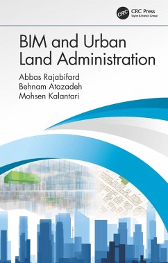
This book describes how legal information used in urban land administration practices can be logically connected to the BIM environment through implementation of BIM models for enhancing communication of vertically stratified legal interests in multi-story buildings; an effective representation and management of complex legal arrangements.

  • Geräte: eReader
  • ohne Kopierschutz
  • eBook Hilfe
  • Größe: 8.32MB
Produktbeschreibung
This book describes how legal information used in urban land administration practices can be logically connected to the BIM environment through implementation of BIM models for enhancing communication of vertically stratified legal interests in multi-story buildings; an effective representation and management of complex legal arrangements.


Dieser Download kann aus rechtlichen Gründen nur mit Rechnungsadresse in A, B, BG, CY, CZ, D, DK, EW, E, FIN, F, GR, HR, H, IRL, I, LT, L, LR, M, NL, PL, P, R, S, SLO, SK ausgeliefert werden.

Autorenporträt
Prof Abbas Rajabifard is Head of Department of Infrastructure Engineering at The University of Melbourne. He is also Director of the Centre for Spatial Data Infrastructures & Land Administration (CSDILA).Prof Rajabifard is a member of Academic Board. He was President of the GSDI Association (2009-2012), Vice Chair of Working Group 3 of the United Nations supported Permanent Committee on GIS Infrastructure for Asia and the Pacific (PCGIAP), is a member of ICA-Spatial Data Standard Commission, and is a member of Victorian Spatial Council. He has been an Executive Board member and national representative to the PCGIAP (1994-1998), member of International Steering Committee for Global Mapping Project (1997-2001) and a member of the UN-ESCAP Group of Experts to develop Guidelines on GIS Standardisation for Asia-Pacific (1995). Prof Rajabifard has active research in the areas of SDI, Land Administration and land management, spatial enablement, spatial enabled government and societies, disaster management, 3D platforms and virtual jurisdictions.

Dr. Mohsen Kalantari is a Senior Lecturer in Geomatics and Associate Director at the Centre for Spatial Data Infrastructures and Land Administration (CSDILA) in the Dept of Infrastructure Engineering at The University of Melbourne. Mohsen teaches Land Administration Systems (LAS) and Spatial Analysis and has several publications. Dr Kalantari is a spatial data engineer and in recognition of his research he has been awarded a prestigious Victoria Fellowship. The Victoria Fellowships recognise young researchers with leadership potential and aim to help them enhance their future careers, while developing new ideas which could offer commercial benefit to Victoria. He has also worked at the Department of Sustainability and Environment (DSE), Land Victoria and has an extensive knowledge of land administration systems of Australia. He completed his PhD in 2008.

Dr. Behnam Atazadeh is a post-doctoral research fellow in the Centre for Spatial Data Infrastructures and Land Administration, Department of Infrastructure Engineering. He has extensive experience in using 3D building information models and other 3D digital technologies for cadastral surveying in urban areas. As part of his research, Behnam has published several articles in reputable scientific journals and conferences in the domain of spatial and urban informatics.