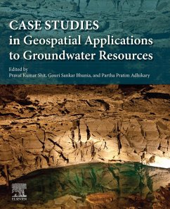
Case Studies in Geospatial Applications to Groundwater Resources provides thorough the most up-to-date techniques in GIS and geostatistics as they relate to groundwater, through detailed case studies that prove real-world applications of remote sensing applications to this subject. Groundwater is the primary source of fresh water in many parts of the world, while come regions are becoming overly dependent on it, consuming groundwater faster than it is naturally replenished and causing water tables to decline unremittingly. India is the largest user of groundwater in the world followed by China and the USA, with developing countries using groundwater at an unsustainable rate. Systematic planning of groundwater usage using modern techniques is essential for the proper utilization, management and modeling of this precious but shrinking natural resource. With the advent of powerful and highspeed personal computers, efficient techniques for water management have evolved, of which remote sensing, GIS (Geographic Information Systems), GPS (Global Positioning Systems) and Geostatistical techniques are of great significance. This book advances the scientific understanding, development, and application of geospatial technologies related to water resource management.
Case Studies in Geospatial Applications to Groundwater Resources is a valuable reference for researchers and postgraduate students in Earth and Environmental Sciences, especially GIS, agriculture, hydrology, natural resources, and soil science, who need to be able to apply the latest technologies in groundwater research in a practical manner.
- Provides detailed case studies on groundwater resources around the world, including regions with highest groundwater resource use
- Covers modern remote sensing and geostatistical technique-based groundwater resource mapping, monitoring, and modelling
- Describes novel region-specific management strategies and techniques for sustainability with case studies to illustrate effectiveness
- Includes practical coverage of the use of geospatial analysis techniques in groundwater resources
Dieser Download kann aus rechtlichen Gründen nur mit Rechnungsadresse in A, B, BG, CY, CZ, D, DK, EW, E, FIN, F, GR, HR, H, IRL, I, LT, L, LR, M, NL, PL, P, R, S, SLO, SK ausgeliefert werden.

