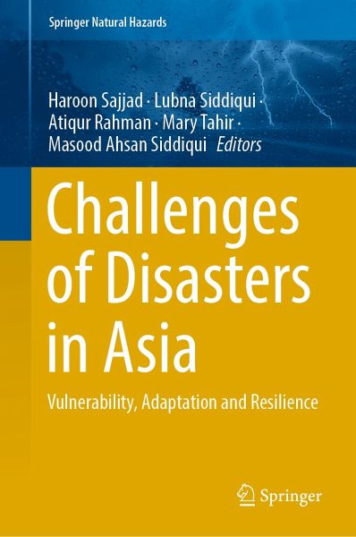
Challenges of Disasters in Asia (eBook, PDF)
Vulnerability, Adaptation and Resilience
106,99 €
inkl. MwSt.
Sofort per Download lieferbar
Challenges of Disasters in Asia (eBook, PDF)
Vulnerability, Adaptation and Resilience
- Format: PDF
- Merkliste
- Auf die Merkliste
- Bewerten Bewerten
- Teilen
- Produkt teilen
- Produkterinnerung
- Produkterinnerung
Bitte loggen Sie sich zunächst in Ihr Kundenkonto ein oder registrieren Sie sich bei
bücher.de, um das eBook-Abo tolino select nutzen zu können.
Hier können Sie sich einloggen
Sie sind bereits eingeloggt. Klicken Sie auf 2. tolino select Abo, um fortzufahren.
Bitte loggen Sie sich zunächst in Ihr Kundenkonto ein oder registrieren Sie sich bei bücher.de, um das eBook-Abo tolino select nutzen zu können.
The book provides an understanding about the disaster impacts, vulnerability assessment, adaptation pathways and mitigation for strengthening the resilience of the society to various hazards. Multi- dimensionality of disasters is depicted by various approaches and effective modelling. The book is a synthesis of research papers presented at online International Conference on the theme organized by the Centre for Disaster management, Department of Geography, Jamia Millia Islamia in collaboration with National Institute of Disaster Management and Regional Remote Sensing Centre (North), Indian…mehr
- Geräte: PC
- ohne Kopierschutz
- eBook Hilfe
- Größe: 15.75MB
- Upload möglich
Andere Kunden interessierten sich auch für
- Weitao ChenIntelligent Interpretation for Geological Disasters (eBook, PDF)149,79 €
- Impact of Climate Change, Land Use and Land Cover, and Socio-economic Dynamics on Landslides (eBook, PDF)149,79 €
- Ashutosh MohantyCyclonic Disasters and Resilience (eBook, PDF)117,69 €
- Society 5.0, Digital Transformation and Disasters (eBook, PDF)128,39 €
- Climate Emergency in the Philippines (eBook, PDF)139,09 €
- Rifaat AbdallaWebGIS for Disaster Management and Emergency Response (eBook, PDF)149,79 €
- Climate Change, Disaster Risks, and Human Security (eBook, PDF)139,09 €
-
-
-
The book provides an understanding about the disaster impacts, vulnerability assessment, adaptation pathways and mitigation for strengthening the resilience of the society to various hazards. Multi- dimensionality of disasters is depicted by various approaches and effective modelling. The book is a synthesis of research papers presented at online International Conference on the theme organized by the Centre for Disaster management, Department of Geography, Jamia Millia Islamia in collaboration with National Institute of Disaster Management and Regional Remote Sensing Centre (North), Indian Space Research Organization (ISRO), New Delhi, India during 02-03 March, 2021. The book has been organized into four parts spreading over 28 chapters. Part I deals with the impact assessment of various disasters. Part II examined ecological and socio-economic vulnerability arising out of the disasters. Part III identifies possible solutions for lessening vulnerability to disasters and effective adaptation strategies. Finally, part IV provides an insight for making the societies resilient to the disasters. The main focus of each chapter was laid implicitly on policy concerns focusing on disaster reduction at spatial scales. The book will immensely be helpful for the researchers, academicians and scientific communities for discussing set of questions necessary for future research. It will attract the attention of functionaries, practitioners, policy makers, training institutes and stakeholders for making appropriate methods of communicating risks and adaptation strategies for disaster management.
Produktdetails
- Produktdetails
- Verlag: Springer Nature Singapore
- Erscheinungstermin: 23. September 2022
- Englisch
- ISBN-13: 9789811935671
- Artikelnr.: 65888631
- Verlag: Springer Nature Singapore
- Erscheinungstermin: 23. September 2022
- Englisch
- ISBN-13: 9789811935671
- Artikelnr.: 65888631
Dr. Haroon Sajjad is a professor in the Department of Geography, Faculty of Natural Sciences, Jamia Millia Islamia, New Delhi, India. He received his B.Sc, M.Sc, M.Phil. and Ph.D. degrees all from Aligarh Muslim University, Aligarh, India. His present research interests include climate change/climate variability impacts, environmental management, sustainable development, watershed management and applications of remote sensing and GIS. He has six books to his credit and has published more than 100 research papers in academic journals. Prof. Sajjad has presented over 50 research papers at national and international conferences including ones held at Sapienza University of Rome, Italy; University of British Columbia, Canada; University of Western Cape, Bellville, South Africa; and University of Brighton, U.K. He has chaired academic sessions at conferences and has organized academic events such as national and international conferences, workshops and training programmes. He has delivered invited talks at numerous universities. Ten doctoral degrees have been awarded to the scholars under his supervision. He is a reviewer for many scientific research journals and a member of scientific bodies and expert panels. He has completed many research projects of various funding agencies as a co-principal investigator.
Dr. Lubna Siddiqui is an associate professor and deputy coordinator, Centre for Disaster Management, Department of Geography, Faculty of Natural Sciences, Jamia Millia Islamia, New Delhi, India. She completed her M.A. at Aligarh Muslim University, Aligarh, and her Ph.D. at Dr. Bhimrao Ambedkar University, Agra, India. She specializes in population geography. Many Ph.D. degrees have been awarded to students under her supervision. She has published more than two dozen research papers in academic journals and presented research papers at national and international conferences; she has been an invited speaker at numerous universities. Dr. Siddiqui has organizedmany national and international conferences and training programmes in her department, and she has completed many research projects of various agencies.
Dr. Atiqur Rahman is a professor in the Department of Geography, Faculty of Natural Sciences, Jamia Millia Islamia, New Delhi, India. He received his Ph.D. degree from Aligarh Muslim University, Aligarh, India. His research interests include urban environmental management, water resource management and public health. He has published eight books and more than 100 research papers in academic journals. Prof. Rahman has presented more than 50 research papers at national and international conferences including ones held at Arizona State University, U.S.A; McGill University, Montreal, Canada; Brown University, Providence, Rhode Island, U.S.A; and the American Academy of Sciences, Texas, U.S.A. In addition, he has spoken in South Africa, Germany, Italy, France and Poland. Eight doctoral degrees have been awarded to scholars under hissupervision. Prof. Rahman has chaired academic sessions at various conferences. He is a reviewer for many research journals and a member of scientific bodies in his field of specialisation. He has completed many national and international research projects.
Dr. Mary Tahir is a professor and the head of the Department of Geography, Jamia Millia Islamia, New Delhi, India. She obtained her M.A. degree from Jamia Millia Islamia and her Ph.D. degree from Jawaharlal Nehru University, New Delhi, India. Her research interests include social geography and environmental geography. She is the author of ten books. Five Ph.D. degrees have been awarded under her supervision. Prof. Tahir has published research papers in national and international journals and delivered invited talks at many universities. She has completed numerous research projects and organized national and international conferences.
Dr. Masood Ahsan Siddiqui is a professor and coordinator, Centre for Disaster Management, Department of Geography, Jamia Millia Islamia, New Delhi, India. He obtained his B.A., M.A., M.Phil. and Ph.D. degrees from Aligarh Muslim University, Aligarh, India. His present research fields include the application of remote sensing and GIS in watershed management and waste management. Prof. Masood has published four books and some three dozen research papers in academic journals. Fourteen students under his supervision have been awarded Ph.D. degrees. He has completed two major research projects awarded by the Department of Science and Technology and the University Grants Commission. Currently he is the principal investigator of two major research projects. He has presented many research papers at national and international conferences. As well, he has organized workshops, training programmes and conferences.
Probabilistic Seismic Hazard Assessment for the Frontal Part of the Mishmi Hills, India and Its Role in Disaster Management.- Assessment of Desertification and Land Degradation Vulnerability in Humid Tropics and Sub-Tropical Regions of India Using Remote Sensing & GIS Techniques.- Analysis of Diversified Impact of Covid-19 Pandemic Across the Indian States.- Spatio-Temporal Analysis of Seasonal Drought Pattern Using Vegetation Condition Index in Latur District.- Sea Level Rise and Impact on Moushuni Island of Sundarban Delta (West Bengal) – A Geospatial Based Approach.- Mapping of Affected Areas by Extreme Weather Events in Kanda Tehsil of Bageshwar District by GIS and RS Technique.- Household Based Approach to Assess the Impact of Riverbank Erosion on Socio-Economic Condition of People: A Case Study of Lower Ganga Plain.- Landslide Susceptibility Mapping of East Sikkim Employing AHP Method.- Socio-Environmental Vulnerability of Agriculture Communities to Climate Change in Western Himalaya – A Household Level Review.- Application of Mike 11 for One Dimensional GLOF Modeling of a Rapidly Expanding Dalung Proglacial Lake, Indus River Basin, Western Himalaya.- Hybrid Tree-based Wetland Vulnerability Modelling.- Spatio-temporal Analysis of Landuse Landcover Change Using STAR Method in Kolkata Urban Agglomeration.- Vulnerability Assessment of COVID Epidemic for Management and Strategic Plan– A Geospatial Based Solution.- Auto Generated Gravity Canal Routes for Flood Mitigation and Groundwater Rejuvenation: A study in Damodar - Barakar River Basin, India.- Assessing the Impact of Disasters and Adaptation Strategies in Sundarban Biosphere Reserve, India: A Household Level Analysis.- Forest Fires in Tropical Deciduous Forests – A Precursor to Anticipatory Adaptation Framework.- Understanding the Flood Early Warning System, A Case Study of Trans-boundary Water Governance in the Gandak River Basin.- Adaptation Policy and Community Discourse of Climate Change in the Mountainous Regions of India.- Analysis of Public Awareness, Health Risks and Coping Strategies against Heat waves in NCT of Delhi, India.- Community Based Flood Preparedness: A case study of Adayar watershed, Chennai city, Tamil Nadu, India.- Building Resilience and Management of Vulnerability: Solution for Reduction of Risk of Disasters.- Employability, A Key to Community’s Socio-economic Malady of Pandemic Proportions.- Living with Floods: Community Based Coping and Resilience mechanism of Mising/Mishing from Floods - A Study of Majuli District of Assam.- Assessment of Public Perception on Designing Colombo Municipal Council Area as a Green City.- Climate Change and Its Impacts assessment through Geospatial technology-A Theoretical Study from Extreme Weather Perspective for Disasters Resilient India.- Corporate Sector and Disaster Risk Management: A Critical Analysis with Reference to Corporate Social Responsibility Law in India.- Impact of Training and Awareness Programmes of Community Volunteers in Disaster Risk Reduction and Response- A Study of Srinagar City.
Probabilistic Seismic Hazard Assessment for the Frontal Part of the Mishmi Hills, India and Its Role in Disaster Management.- Assessment of Desertification and Land Degradation Vulnerability in Humid Tropics and Sub-Tropical Regions of India Using Remote Sensing & GIS Techniques.- Analysis of Diversified Impact of Covid-19 Pandemic Across the Indian States.- Spatio-Temporal Analysis of Seasonal Drought Pattern Using Vegetation Condition Index in Latur District.- Sea Level Rise and Impact on Moushuni Island of Sundarban Delta (West Bengal) - A Geospatial Based Approach.- Mapping of Affected Areas by Extreme Weather Events in Kanda Tehsil of Bageshwar District by GIS and RS Technique.- Household Based Approach to Assess the Impact of Riverbank Erosion on Socio-Economic Condition of People: A Case Study of Lower Ganga Plain.- Landslide Susceptibility Mapping of East Sikkim Employing AHP Method.- Socio-Environmental Vulnerability of Agriculture Communities to Climate Change in Western Himalaya - A Household Level Review.- Application of Mike 11 for One Dimensional GLOF Modeling of a Rapidly Expanding Dalung Proglacial Lake, Indus River Basin, Western Himalaya.- Hybrid Tree-based Wetland Vulnerability Modelling.- Spatio-temporal Analysis of Landuse Landcover Change Using STAR Method in Kolkata Urban Agglomeration.- Vulnerability Assessment of COVID Epidemic for Management and Strategic Plan- A Geospatial Based Solution.- Auto Generated Gravity Canal Routes for Flood Mitigation and Groundwater Rejuvenation: A study in Damodar - Barakar River Basin, India.- Assessing the Impact of Disasters and Adaptation Strategies in Sundarban Biosphere Reserve, India: A Household Level Analysis.- Forest Fires in Tropical Deciduous Forests - A Precursor to Anticipatory Adaptation Framework.- Understanding the Flood Early Warning System, A Case Study of Trans-boundary Water Governance in the Gandak River Basin.- Adaptation Policy and Community Discourse of Climate Change in the Mountainous Regions of India.- Analysis of Public Awareness, Health Risks and Coping Strategies against Heat waves in NCT of Delhi, India.- Community Based Flood Preparedness: A case study of Adayar watershed, Chennai city, Tamil Nadu, India.- Building Resilience and Management of Vulnerability: Solution for Reduction of Risk of Disasters.- Employability, A Key to Community's Socio-economic Malady of Pandemic Proportions.- Living with Floods: Community Based Coping and Resilience mechanism of Mising/Mishing from Floods - A Study of Majuli District of Assam.- Assessment of Public Perception on Designing Colombo Municipal Council Area as a Green City.- Climate Change and Its Impacts assessment through Geospatial technology-A Theoretical Study from Extreme Weather Perspective for Disasters Resilient India.- Corporate Sector and Disaster Risk Management: A Critical Analysis with Reference to Corporate Social Responsibility Law in India.- Impact of Training and Awareness Programmes of Community Volunteers in Disaster Risk Reduction and Response- A Study of Srinagar City.