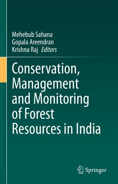
Conservation, Management and Monitoring of Forest Resources in India (eBook, PDF)
Statt 160,49 €**
149,79 €
**Preis der gedruckten Ausgabe (Gebundenes Buch)
inkl. MwSt. und vom Verlag festgesetzt.
Conservation, Management and Monitoring of Forest Resources in India (eBook, PDF)
- Format: PDF
- Merkliste
- Auf die Merkliste
- Bewerten Bewerten
- Teilen
- Produkt teilen
- Produkterinnerung
- Produkterinnerung
Bitte loggen Sie sich zunächst in Ihr Kundenkonto ein oder registrieren Sie sich bei
bücher.de, um das eBook-Abo tolino select nutzen zu können.
Hier können Sie sich einloggen
Sie sind bereits eingeloggt. Klicken Sie auf 2. tolino select Abo, um fortzufahren.
Bitte loggen Sie sich zunächst in Ihr Kundenkonto ein oder registrieren Sie sich bei bücher.de, um das eBook-Abo tolino select nutzen zu können.
This volume is devoted to compiling recent advancements, methodological improvements, new processing techniques, integration methods and rigorous applications associated with conceptual techniques on the conservation and monitoring of forest resources for a scientific audience, with a focus on cases and applications in India. The primary objective of the book is to advance the scientific understanding of the recent trends and technological improvements in forest conservation, management and related research themes in forest resources and human-wildlife interactions. The book is organized into…mehr
- Geräte: PC
- ohne Kopierschutz
- eBook Hilfe
- Größe: 22.97MB
- Upload möglich
Andere Kunden interessierten sich auch für
- Sustainable Management of Natural Resources (eBook, PDF)149,79 €
- Forest Science (eBook, PDF)128,39 €
- Application of Remote Sensing and GIS in Natural Resources and Built Infrastructure Management (eBook, PDF)149,79 €
- Sajal RoyClimate Change Impacts on Gender Relations in Bangladesh (eBook, PDF)53,49 €
- Deforestation in the Teknaf Peninsula of Bangladesh (eBook, PDF)96,29 €
- Managing Water, Soil and Waste Resources to Achieve Sustainable Development Goals (eBook, PDF)93,08 €
- Climate Change, Natural Resources and Sustainable Environmental Management (eBook, PDF)394,83 €
-
-
-
This volume is devoted to compiling recent advancements, methodological improvements, new processing techniques, integration methods and rigorous applications associated with conceptual techniques on the conservation and monitoring of forest resources for a scientific audience, with a focus on cases and applications in India. The primary objective of the book is to advance the scientific understanding of the recent trends and technological improvements in forest conservation, management and related research themes in forest resources and human-wildlife interactions. The book is organized into five sections: (I) Forest Conservation Ecology (II) Forest Conservation and Society (III) Forest Management (IV) Forest Monitoring using GIS and Remote Sensing and (V) Human Wildlife Conflicts. It covers various research themes related to forestry, wildlife, habitat fragmentation, forest management and human-wildlife conflict research, and therefore will bebeneficial to a diverse range of researchers, scientific organizations, wildlife scientists, biologists, ecologists and planners in the fields of wildlife and forestry. The book will further be of use to post-graduates, PhD research scholars, professors, geospatial experts, modellers, foresters, agricultural scientists, biologists, ecologists, environmental consultants and big data compilers.
Produktdetails
- Produktdetails
- Verlag: Springer International Publishing
- Erscheinungstermin: 4. August 2022
- Englisch
- ISBN-13: 9783030982331
- Artikelnr.: 64762212
- Verlag: Springer International Publishing
- Erscheinungstermin: 4. August 2022
- Englisch
- ISBN-13: 9783030982331
- Artikelnr.: 64762212
Dr Mehebub Sahana is a cultural and environmental geographer with an interest in analysing land-use changes with special respect to spaces, politics, and the governance of the living and materialistic world. His present research interests include social-environmental interface, socio-ecological resilience and systems thinking; geohazards; landscape ecology; multi hazard risk assessment; land-use change; rural-urban conversion and the socio-political implications of land-use dynamics. He is currently working as a Research Associate at the School of Environment, Education & Development, The University of Manchester, UK. Previously, he was employed as a Lecturer/research consultant (2018-2019) at Indira Gandhi Conservation Monitoring Centre (IGCMC), WWF-India, New Delhi. He received his Ph.D. in Environmental Geography (2018) from the Department of Geography, Faculty of Natural Sciences, Jamia Millia Islamia, New Delhi, India. He has contributed more than 50 scientific researchpapers in international journals on issues pertaining to land-use changes and environmental degradation and their links with climate change induced vulnerabilities.
Dr Gopala Areendran is the Director of Indira Gandhi Conservation Monitoring Centre (IGCMC) at WWF – India. He has more than 25 years of experience as a professional and leader in geospatial technology and has been the driving force of location-based data monitoring and analytics since 2001 at WWF-India. His work at WWF ranges from addressing conservation issues occurring in various landscapes, with a high focus on the tiger, elephant, and rhinoceros to overseeing several institutional GIS based projects. Dr Areendran has an MS degree in Ecology from Pondicherry University and PhD from Wildlife Institute of India. He has also worked with leading research centres like Salim Ali Centre for Ornithology and Natural History (SACON), Wildlife Institute of India (WII) and Madras Environmental Society (MES), Chennai and Institute of Remote Sensing, Anna University, Chennai. He has published several research papers and reports in peer reviewed journals, and were involved in publication of 4 books in the capacity of editor, and co- author. As a pioneer of geospatial education, has also supervised over a hundred masters and research students.
Dr. Krishna Raj is a Specialist in Geo-spatial Application has done Masters in Geography from Banaras Hindu University, Varanasi, India. P.G. Diploma in Advanced Remote Sensing and Cartography. Presently working with WWF – India as Sr. Programme Coordinator (GIS/RS), IGCMC, WWF-India and responsible for all kind of GIS and Remote sensing projects within IGCMC, WWF-India. He has handled Geospatial Modeling and Analytical work in various major research projects of WWF – India during last 20 years. Prior Joining to WWF-India has worked with multinational company RMSI as a GIS Engineer & Lepton Software India Ltd as GIS Professional, got expertise on different Remote Sensing & GIS projects.
1-Introduction to the Forest Resources in India.- 2-Assessment of Carbon sequestration in Delhi, India.- 3-Assessments of Bio-physical characteristics of Vegetation cover in Western Part of Rarh Plateau in West Bengal.- 4-Forest Cover Change Detection Using Remote Sensing and GIS in The Uttara Kannada District of Karnataka.- 5-Delineating the mangrove patches along coastal Kerala using GIS, satellite data and field validation.- 6-Assessing potential Habitat suitability for Panthera Tigris using multiple grain size and different ensemble methods in maximum entropy modeling.- 7-Bhutan heading from carbon negative to carbon neutral country.- 8-Analyzing the Dynamics of Forest Fire in Almora District using GIS and Remote Sensing.- 9-Green placemaking in Kolkata: Role of Urban Greens and Urban Forestry.- 10-Forest Resource Scenario of Industrial town: A Study of Asansol Durgapur Region.- 11-Application of participatory rural appraisal and geospatial techniques for analyzing the dynamics ofmangrove forest and dependent livelihood in Indian Sundarban.- 12-Forest Cover Change Detection and Local Community Participation in Forest Management: Evidence from Rural North Sikkim, India.- 13-Seasonal relation of NTFPs and socio-economic indicators to the household income of the forest-fringe communities of Jaldapara National Park.- 14-A People’s Biodiversity Register of Henry’s Island, Indian Sundarban.- 15-Forest Management in the age of Geospatial technology.- 16-Landscape characterisation and forest fragmentation analysis using geospatial techniques: Case study from Central Indian Highlands.- 17-Monitoring forest status in Barail wildlife sanctuary using forest fragmentation approach.- 18-Geo-spatial analysis to assess the changing pattern of land use and its impact on forest fragmentation in Sri Lanka from 2000 to 2020.- 19-Assessment of mangroves suitability in Andaman Islands, using geospatial technique.- 20-Remote Sensing Based Forest Cover Change Detection and Ecosystem Assessment in Madhupur Sal Forest of Bangladesh.- 21-Changing landscape and increasing human wildlife conflict: Introspection from a transboundary landscape.- 22-Corridor Mapping of Asian Elephant (Elephas maximus) in Central Indian Corridors (Jharkhand and West Bengal), using Geospatial Techniques.- 23-Issues of Biodiversity Conservation and Conflict in Gorumara National Park, West Bengal, India.- 24-A Combined Machine Learning and Data Fusion Based Approach for Flood Susceptibility Analysis to Study Impact on Vulnerable Wildlife in Kaziranga National Park.- 25-The future of Indian forests: Conservation and Monitoring and management perspectives.
1-Introduction to the Forest Resources in India.- 2-Assessment of Carbon sequestration in Delhi, India.- 3-Assessments of Bio-physical characteristics of Vegetation cover in Western Part of Rarh Plateau in West Bengal.- 4-Forest Cover Change Detection Using Remote Sensing and GIS in The Uttara Kannada District of Karnataka.- 5-Delineating the mangrove patches along coastal Kerala using GIS, satellite data and field validation.- 6-Assessing potential Habitat suitability for Panthera Tigris using multiple grain size and different ensemble methods in maximum entropy modeling.- 7-Bhutan heading from carbon negative to carbon neutral country.- 8-Analyzing the Dynamics of Forest Fire in Almora District using GIS and Remote Sensing.- 9-Green placemaking in Kolkata: Role of Urban Greens and Urban Forestry.- 10-Forest Resource Scenario of Industrial town: A Study of Asansol Durgapur Region.- 11-Application of participatory rural appraisal and geospatial techniques for analyzing the dynamics ofmangrove forest and dependent livelihood in Indian Sundarban.- 12-Forest Cover Change Detection and Local Community Participation in Forest Management: Evidence from Rural North Sikkim, India.- 13-Seasonal relation of NTFPs and socio-economic indicators to the household income of the forest-fringe communities of Jaldapara National Park.- 14-A People's Biodiversity Register of Henry's Island, Indian Sundarban.- 15-Forest Management in the age of Geospatial technology.- 16-Landscape characterisation and forest fragmentation analysis using geospatial techniques: Case study from Central Indian Highlands.- 17-Monitoring forest status in Barail wildlife sanctuary using forest fragmentation approach.- 18-Geo-spatial analysis to assess the changing pattern of land use and its impact on forest fragmentation in Sri Lanka from 2000 to 2020.- 19-Assessment of mangroves suitability in Andaman Islands, using geospatial technique.- 20-Remote Sensing Based Forest Cover Change Detection and Ecosystem Assessment in Madhupur Sal Forest of Bangladesh.- 21-Changing landscape and increasing human wildlife conflict: Introspection from a transboundary landscape.- 22-Corridor Mapping of Asian Elephant (Elephas maximus) in Central Indian Corridors (Jharkhand and West Bengal), using Geospatial Techniques.- 23-Issues of Biodiversity Conservation and Conflict in Gorumara National Park, West Bengal, India.- 24-A Combined Machine Learning and Data Fusion Based Approach for Flood Susceptibility Analysis to Study Impact on Vulnerable Wildlife in Kaziranga National Park.- 25-The future of Indian forests: Conservation and Monitoring and management perspectives.