Coventry's Medieval Suburbs (eBook, PDF)
Excavations at Hill Street, Upper Well Street and Far Gosford Street 2003-2007

PAYBACK Punkte
7 °P sammeln!
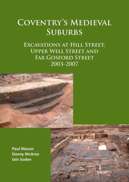
Hill Street, Upper Well Street and Far Gosford Street comprise three suburban streets which stood directly outside the city gates of Coventry for much of the medieval period. As a result of the 2003-2007 excavations an extensive body of archaeological, environmental and documentary evidence has been brought together to allow comparison in terms of land planning, construction methodologies, character and relative fluctuations in the long-term economy of two of the city's medieval and post-medieval suburbs. As well as evidence for street frontage occupation, the sites contain substantial portion...
Hill Street, Upper Well Street and Far Gosford Street comprise three suburban streets which stood directly outside the city gates of Coventry for much of the medieval period. As a result of the 2003-2007 excavations an extensive body of archaeological, environmental and documentary evidence has been brought together to allow comparison in terms of land planning, construction methodologies, character and relative fluctuations in the long-term economy of two of the city's medieval and post-medieval suburbs. As well as evidence for street frontage occupation, the sites contain substantial portions of the city's defences, never before looked at in such detail. The new data is of great value in comparing the results with those previously gained from a variety of smaller sites in Coventry and comparable sites elsewhere in the country. The work has, in some detail, married up excavated data and documentary sources for the working of the defences over a period of 250 years. In addition the immediate suburban environment has come under scrutiny and an unprecedented level of botanical data has come to light in a programme of sampling for both seeds and pollens as a guide to the changing character of the suburbs. At Hill Street, excavation uncovered two medieval and post-medieval frontage properties 50m wide and their rear yards adjacent to the city ditch. While upstanding structural remains were scant, analysis of contemporary pits has highlighted mainly domestic but also some industrial aspects of the properties and given an insight into the diet, economy and changing face of suburban Hill Street from the 13th to 19th centuries. Excavation also uncovered some 55m of the city ditch adjacent to Bond Street, into which four large sections were cut, three close to Hill Street and one at the junction with Upper Well Street. The excavations highlight the huge investment made in digging and maintaining the ditch as a defensive line for the first half of the 15th century before it was gradually misused for fly-tipping and eventually lost beneath a welter of dumping by the later 17th century. It was probably indefensible long before the Civil War. A varied and rich environmental profile of the site has been constructed, which paints a picture of a suburban, semi-rural habitat which was increasingly spoiled in the 16th and 17th centuries by unrestricted dumping of refuse and cess. A wide variety of finds was recovered, indicative of both domestic and industrial occupation and use. This range was dominated by a large group of well-preserved late medieval leather shoes. The Far Gosford Street excavations revealed evidence for some 800 years of human activity. The earliest remains comprised a solid timber post, possibly related to a bridge over the River Sherbourne, for which tree-ring dating established a felling date of 1162-1212. A frontage was first occupied in the early 14th century when buildings were laid out along the street. A hoard of silver pennies found buried beneath the floor of one of the buildings probably represents the savings of one of the street's earliest residents. These structures were replaced in the first half of the 15th century, probably at the same time as the city wall was built a short distance to the west. A second medieval frontage lasted until 1643 when it was again dismantled during the Civil War. Entrenchments dating to this period were also excavated. In the 18th century a third frontage was built, replaced in the 19th century and finally demolished to make way for Singer Motors car showroom after they acquired the site in 1926.
Dieser Download kann aus rechtlichen Gründen nur mit Rechnungsadresse in A, B, BG, CY, CZ, D, DK, EW, E, FIN, F, GR, HR, H, IRL, I, LT, L, LR, M, NL, PL, P, R, S, SLO, SK ausgeliefert werden.


