72,95 €
72,95 €
inkl. MwSt.
Sofort per Download lieferbar
72,95 €
72,95 €
inkl. MwSt.
Sofort per Download lieferbar

Alle Infos zum eBook verschenken
Als Download kaufen
72,95 €
inkl. MwSt.
Sofort per Download lieferbar
Jetzt verschenken
72,95 €
inkl. MwSt.
Sofort per Download lieferbar

Alle Infos zum eBook verschenken
  • Format: PDF

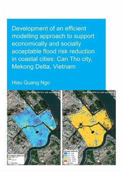
This study presents a flood modelling system that can provide rapid and sufficiently accurate estimates of flood risk within a methodology that is accessible to a wider range of stakeholders was developed for a coastal city - Can Tho city, Mekong Delta, Vietnam.

Produktbeschreibung
This study presents a flood modelling system that can provide rapid and sufficiently accurate estimates of flood risk within a methodology that is accessible to a wider range of stakeholders was developed for a coastal city - Can Tho city, Mekong Delta, Vietnam.


Dieser Download kann aus rechtlichen Gründen nur mit Rechnungsadresse in A, B, BG, CY, CZ, D, DK, EW, E, FIN, F, GR, HR, H, IRL, I, LT, L, LR, M, NL, PL, P, R, S, SLO, SK ausgeliefert werden.

Autorenporträt
Hieu Quang Ngo was born in Ha Noi, Viet Nam. He obtained his Bachelor's degree and MSs' degree in Hydraulic Engineering from Water Resources University, Viet Nam (2007 - 2015). Thereafter he worked at the Hydraulic Construction Institute - Vietnam Academy for Water Resources. In this period, he functioned as an engineering designer, researcher and project leader, where he was involved in designing hydraulic engineering works and scientific research related to planning and designing hydraulic structures. In 2015, he was offered a PhD position in IHE Delft, in collaboration with Delft University of Technology. His research interests include: climate change impacts and human activities on flooding in coastal cities; development of efficient modelling systems to support constructing probabilistic flood hazard maps and, further, to support flood risk reduction management in coastal and estuaries cities; development of interactive tools for co-designing of risk reduction measures; remote sensing and GIS applications in flood management; river and coastal flood modelling at global, regional and local scales.