Sie sind bereits eingeloggt. Klicken Sie auf 2. tolino select Abo, um fortzufahren.
Bitte loggen Sie sich zunächst in Ihr Kundenkonto ein oder registrieren Sie sich bei bücher.de, um das eBook-Abo tolino select nutzen zu können.
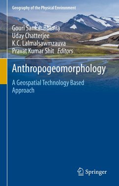
This volume provides a versatile introduction to the study of drainage basin evolution, morphology, drainage basin hydrology and sedimentology, human interference, natural and anthropogenic hazards and various management techniques. This book offers the responsible factors of sediment yield and their absolute and specific growth and rate of delivery through tributaries to the main streams. Rivers are important geomorphic agents which reflect an amazing variety of form and behaviour, showing the wide range of natural environment in which they are originated. The drainage system evolution and…mehr
This volume provides a versatile introduction to the study of drainage basin evolution, morphology, drainage basin hydrology and sedimentology, human interference, natural and anthropogenic hazards and various management techniques.
This book offers the responsible factors of sediment yield and their absolute and specific growth and rate of delivery through tributaries to the main streams. Rivers are important geomorphic agents which reflect an amazing variety of form and behaviour, showing the wide range of natural environment in which they are originated. The drainage system evolution and spatial network development within the dynamic nature are being discussed and how they are adjusted in the geomorphic time scale over the millions of years. This book shows how drainage systems function and react to change and why this thoughtful is required for flourishing integrated basin management. In tropical and sub-tropical countries population pressures as well as different developmental projects are being executed on the drainage basin without proper planning. Today scientists consider drainage basin as an administrative unit during implementation of regional projects. In this context this book will carry a bench mark for scholars and young scientists.
Dieser Download kann aus rechtlichen Gründen nur mit Rechnungsadresse in A, B, BG, CY, CZ, D, DK, EW, E, FIN, F, GR, HR, H, IRL, I, LT, L, LR, M, NL, PL, P, R, S, SLO, SK ausgeliefert werden.
Die Herstellerinformationen sind derzeit nicht verfügbar.
Autorenporträt
Dr Pravat Kumar Shit is an Assistant Professor at the PG Department of Geography, Raja N. L. Khan Women's College (Autonomous), West Bengal, India. He received his M.Sc & Ph.D. degrees in Geography from Vidyasagar University and PG Diploma in Remote Sensing & GIS from Sambalpur University. His research interests include applied geomorphology, soil erosion, groundwater, forest resources, wetland ecosystem, environmental contaminants & pollution, and natural resources mapping & modelling. He has published ten books (eight books in Springer) and more than 60 papers in peer-reviewed journals. He is currently the editor of the GIScience and Geo-environmental Modelling (GGM) Book Series, Springer-Nature. Dr. Biswajit Bera is an Assistant Professor in the Department of Geography, Sidho Kanho Birsha University, West Bengal (India). He did M.Sc and Ph.D from University of Calcutta, West Bengal (India). He has done P.G. Certificate course in ground water hydrology from IISWBM, Kolkata. He has a rich experience of teaching in different core areas of Geography in various Colleges and Universities over the last 10 years. He is the recipient of prestigious Young Geomorphologist Award and International Young Geomorphologist scholarship. Dr. Bera has published five books for school, college and university students and several research articles in both National and International peer reviewed journals. His research interests include fluvial Geomorphology, Hydrology and Environmental Geography. Dr. Bera regularly appears in debate/talk in both National print and electronic media. Recently, he has completed the ICSSR Major research Project awarded by Ministry of HRD, Govt. of India. Dr. Aznarul Islam is an Assistant Professor in the Department of Geography, Aliah University, Kolkata, India. He did Master of Science in Geography from Kalyani University, India and M.Phil and PhD in Geography from the University of Burdwan, India. He has already published more than twenty five research papers in different national and international journals, edited volumes and conference proceedings. He is an editorial board member of five international journals and also acting as the reviewer of eight international journals. He is an editor of 'Neo-Thinking on Ganges Brahmaputra Basin Geomorphology', Springer International Publishing and 'Quaternary Geomorphology in India - Case Studies from the Lower Ganga Basin' Springer International Publishing. His principal area of research include geomorphology of Bengal basin especially river bank erosion, channel migration, flood, anthropo-geomorphology and channel decaying. Dr. Sandipan Ghosh holds the post-graduate degrees of M.Sc, M.Phil and Ph.D. from The University of Burdwan, West Bengal, India. He has published four books and more than 40 international and national research articles in various geography and geosciences journals.His principal research field includes Fluvial Geomorphology, Regolith Geology and Quaternary Geomorphology. Currently, he is working as an Assistant Professor in the Department of Geography, Chandrapur College (Barddhaman, West Bengal). Dr. Gouri Sankar Bhunia received Ph.D. from the University of Calcutta, India in 2015. His Ph.D. dissertation work focused on environmental control measures of infectious disease using Geospatial technology. His research interests include environmental modelling, risk assessment, natural resources mapping and modelling, data mining and information retrieval using Geospatial technology. Dr Bhunia is associate editor and on the editorial boards of three international journal in Health GIS and Geosciences. Dr. Bhunia has published more than 60 articles in various journals in Scopus indexed. He is currently the editor of the GIScience and Geo-environmental Modelling (GGM) Book Series, Springer-Nature.
Inhaltsangabe
Part-I: Evolution and Development of Drainage System.- 1. Drainage basin as a system unit (case study of gully basin or river basin).- 2. Geomorphic threshold and evolution of drainage system (case study of badland).- 3. Mechanics and landforms of drainage system (case study of badland / river).- 4. System of stream classification (case study of ephemeral gully basin).- 5. Controlling factors of drainage system (case study of badland /Plateau regions).- Part-II: Drainage Basin Morphology.- 1. Morphometric properties of Drainage Basin (case study of badland /Plateau regions).- 2. Quantitative analysis of Drainage Basin (case study of badland /Plateau regions).- 3. Hypsometry curve analysis (case study analysis).- 3. Alluvial Fan Morphology (case study of Hillslope / Estuarine).- 4. Bed Morphology of drainage basin (case study of ephemeral gully basin / Mountain River / Plateau River).- Part-III: Drainage Basin Hydrology and Modelling.- 1. River Hydraulics properties (case study of badland /Plateau regions).- 2. Hydrological frequency-magnitude analysis (case study analysis).- 3. Estimation of Rainfall-runoff with computations (case study analysis).- 4. Flood risk analysis (case study analysis).- 5. Ground water prospecting and modelling.- 6. GIS based hydrologic modelling.- Part-IV: Drainage Basin Sedimentology.- 1. Sediment properties: particle size distribution (case study analysis).- 2. Estimation of erosion and sediment yieldModelling (GIS based).- 3. Sediment facies analysis (case study analysis).- 4. Bed load sediment transport modeling (case study analysis).- 5. River deposition and fluvial landforms (case study analysis).- 6. Geo-chemical analysis of sediment.- Part-V: Human Interference/interventions on Drainage Basin.- 1. Cheek dam impact (case study analysis).- 2. River embankments (case study analysis).- 3. Dams construction (case study analysis).- 4. Barrage/Bridge construction (case study analysis).- 5. Sand mining/ stone quarrying (case study analysis).- 6. Landuse changes(deforestation, urbanization, agricultural expansion) and sediment yield (case study analysis).- 7. River pollution and channel changes.- Part-VI: Drainage Basin Management.- 1. Quantitative analysis of watershed geomorphology using RS and GIS (Machine learning algorithm, SWAT etc).- 2. River water management under watershed using geospatial techniques.- 3. Integrated river basin management and geostatistics.- 4. Management of Ecological Variability (ecological flow) and Pollution of the Hyporheic Zone using Geospatial techniques.- 5.. Social engineering and river basin management.- 6. Basin management and regional planning.
Es gelten unsere Allgemeinen Geschäftsbedingungen: www.buecher.de/agb
Impressum
www.buecher.de ist ein Internetauftritt der buecher.de internetstores GmbH
Geschäftsführung: Monica Sawhney | Roland Kölbl | Günter Hilger
Sitz der Gesellschaft: Batheyer Straße 115 - 117, 58099 Hagen
Postanschrift: Bürgermeister-Wegele-Str. 12, 86167 Augsburg
Amtsgericht Hagen HRB 13257
Steuernummer: 321/5800/1497
USt-IdNr: DE450055826