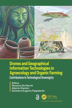
Drones and Geographical Information Technologies in Agroecology and Organic Farming (eBook, PDF)
Contributions to Technological Sovereignty
Redaktion: de Marchi, Massimo; Eugenio Pappalardo, Salvatore; Diantini, Alberto
0,00 €
0,00 €
inkl. MwSt.
Sofort per Download lieferbar

0 °P sammeln
0,00 €
Als Download kaufen

0,00 €
inkl. MwSt.
Sofort per Download lieferbar

0 °P sammeln
Jetzt verschenken
Alle Infos zum eBook verschenken
0,00 €
inkl. MwSt.
Sofort per Download lieferbar
Alle Infos zum eBook verschenken

0 °P sammeln
Drones and Geographical Information Technologies in Agroecology and Organic Farming (eBook, PDF)
Contributions to Technological Sovereignty
Redaktion: de Marchi, Massimo; Eugenio Pappalardo, Salvatore; Diantini, Alberto
- Format: PDF
- Merkliste
- Auf die Merkliste
- Bewerten Bewerten
- Teilen
- Produkt teilen
- Produkterinnerung
- Produkterinnerung

Bitte loggen Sie sich zunächst in Ihr Kundenkonto ein oder registrieren Sie sich bei
bücher.de, um das eBook-Abo tolino select nutzen zu können.
Hier können Sie sich einloggen
Hier können Sie sich einloggen
Sie sind bereits eingeloggt. Klicken Sie auf 2. tolino select Abo, um fortzufahren.

Bitte loggen Sie sich zunächst in Ihr Kundenkonto ein oder registrieren Sie sich bei bücher.de, um das eBook-Abo tolino select nutzen zu können.
Drones, GPS, mapping, satellite images, GIS and WebGIS are geographic information technologies that assist in the evolution of healthy agroecosystems and facilitate the agroecological transition. Precision conventional precision farming technologies to reduce environmental impacts in the yield paradigm can take other directions.
- Geräte: PC
- ohne Kopierschutz
- eBook Hilfe
- Größe: 22.57MB
Andere Kunden interessierten sich auch für
![Drones and Geographical Information Technologies in Agroecology and Organic Farming (eBook, ePUB) Drones and Geographical Information Technologies in Agroecology and Organic Farming (eBook, ePUB)]() Drones and Geographical Information Technologies in Agroecology and Organic Farming (eBook, ePUB)0,00 €
Drones and Geographical Information Technologies in Agroecology and Organic Farming (eBook, ePUB)0,00 €![Handbook of Himalayan Ecosystems and Sustainability, Volume 1 (eBook, PDF) Handbook of Himalayan Ecosystems and Sustainability, Volume 1 (eBook, PDF)]() Handbook of Himalayan Ecosystems and Sustainability, Volume 1 (eBook, PDF)60,95 €
Handbook of Himalayan Ecosystems and Sustainability, Volume 1 (eBook, PDF)60,95 €![The Digital Age in Agriculture (eBook, PDF) The Digital Age in Agriculture (eBook, PDF)]() Mehmet OzguvenThe Digital Age in Agriculture (eBook, PDF)52,95 €
Mehmet OzguvenThe Digital Age in Agriculture (eBook, PDF)52,95 €![Agriculturally Important Microorganisms (eBook, PDF) Agriculturally Important Microorganisms (eBook, PDF)]() Agriculturally Important Microorganisms (eBook, PDF)54,95 €
Agriculturally Important Microorganisms (eBook, PDF)54,95 €![Food Security, Food Prices and Climate Variability (eBook, PDF) Food Security, Food Prices and Climate Variability (eBook, PDF)]() Molly BrownFood Security, Food Prices and Climate Variability (eBook, PDF)52,95 €
Molly BrownFood Security, Food Prices and Climate Variability (eBook, PDF)52,95 €![Climate Neutral and Resilient Farming Systems (eBook, PDF) Climate Neutral and Resilient Farming Systems (eBook, PDF)]() Climate Neutral and Resilient Farming Systems (eBook, PDF)0,00 €
Climate Neutral and Resilient Farming Systems (eBook, PDF)0,00 €![Smart Farming Technologies to Attain Food and Nutrition Security (eBook, PDF) Smart Farming Technologies to Attain Food and Nutrition Security (eBook, PDF)]() P. Parvatha ReddySmart Farming Technologies to Attain Food and Nutrition Security (eBook, PDF)52,95 €
P. Parvatha ReddySmart Farming Technologies to Attain Food and Nutrition Security (eBook, PDF)52,95 €-
-
-
Drones, GPS, mapping, satellite images, GIS and WebGIS are geographic information technologies that assist in the evolution of healthy agroecosystems and facilitate the agroecological transition. Precision conventional precision farming technologies to reduce environmental impacts in the yield paradigm can take other directions.
Dieser Download kann aus rechtlichen Gründen nur mit Rechnungsadresse in A, B, BG, CY, CZ, D, DK, EW, E, FIN, F, GR, HR, H, IRL, I, LT, L, LR, M, NL, PL, P, R, S, SLO, SK ausgeliefert werden.
Produktdetails
- Produktdetails
- Verlag: Taylor & Francis eBooks
- Seitenzahl: 308
- Erscheinungstermin: 29. September 2022
- Englisch
- ISBN-13: 9780429629211
- Artikelnr.: 64278865
- Verlag: Taylor & Francis eBooks
- Seitenzahl: 308
- Erscheinungstermin: 29. September 2022
- Englisch
- ISBN-13: 9780429629211
- Artikelnr.: 64278865
- Herstellerkennzeichnung Die Herstellerinformationen sind derzeit nicht verfügbar.
Massimo De Marchi has a PhD in Geography. He is an Associate Professor at Department of Civil and Architectural and Environmental Engineering, University of Padova. His other roles include being an Academic coordinator of Jean Monnet Centre of Excellence on Climate Justice; Director of Second Level professional Master program in "GIScience and Unmanned System for the integrated management of the territory and the natural resources - with majors" (EQF8); Coordinator of the International Joint Master Degree on Sustainable Territorial Development - Climate Change Diversity Cooperation (STeDe - CCD) (EQF7); Co-Director of Joint program on "Climate Change Policies, Biodiversity and Ecosystem Services", University of Padova, Andean University Simón Bolívar, Quito, Ecuador (EQF 7). Massimo teaches Environmental Impact Assessment (Master in Natural Sciences), Agroecology and Ecosystem Services (Master in Natural Sciences), Participatory GIS and Drones for Good (Master GIScience). His research focuses on adopting a qualitative GIScience approach, deal with participatory processes and environmental conflict management in complex territories with high biological and cultural diversity, land and environmental policies, sustainable local development, tourism and regional sustainability. Alberto Diantini has a PhD in Geographical Studies. He is a postdoc researcher at the Department of Historical and Geographic Sciences and the Ancient World, University of Padova. He teaches courses in Environmental Conflicts, Climate Justice and Social Impact Assessment for the STeDe International Master Programme at the University of Padova, and Mixed Methods and Scientific Communication in Socio-environmental Sciences at the Universidad Andina Simón Bolívar in Quito. His main research concerns agroecology as an alternative to the extractivist economic approach, and socio-environmental conflicts and social licence to operate in the oil contexts of the Ecuadorian Amazon and Italy. Salvatore Eugenio Pappalardo has a PhD in Human and Physical Geography and PhD in Crop Science (University of Padua). He is a researcher in Environmental Geography, and is responsible for the GIScience and Drones for Good Laboratory (Department of Civil and Architectural and Environmental Engineering, University of Padova); Vice-Director of Second Level professional Master program in "GIScience and Unmanned System for the integrated management of the territory and the natural resources - with majors". He teaches Drones for Good: UAV and Digital Earth (Bachelor in Technologies for building and territory management), Geovisualization of territorial change: Digital Earth and Participatory GIS (STeDe International Master Programme at the University of Padova), Climate change: adaption on ecosystems and societies (Bachelor in Enginereeing), UAV for integrated management of natural resources (Second Level professional Master in GIScience). He is a visiting professor at the Andean University Simón Bolívar of Quito, (Ecuador). By adopting a GIScience approach he is working on impacts of anthropic activities on ecosystems and biodiversity, with a focus on oil production in Amazon rainforest, and on urban and rural sustainability in Italy.
1. Agroecology and Sustainable Food Systems: Inquiring Technological
Approaches Part I: Technologies and Geographic Information: Combining
Sovereignties in Agroecology 2. Participatory Geographic Information
Science: Disclosing the Power of Geographical Tools and Knowledge in
Agroecological Transition 3. Sustainable Agricultural Development to
Achieve SDGs: The Role of Livestock and the Contribution of GIS in
Policy-making Process Part II: Agroecology at Farm Level: Contribution of
New Basket of Growing Geographical Technologies 4. Revolution in Precision
of Positioning Systems: Diffusing Practice in Agroecology and Organic
Farming 5. Hyperspectral Remote Sensing and Field Spectroscopy:
Applications in Agroecology and Organic Farming 6. Drones for Good: UAS
Applications in Agroecology and Organic Farming Part III: Landscapes and
Ecosystem Services, Technologies for Agroecological Transitions 7. WebGIS:
Status, Trends and Potential Uptake in Agroecology 8. Geospatial Support
for Agroecological Transition through Geodesign 9. Smart Cities and
Agroecology: Urban Agriculture, Proximity to Food and Urban Ecosystem
Services 10. (Free and Open) Satellite Imageries for Land Rights and
Climate Justice in Amazon Agroforestry Systems 11. Connecting Farms and
Landscapes through Agrobiodiversity: The Use of Drones in Mapping the Main
Agroecological Structure Part IV: Conclusions and Perspectives 12.
Agroecological Transitions in the Era of Pandemics: Combining Local
Knowledge and the Appropriation of New Technologies
