Sie sind bereits eingeloggt. Klicken Sie auf 2. tolino select Abo, um fortzufahren.
Bitte loggen Sie sich zunächst in Ihr Kundenkonto ein oder registrieren Sie sich bei bücher.de, um das eBook-Abo tolino select nutzen zu können.
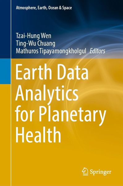
Planetary health involves complex spatial–temporal interactions among agents, hosts, and earth environment. Due to rapid technical development of geomatics, including geographic information systems (GIS) and remote sensing (RS) in the era of big data analytics, therefore, earth data analytics has become one of the important approaches for monitoring earth surface process and measuring of the effects of environment changes on all humans and other living organisms on earth. Various methods in earth data analytics, including spatial–temporal statistics, spatial evolutionary algorithms, remote…mehr
Planetary health involves complex spatial–temporal interactions among agents, hosts, and earth environment. Due to rapid technical development of geomatics, including geographic information systems (GIS) and remote sensing (RS) in the era of big data analytics, therefore, earth data analytics has become one of the important approaches for monitoring earth surface process and measuring of the effects of environment changes on all humans and other living organisms on earth. Various methods in earth data analytics, including spatial–temporal statistics, spatial evolutionary algorithms, remote sensing image analysis, wireless geo-sensors, and location-based analytics, are an emerging discipline in understanding complex interactions in planetary health. This edited book provides a broad focus on methodological theories of earth data analytics and their applications to measuring the process of planetary health, with the goal to build scientific understanding on how geospatial analytics can provide valuable insights in measuring environmental risks in Southeast Asian regions. It is collection of selected papers covering both theoretical and empirical studies focusing on topics relevant to spatial perspectives on planetary health and environmental exposure studies. The book is written for senior undergraduates, graduate students, lecturers, and researchers in applications of geospatial technologies for public health and environmental studies.
Tzai-Hung Wen: Dr. Tzai-Hung Wen is Professor of Geographic Information Science (GISc) and Epidemiology at National Taiwan University (NTU). He currently also serves as Chairman of the Chinese Cartographic Association and Editor-in-Chief of the Journal of Population Studies. His research concentrates on developing spatial–temporal statistical and computational methods for examining the associations between urban environmental changes and human health risks. Mathuros Tipayamongkholgul: Dr. Mathuros Tipayamongkholgul is Associate Professor in Department of Epidemiology at the Faculty of Public Health, Mahidol University, Thailand. She is Epidemiologist by training, and her research focuses on spatial epidemiology and time-series analysis in public health. Ting-Wu Chuang Dr. Chuang is a spatial epidemiologist and his research focuses on evaluating environmental influences on the transmission dynamics of infectious diseases. He has been using remotely sensed satellite images and geographic information systems (GIS) to undertake spatial and temporal analyses and develop forecasting models for malaria and dengue. He is an Associate Professor of Molecular Parasitology and Tropical Diseases at Taipei Medical University in Taiwan.
Inhaltsangabe
Topic 1. Environmental Quality Monitoring.- Chap1: Applications of Remote Sensing for Air Pollution Monitoring in Thailand: An Early Warning for Public Health.- Chap2: A novel evaluation of air pollution impact from stationary emission sources to ambient air quality via time-series Granger causality.- Chap3: Groundwater Recharge, Monitoring and Finding Suitable Areas for Groundwater Recharge in Northeast Thailand.- Topic 2. Environmental Changes and Health.- Chap4: Health benefits of air pollution reduction during the COVID-19 lockdown period in Thailand using a machine learning algorithm.- Chap5: Satellite-Derived Vegetation Indices as A Criterion for Assessing Green Exposure that is Related to Human Health Burdens.- Chap6: Five common myths about land use change and infectious disease.- Topic 3. Data and Methodological Issues for Health Studies.- Chap7: Geospatial Environmental Data for Planetary Health Applications.- Chap8: Delineating zones of disease diffusion from the amenity-sharing network in Peninsular Malaysia.- Chap9: Approaches for spatial and temporal-spatial clustering analysis in avian influenza outbreaks.- Chap10: Detecting urban form using remote sensing: spatiotemporal research gaps for sustainable environment and human health
Es gelten unsere Allgemeinen Geschäftsbedingungen: www.buecher.de/agb
Impressum
www.buecher.de ist ein Internetauftritt der buecher.de internetstores GmbH
Geschäftsführung: Monica Sawhney | Roland Kölbl | Günter Hilger
Sitz der Gesellschaft: Batheyer Straße 115 - 117, 58099 Hagen
Postanschrift: Bürgermeister-Wegele-Str. 12, 86167 Augsburg
Amtsgericht Hagen HRB 13257
Steuernummer: 321/5800/1497