241,95 €
241,95 €
inkl. MwSt.
Sofort per Download lieferbar
payback
121 °P sammeln
241,95 €
241,95 €
inkl. MwSt.
Sofort per Download lieferbar

Alle Infos zum eBook verschenken
payback
121 °P sammeln
Als Download kaufen
241,95 €
inkl. MwSt.
Sofort per Download lieferbar
payback
121 °P sammeln
Jetzt verschenken
241,95 €
inkl. MwSt.
Sofort per Download lieferbar

Alle Infos zum eBook verschenken
payback
121 °P sammeln
  • Format: ePub

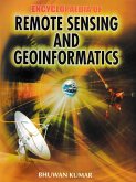
The Encyclopaedia of remote Sensing and Geoinformatics manages to address most of the prominent issues related to remote sensing, GIS, GPS and geoinfbrmatics. It provides readers with a completely overview of the said subject with a completely new perspective. Remote sensing is the science of acquiring, processing and interpreting images that record the interaction between electromagnetic energy and matter. The term remote sensing implies the sensing of the earth's surface from space by making use of the properties of electromagnetic waves emitted, reflected or diffracted by the sensed…mehr

  • Geräte: eReader
  • mit Kopierschutz
  • eBook Hilfe
  • Größe: 1.52MB
  • FamilySharing(5)
Produktbeschreibung
The Encyclopaedia of remote Sensing and Geoinformatics manages to address most of the prominent issues related to remote sensing, GIS, GPS and geoinfbrmatics. It provides readers with a completely overview of the said subject with a completely new perspective. Remote sensing is the science of acquiring, processing and interpreting images that record the interaction between electromagnetic energy and matter. The term remote sensing implies the sensing of the earth's surface from space by making use of the properties of electromagnetic waves emitted, reflected or diffracted by the sensed objects. It is for the purpose of improving natural resources management, land use, and the protection of the environment. In other words, remote sensing is the science and art of obtaining information about an object, area, or phenomenon through the analysis of data acquired by a device that is not in contact with the object, area, or phenomenon through the analysis of data. This encyclopaedia contains highly useful readings on this tiopic.

Dieser Download kann aus rechtlichen Gründen nur mit Rechnungsadresse in A, B, BG, CY, CZ, D, DK, EW, E, FIN, F, GR, HR, H, IRL, I, LT, L, LR, M, NL, PL, P, R, S, SLO, SK ausgeliefert werden.

Autorenporträt
Dr. Bhuwan kumar, Assistant professor, in the Faculty of Disaster Management, Haryana Institute of Public Administration Gurgaon He Received his of Geography, Delhi, Delhi He has visited foreign university for academic discussion in the Faculty of Science, University of Groningen, The Netherlands. He has contributed several research papers in geographical journals of national and international repute, and is author of Urban Development & Anthropogenic Climate Change.