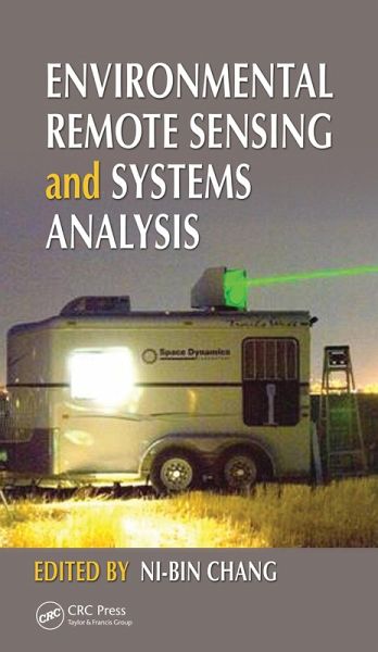
Environmental Remote Sensing and Systems Analysis (eBook, PDF)
Redaktion: Chang, Ni-Bin
Alle Infos zum eBook verschenken
Environmental Remote Sensing and Systems Analysis (eBook, PDF)
Redaktion: Chang, Ni-Bin
- Format: PDF
- Merkliste
- Auf die Merkliste
- Bewerten Bewerten
- Teilen
- Produkt teilen
- Produkterinnerung
- Produkterinnerung
Hier können Sie sich einloggen
Bitte loggen Sie sich zunächst in Ihr Kundenkonto ein oder registrieren Sie sich bei bücher.de, um das eBook-Abo tolino select nutzen zu können.
Reflecting the dramatic changes in the field due to global climate change, economic development, and population growth, this book presents an integrated, quantitative, systems-level method of remote sensing that is essential for tracking down the dynamics of coupled natural and human systems. It provides systematic coverage of water quality monitoring, air quality monitoring, and land-use patterns and degradation, from the urban to the global scale. Focusing on applications to enhance field-oriented problem solving, it explores new methods and techniques to demonstrate state-of-the-art accomplishments and future trends in remote sensing.…mehr
- Geräte: PC
- mit Kopierschutz
- eBook Hilfe
- Größe: 66.79MB
- Multiscale Hydrologic Remote Sensing (eBook, PDF)80,95 €
- Handbook of Himalayan Ecosystems and Sustainability, Volume 1 (eBook, PDF)60,95 €
- George Z. XianRemote Sensing Applications for the Urban Environment (eBook, PDF)54,95 €
- Applications of Small Unmanned Aircraft Systems (eBook, PDF)46,95 €
- Advanced Applications in Remote Sensing of Agricultural Crops and Natural Vegetation (eBook, PDF)46,95 €
- Nicolas R. DaleziosRemote Sensing Applications in Environmental and Earth System Sciences (eBook, PDF)48,95 €
- Remote Sensing of Glaciers (eBook, PDF)64,95 €
-
-
-
Dieser Download kann aus rechtlichen Gründen nur mit Rechnungsadresse in A, B, BG, CY, CZ, D, DK, EW, E, FIN, F, GR, HR, H, IRL, I, LT, L, LR, M, NL, PL, P, R, S, SLO, SK ausgeliefert werden.
- Produktdetails
- Verlag: Taylor & Francis eBooks
- Seitenzahl: 520
- Erscheinungstermin: 23. März 2012
- Englisch
- ISBN-13: 9781439877449
- Artikelnr.: 38302359
- Verlag: Taylor & Francis eBooks
- Seitenzahl: 520
- Erscheinungstermin: 23. März 2012
- Englisch
- ISBN-13: 9781439877449
- Artikelnr.: 38302359
- Herstellerkennzeichnung Die Herstellerinformationen sind derzeit nicht verfügbar.
Quality Monitoring, Watershed Development, and Coastal Management: Using
Remote Sensing-Based Carlson Index Mapping to Assess Hurricane and Drought
Effects on Lake Trophic State. Mapping Potential Annual Pollutant Loads in
River Basins Using Remotely Sensed Imagery. Identifying the Impact of Oil
Spills with the Remote Sensing- Based Oil Spread Index Method. Remote
Sensing to Predict Estuarine Water Salinity. Multitemporal Remote Sensing
of Coastal Sediment Dynamics. Estimating Total Phosphorus Impacts in a
Coastal Bay with Remote Sensing Images and In Situ Measurements. Monitoring
and Mapping of Flood Plumes in the Great Barrier Reef Based on In Situ and
Remote Sensing Observations. Sensing and Monitoring for Land Use Patterns,
Reclamation, and Degradation: Satellite Remote Sensing for Landslide
Prediction. Analysis of Impervious Surface and Suburban Form Using High
Spatial Resolution Satellite Imagery. Use of InSAR for Monitoring Land
Subsidence in Mashhad Subbasin, Iran. Remote Sensing Assessment of Coastal
Land Reclamation Impact in Dalian, China, Using High-Resolution SPOT Images
and Support Vector Machine. Mapping Impervious Surface Distribution with
the Integration of Landsat TM and QuickBird Images in a Complex Urban-
Rural Frontier in Brazil. Air Quality Monitoring, Land Use/Land Cover
Changes, and Environmental Health Concern: Using Lidar to Characterize
Particles from Point and Diffuse Sources in an Agricultural Field.
Measurement of Aerosol Properties over Urban Environments from Satellite
Remote Sensing. DOAS Technique: Emission Measurements in Urban and
Industrial Regions. Interactions between Ultraviolet-B and Total Ozone
Concentrations in the Continental United States. Remote Sensing of Asian
Dust Storms. Forest Fire and Air Quality Monitoring from Space. Satellite
Remote Sensing of Global Air Quality.