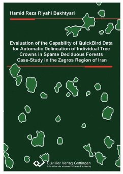
This work represents first attempts at delineating individual tree crowns in Zagros area
using QuickBird data. The Zagros forest zone is the second important forest region of
Iran with high ecological and socio-economic values and provides services to a
significant parts of Iran’s human population. These forests are experiencing rapid
degradation due to environmental and human impact at local scale. To efficiently manage
these forests for conservation and other ecological purposes forest managers demand to
have detailed information on forest composition and structure. Because of the wide extent
as well as spatial structure of these forests, extracting the required information by means
of traditional field based methods is time-consuming and costly, whilst application of
low-medium resolution satellite imagery will not yield accurate and reliable results. It is,
therefore, critically important to investigate the new advanced spaceborne remote sensing
technologies that permit to extract detail information. Very high spatial resolution satellite
imagery can supply forest management planning with individual tree based information,
which was unfeasible to accomplish with the same efficiency and precision with
moderate-resolution satellite imagery. Application to the Zagros forests face to the unique
technical challenges including high variability in crown shape and size, strong effects of
the background reflectance, and varying age and health condition.
The capabilities of QuickBird imagery examined with the data acquired over the Oak
forest site on the South West of Iran. Different image fusion techniques were applied to
exploit optimal spatial and spectral information of this imagery. The core technical
objective was selecting a fusion method with high fidelity of spectral and spatial
information. Quality assessment of fused images showed that the PCA method performs
better than the others in this study.
Individual tree crowns were delineated using Marker Controlled Watershed and LoG
methods. Marker Controlled Watershed method starts with detecting the significant edges,
after that obtaining a relevant marker set, representing the locations of the individual tree
crowns, then according to a certain rules delineate the Watersheds from the combination
of markers and edges. The LoG method starts from converting image to the binary using
Out¿s method and then extracts significant edges using the Laplacian of Gaussian filter. It
was then important to portray the overall effectiveness of the performed delineation
methods. To evaluate the delineation results crown by crown accuracy assessment was
performed. This accuracy considers the degree of correspondence between Computer-
Generated Segments (CGS) and the actual Ground Reference Segments (GRS). Apparent
quality measures and conditions for determining the delineation accuracy is defined and
used.
The accuracy assessment showed in this study that about 50% of crowns can be
delineated with high accuracy (perfect match) in both methods. The LoG method seems
well suited and approximately 58.1% of crowns were delineated with high accuracy
(perfect match). The total rate of good matches for this method was 9.8%. There were
few omissions errors. Commission errors, i.e., CGS not associated with GRS did not
occur. Automated tree crown delineation in deciduous sparse forests with variable crown
shape and size is a complicated procedure.
In this study QuickBird imagery showed wide capabilities for individual tree crown
delineation in sparse forests of Zagros region. Further investigations are also needed to
document the potential of QuickBird imagery in different acquisition and forest types,
such as more heterogeneous stands and complex topography.
Dieser Download kann aus rechtlichen Gründen nur mit Rechnungsadresse in A, B, BG, CY, CZ, D, DK, EW, E, FIN, F, GR, HR, H, IRL, I, LT, L, LR, M, NL, PL, P, R, S, SLO, SK ausgeliefert werden.


